Giveaways
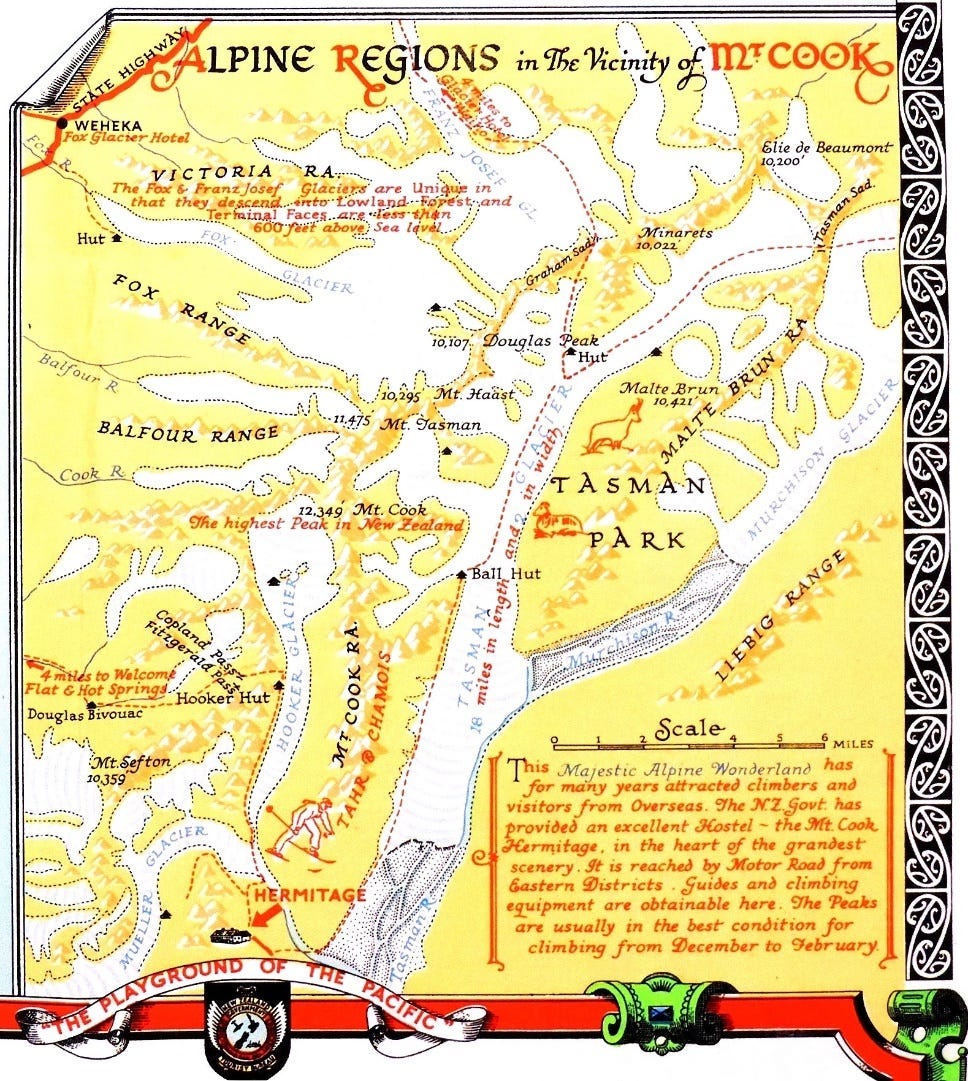
I’D always wanted to go by helicopter to the top of the Tasman Glacier, near Mount Cook: a famous tourist trip for decades, though not always by helicopter. When the following map was made, I suspect you had to get there on foot.
The 1962 tourist film Holiday for Susan shows people going there by skiplane. But I wanted to go by helicopter at least part of the way.
Holiday for Susan, opening at the point where the tourists take the skiplane (11:37)
But I was put off by the usual price for a helicopter ride there and back, and I also thought (for some reason) that this ride was purely for gun skiers and that people would think I was just a tourist.
Little did I realise that most of the people who take the ride are tourists.
Anyhow, one day when I was browsing on Bookme for something else, I came across a round-trip flight to the Tasman Glacier for NZ $250, where you went up by skiplane and came back by helicopter.
It must have been a real special, but I managed to nab it and stopped worrying about whether I was a good enough skier or not.
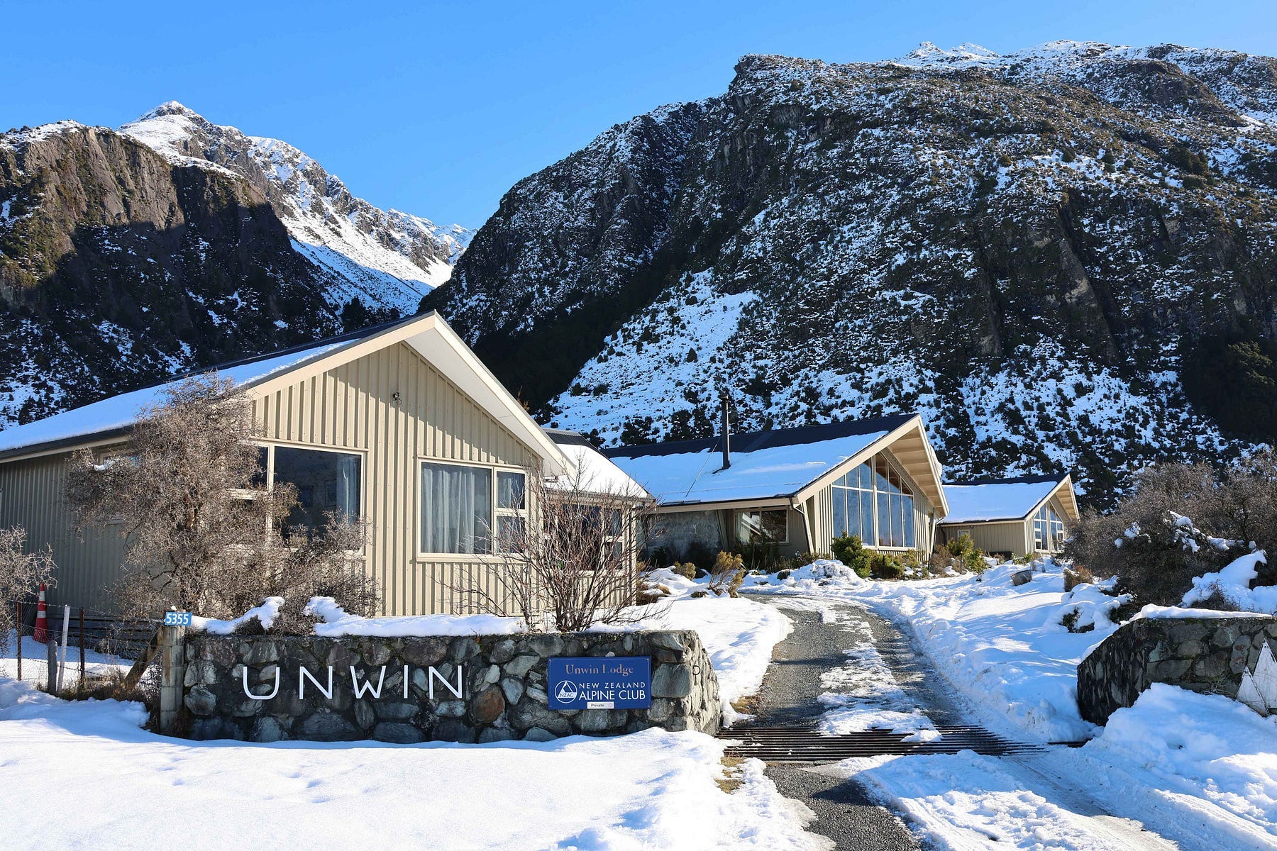
I decided to stay at the New Zealand Alpine Club’s Unwin Lodge.
There’s quite a range of accommodation at the Aoraki Mount Cook Village, including the Hermitage (which is quite expensive). There are cheaper lodges, though they are often limited to mountaineering club members.
Joining the New Zealand Alpine Club costs NZ $200 a year and you can stay at their lodges, such as the Unwin Lodge, for as little as NZ $25 a night, which I think is a really good deal. The Unwin Lodge also takes casual guests for NZ $50 a night.
Here is a video I made of Lake Pūkaki the day before (another of the region’s attractions) and then of Unwin Lodge on the morning of my flights.
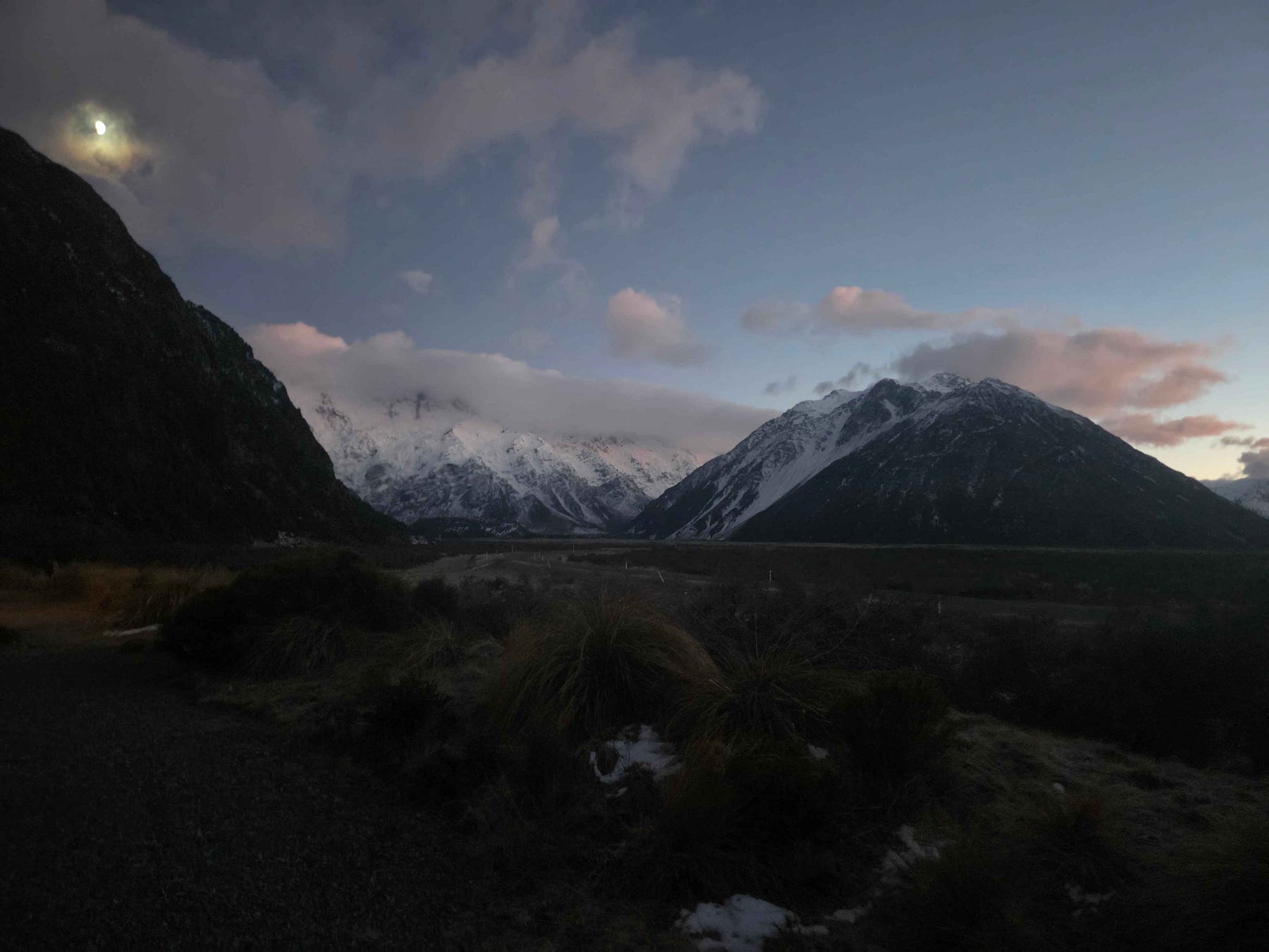
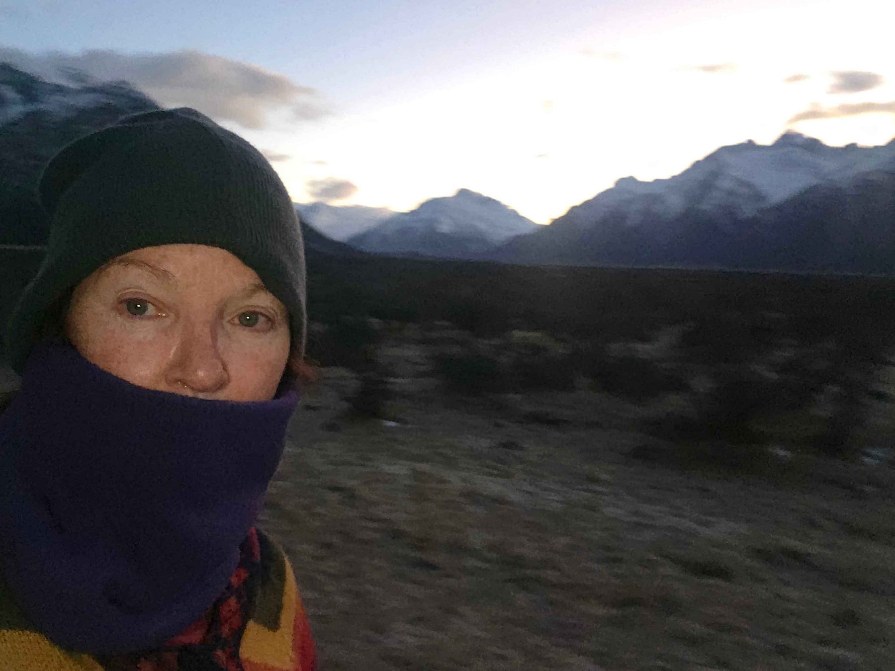
I went for a walk in the twilight the night before, photographing scenes, and again in the morning (this was winter, and the days were short).
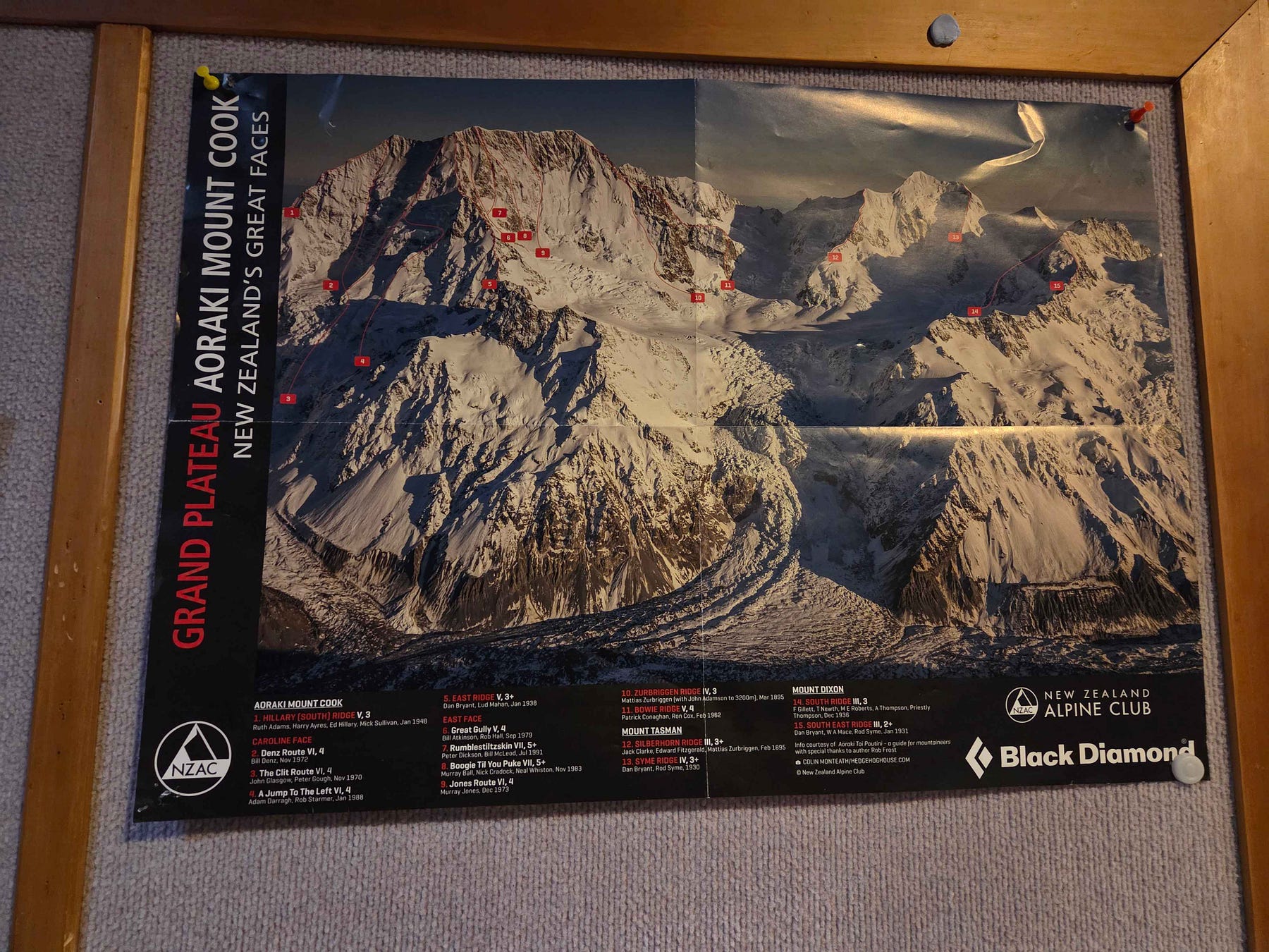
At the airfield near Aoraki Mount Cook Village, there were posters advertising both the skiplane and helicopter routes.
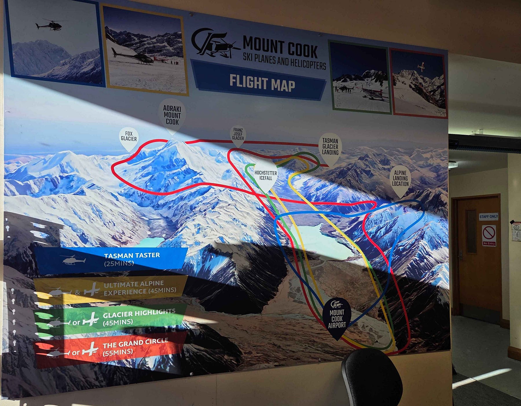
I flew with Mount Cook Ski Planes and Helicopters, on a journey called the Ultimate Alpine Experience, which is normally NZ $499 per person and has the advantage of combining a plane and a helicopter so that you get to fly in both.
Here is another poster, for Southern Lakes Helicopters: their Aoraki Mount Cook services can be clicked here.
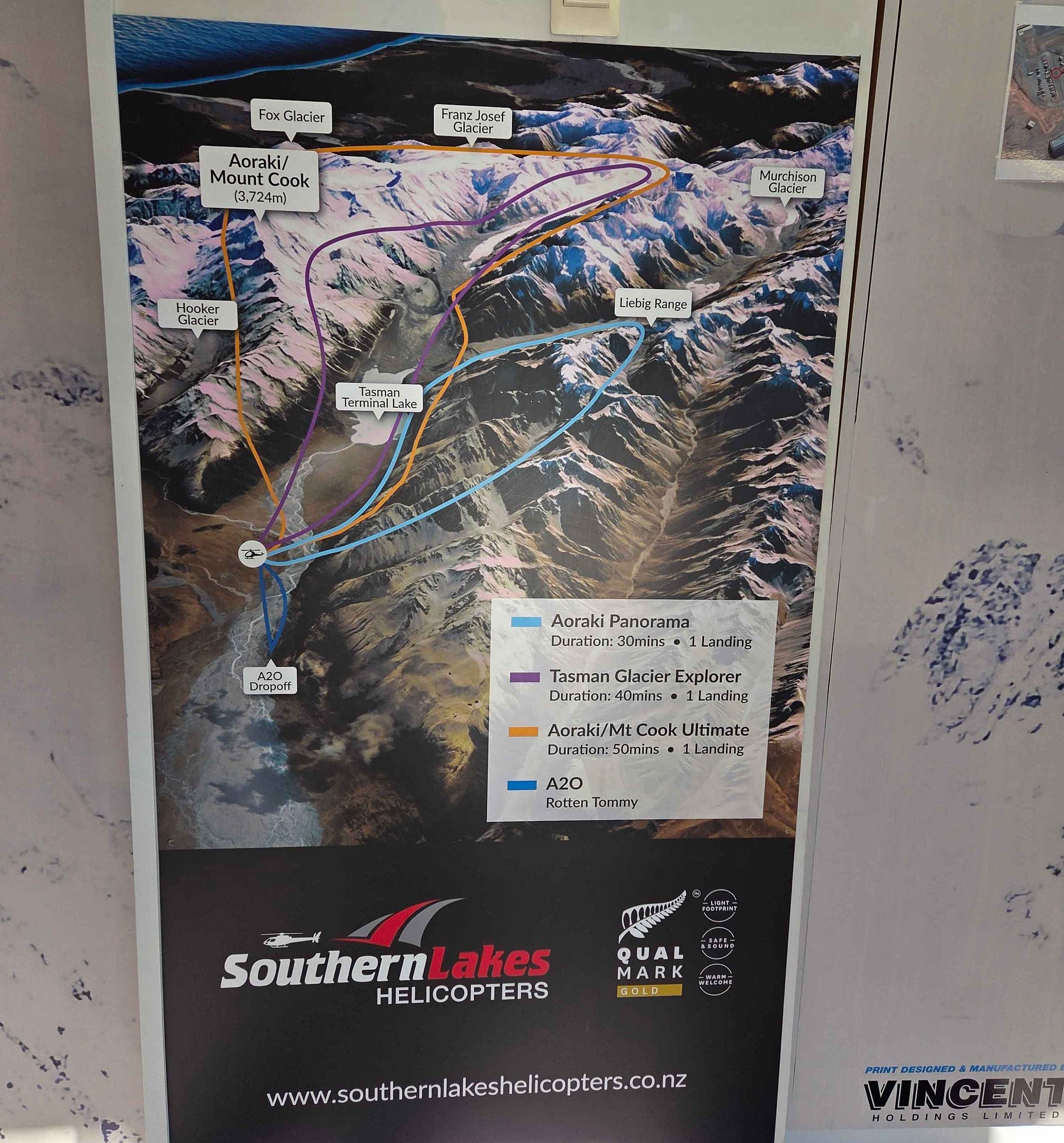
There are other services as well, such as The Helicopter Line.
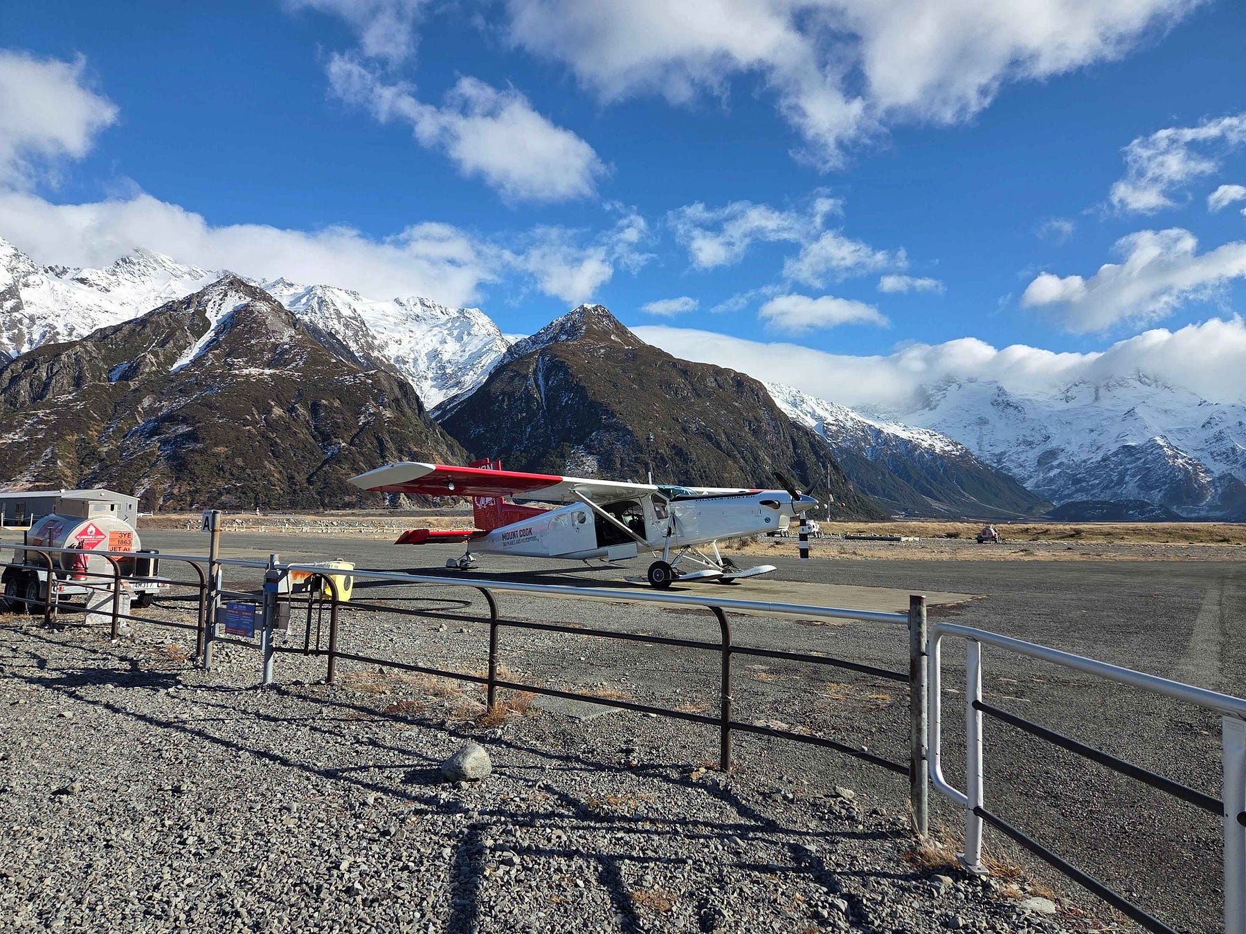
From the airfield, we took off in the skiplane, which you can see here.
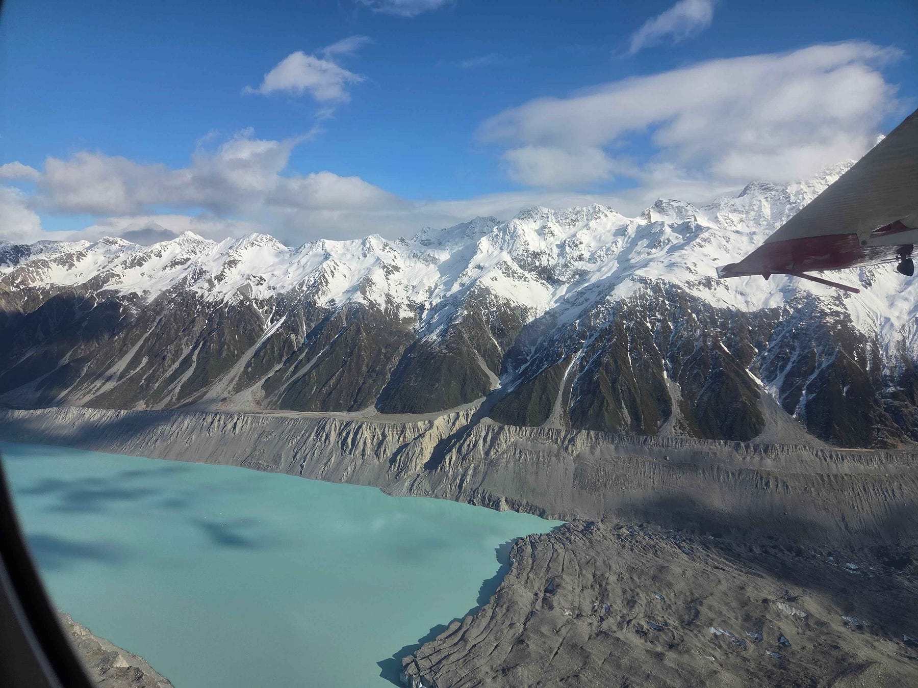
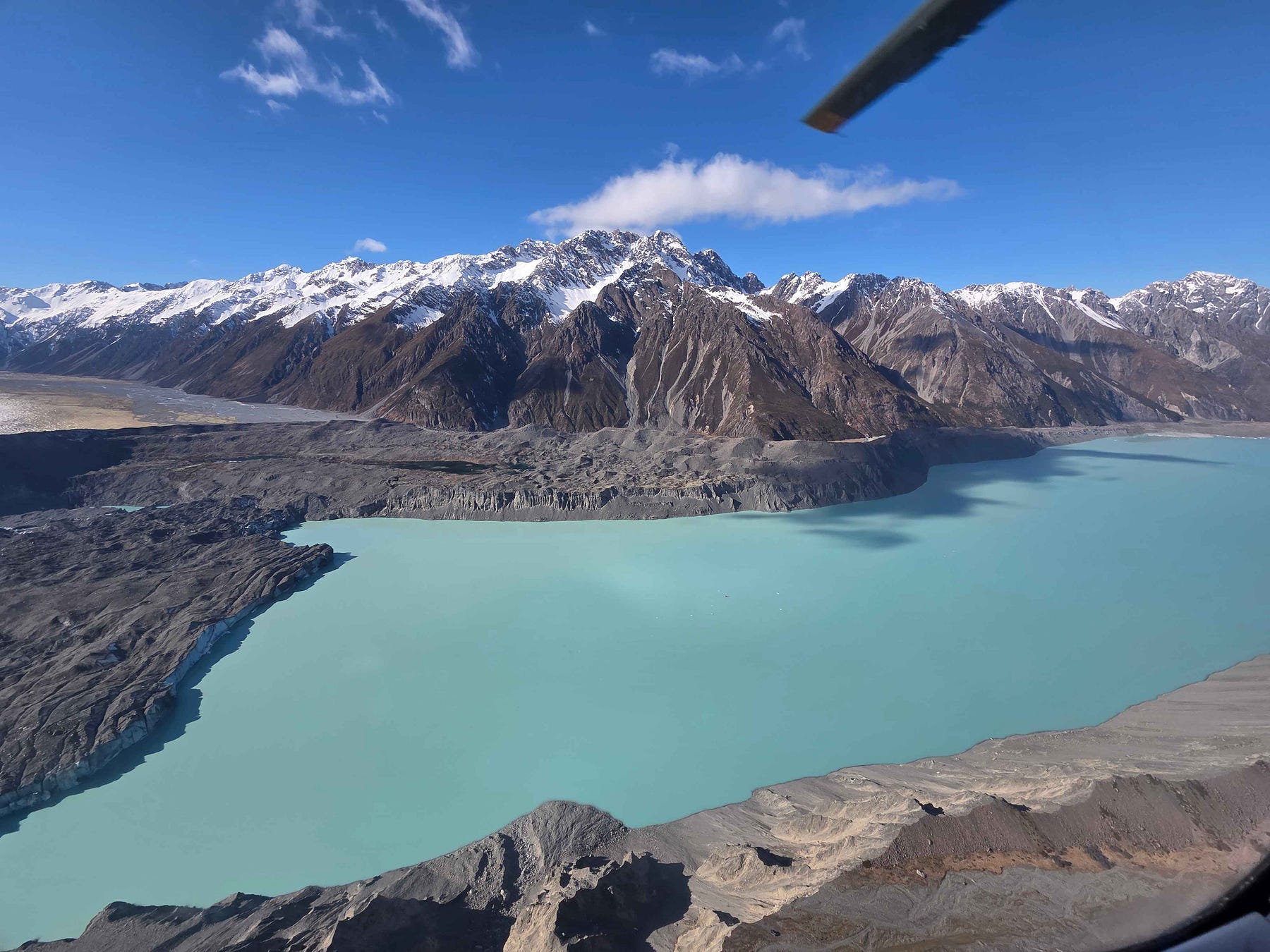
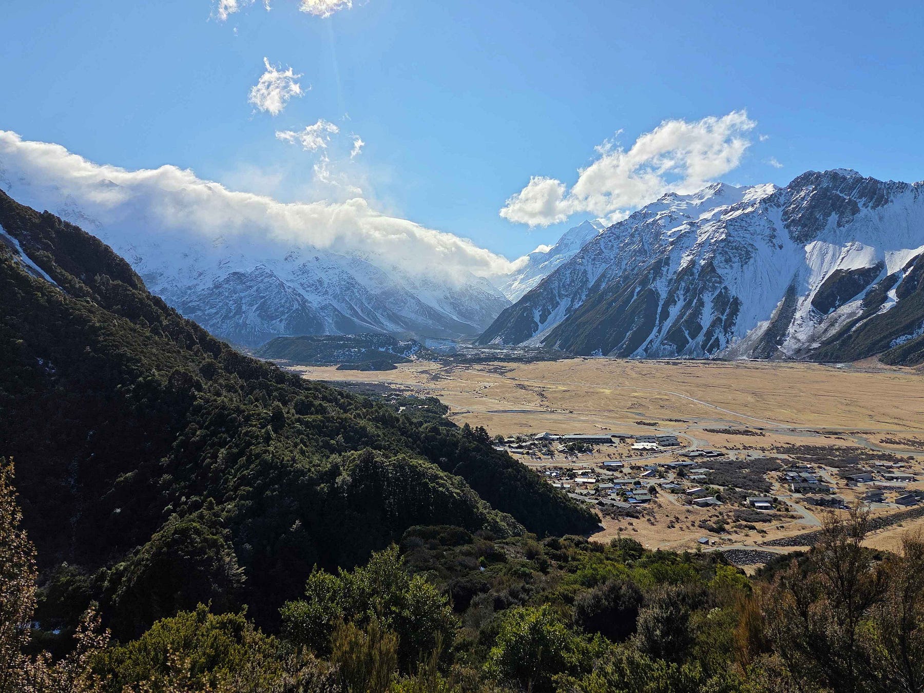
The Tasman Glacier, officially Haupapa / Tasman Glacier, is the longest glacier in New Zealand. In the 1946 map above, the Tasman Glacier is described as being 18 miles in length and two miles wide. But it has since shrunk, and now has a paint-blue lake at its foot, the Tasman Terminal Lake, or Tasman Lake, which formed out of several smaller meltwater ponds in the mid-1980s and has since grown dramatically.
The ice at the head of the Tasman Terminal Lake looks brown, because it is covered in rock dust from crumbling hillsides exposed by the retreat and thinning of the glacier. This is really obvious in the next photo.
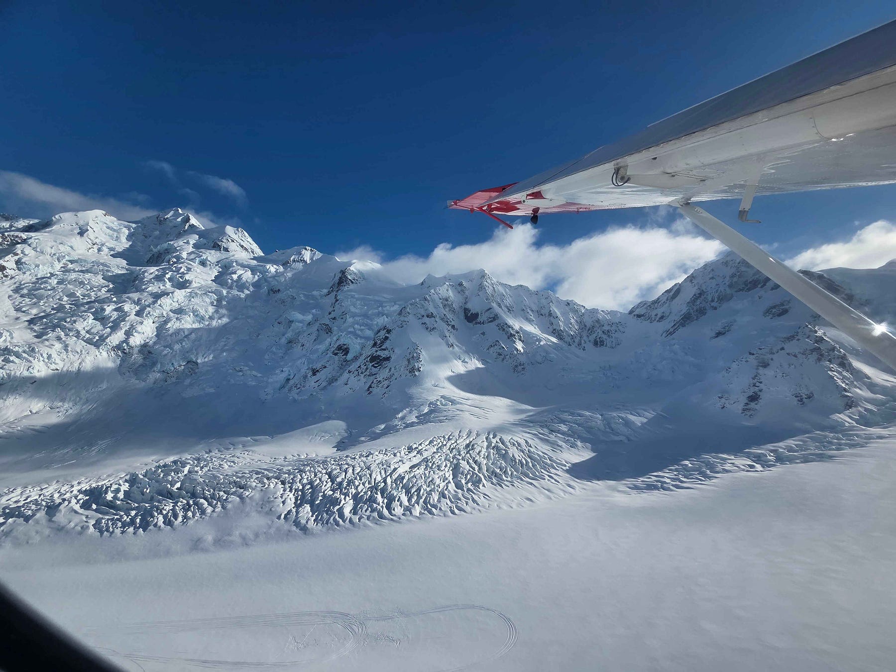
Here is a video I made of my flight up to the landing spot, higher up on the Tasman Glacier.
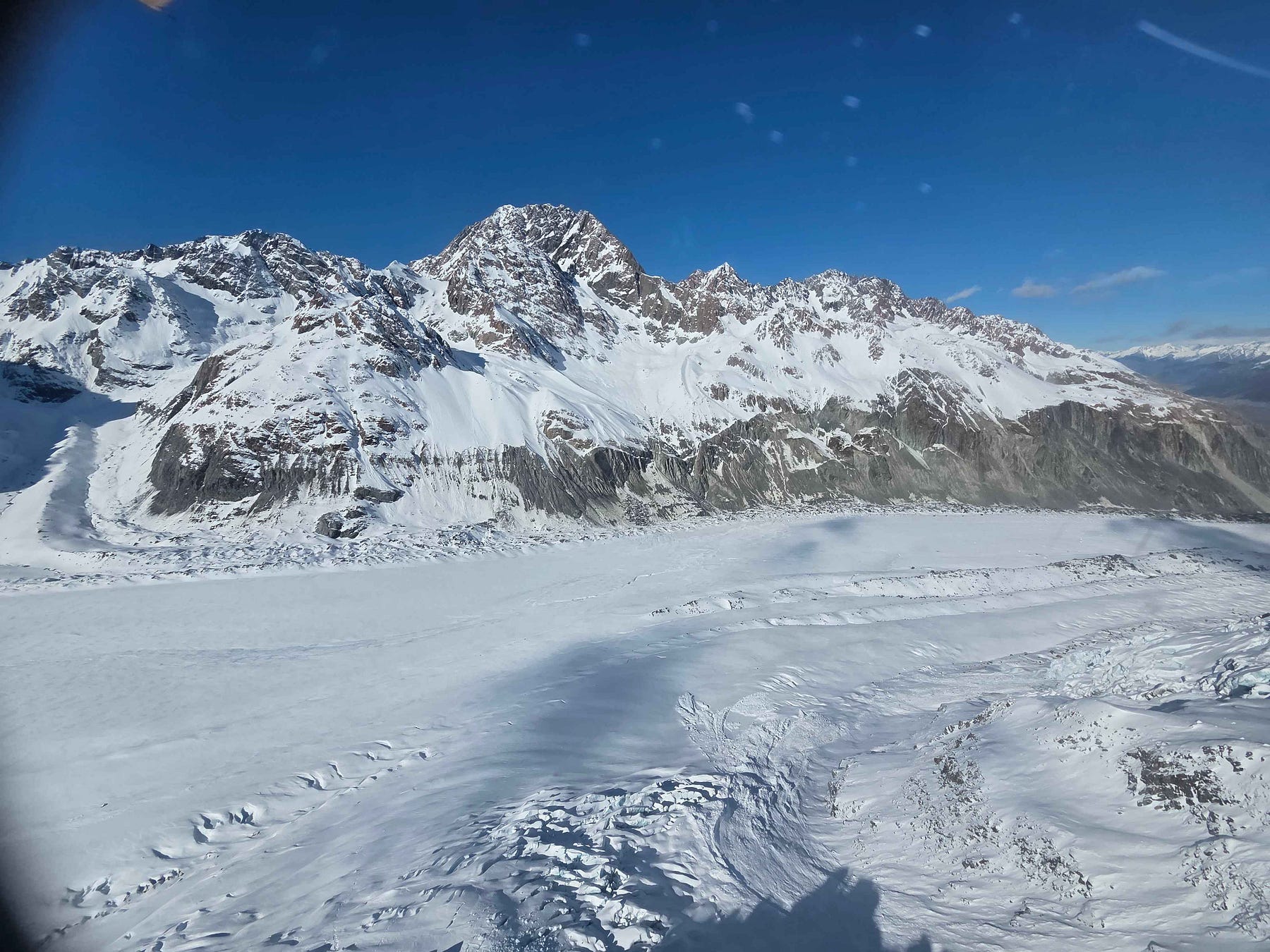
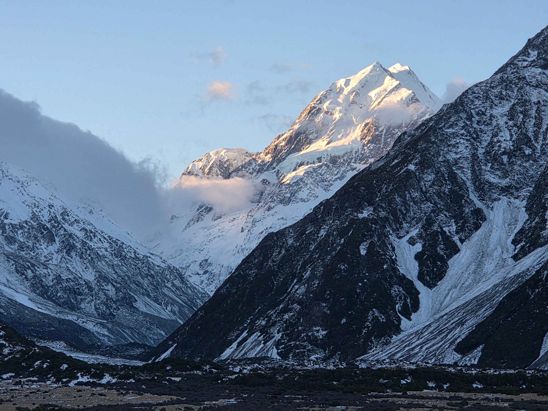
The next photo shows the plane flying over a healthier and snowier part of the glacier, further up. This is perhaps how the Tasman Terminal Lake area looked back in 1946.
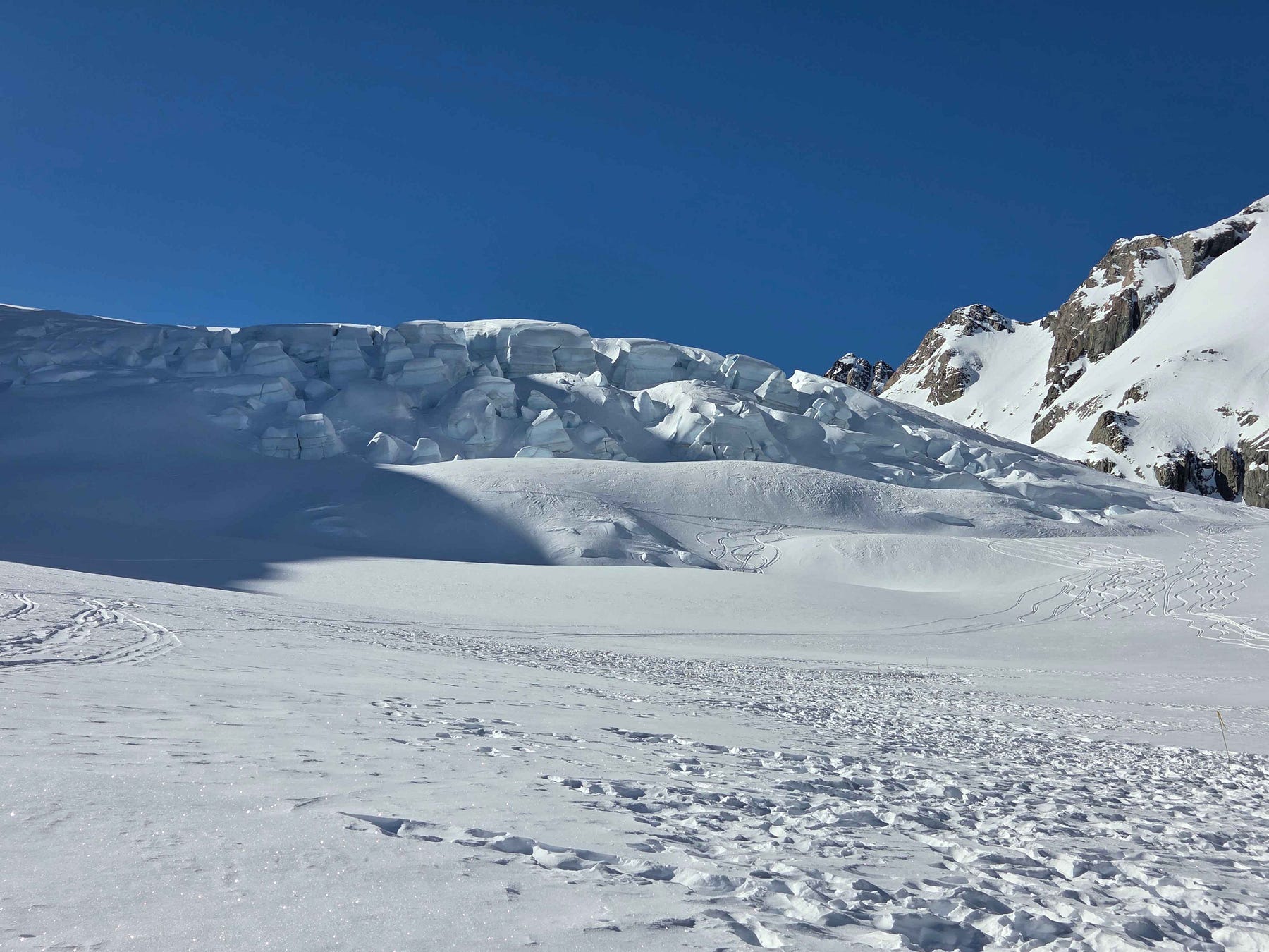
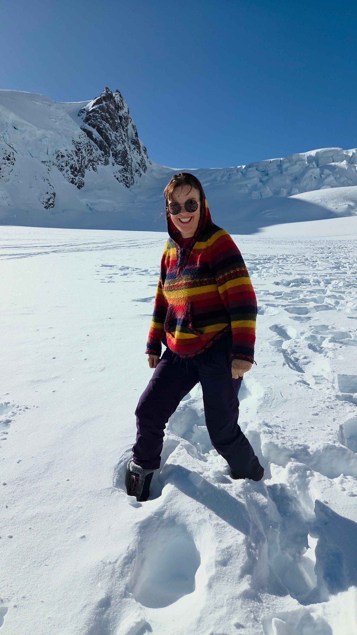
And so, we landed on the firm ice and snow, as you can see in the video above, and got out to walk around.
In this video, I’m asking some questions about the names of the mountains, and noting that, indeed, even the skiers who came along did not look too expert.
And then we took off in the helicopter, which had somewhat bigger windows than the skiplane.
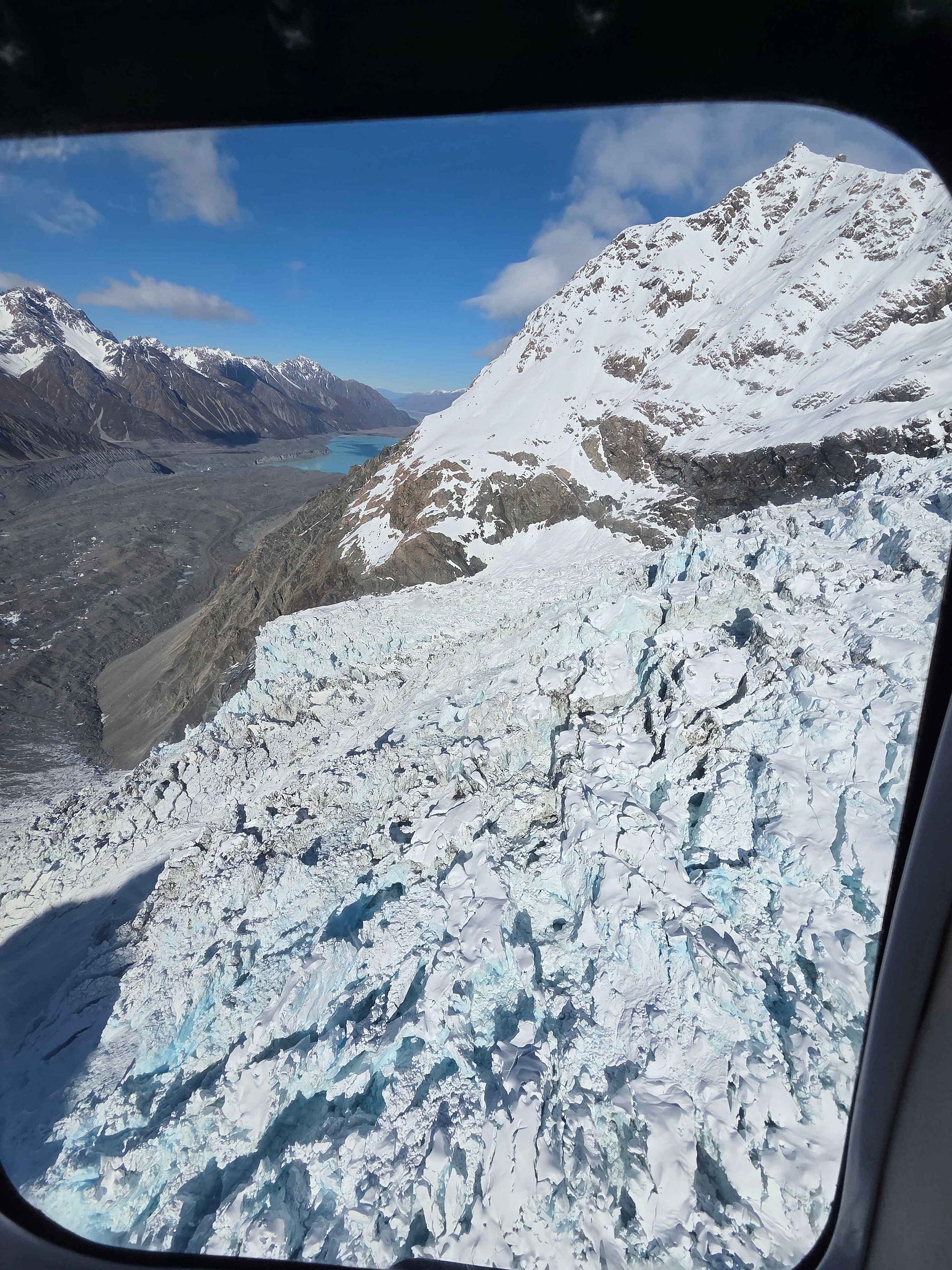
I saw lovely blue ice at a spot called the Hochstetter Icefall.
And then on down over the Tasman Terminal Lake, again.
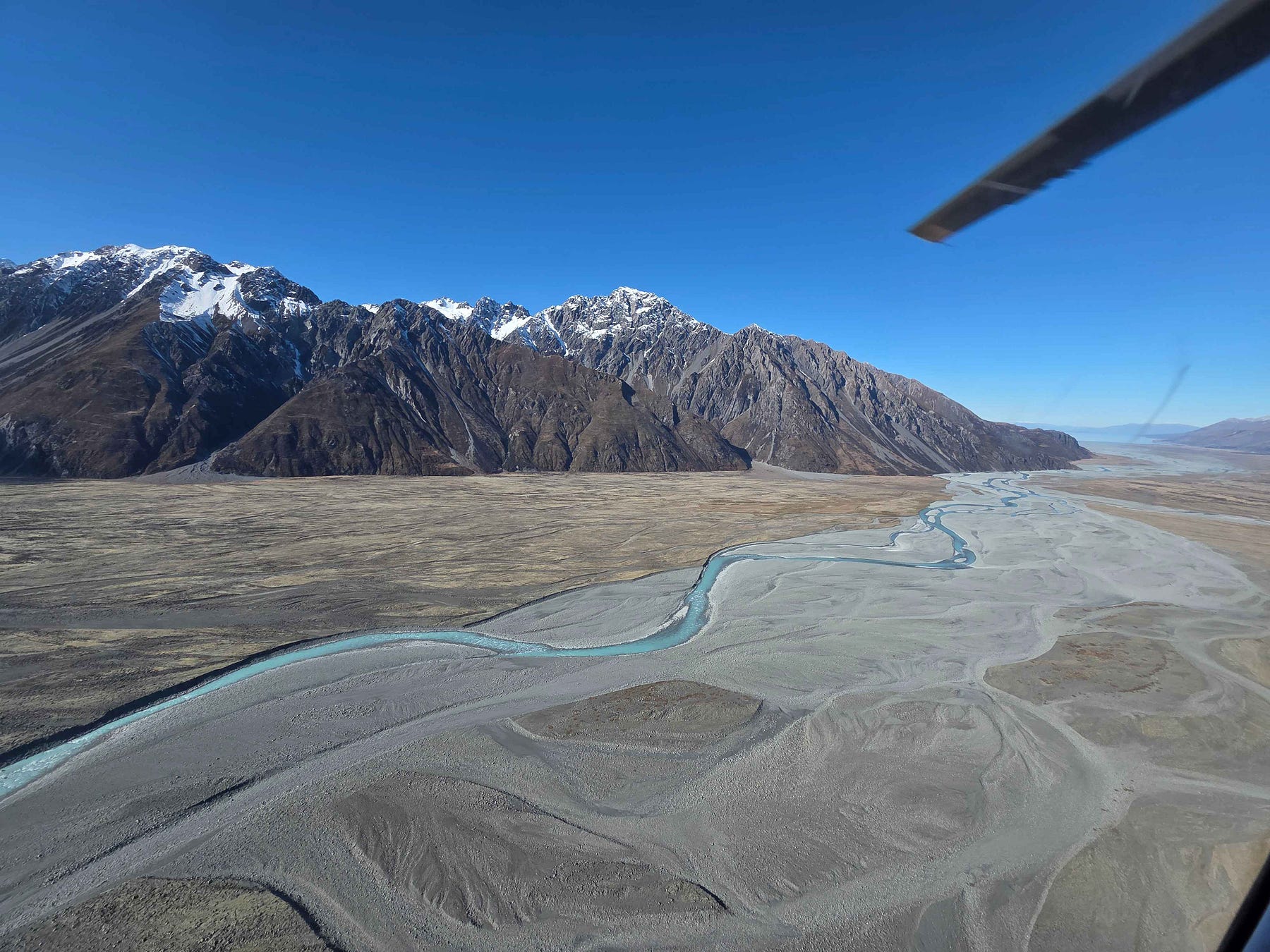
And down the Tasman River to the Aoraki Mount Cook Village.
Here is a video of the whole helicopter flight, starting with its landing on the glacier in a great cloud of snow and ending with my joyful remark that the flight was amazing!
One of the pilots said that things had been very quiet this winter, and that it was mostly Asian tourism that was keeping things going at the moment. Was this more evidence of New Zealand’s current recession, perhaps?
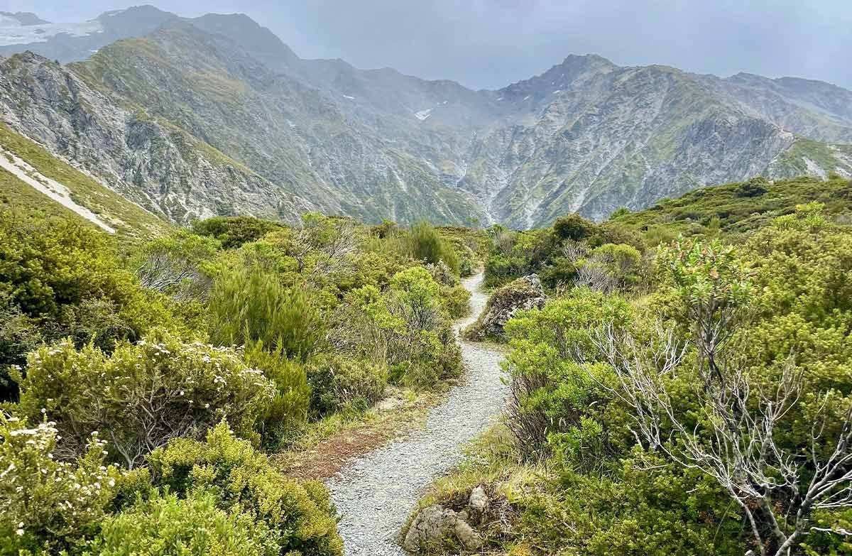
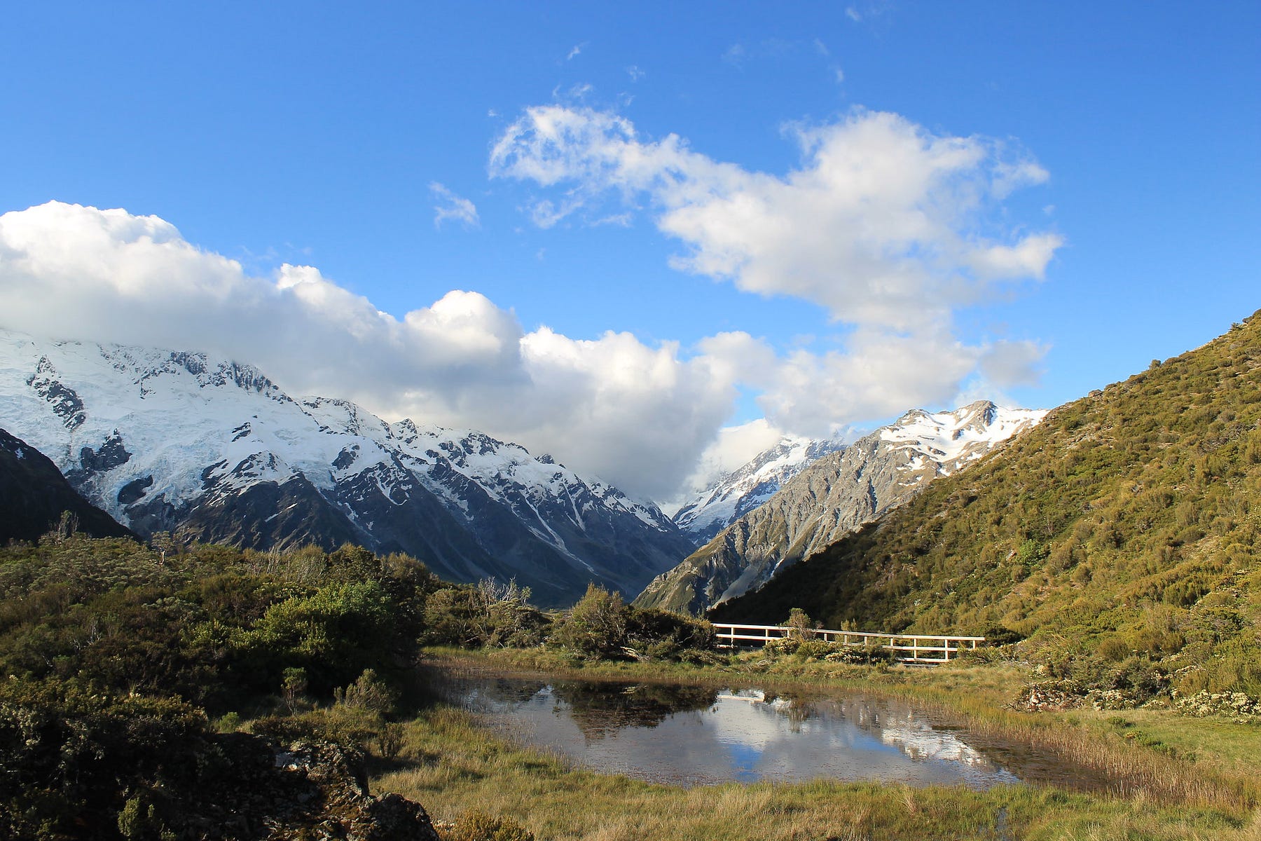
After my flights, I explored the Red Tarns Track, which you can hike up for a good view over the village and up the valleys. Tarn means a mountain lake with no obvious outlet, and the Red Tarns are so called because they are full of red-coloured pond weed.
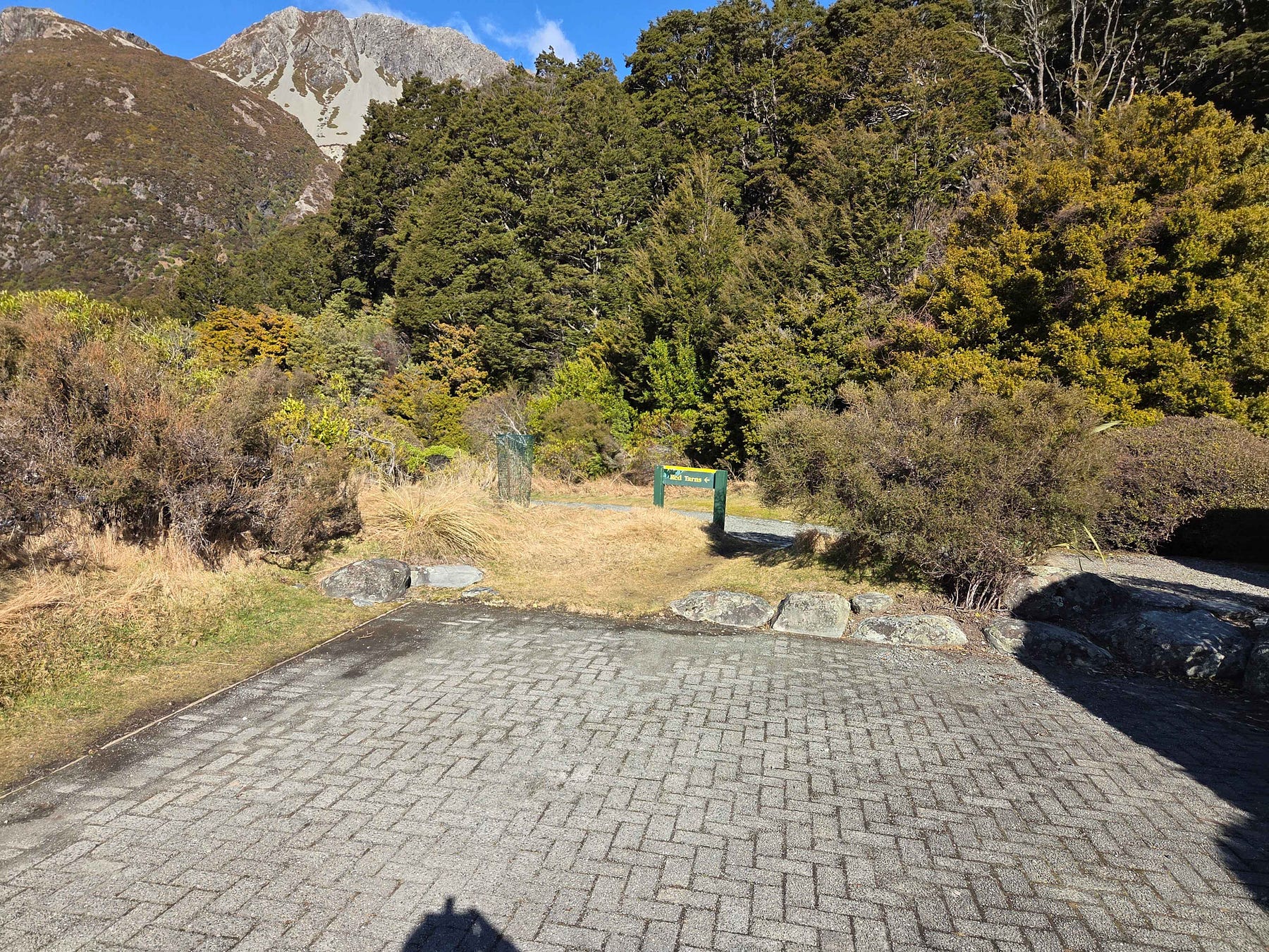
There is a steep and exposed climb, mostly by way of steps, for 300 vertical metres up to a lookout.
After the lookout, there is then, apparently, a short, flat hike toward the Red Tarns, after which the track is named. I should have gone past the lookout and finished the hike!
I have four more posts that are about the Aoraki/Mount Cook area or that include sections on it. They are A Trip to the Mackenzie Country, Enjoying the Glaciers while we Can, Aoraki / Mount Cook and Christchurch to Queenstown, New Zealand: An accessible wilderness journey for solo women travellers.
If you liked this post, check out my book about the South Island! It’s available for purchase from available from this website, a-maverick.com.

Subscribe to our mailing list to receive free giveaways!
