Giveaways
IN this post, I will quickly round off with some more of the things I saw in town, to add to Part 1 and Part 2 of ‘Thrilling Manila,’ before heading out to the volcanic Taal Lake south of the city, and then to Subic Bay, both places where the inhabitants of Manila like to go.
To start with, I saw a wonderful tourist map of the Intramuros district while I was in Manila:

Another of the places I really enjoyed visiting in the Intramuros was the Casa Manila Museum, landmark number 9 on the map. This is an old Spanish house, obviously of the more affluent class.
The following photo shows a four-poster bed carved by a renowned Chinese craftsman named Ah-Tay, of Binondo.

The tiny squares in the window shutters are filled with capiz, the shell of the windowpane oyster, which has nearly flat, translucent shells. The next photo shows the sala, or main hall of the house.

As the saying goes, they sure as heck don’t make them like that anymore.
Indeed, I wonder how all this delicate wood-carving survived the Battle of Manila? (I wrote about that in Part 2, last week.)
I also enjoyed visiting the National Museum of Fine Arts, in another grand building that used to house the Philippines’ Congress and Senate. The next photo shows the Old Senate Hall. These days, the Old Senate Hall is decorated with a grand mural, originally commissioned for the Manila Town Hall, called Filipino Struggles Through History.

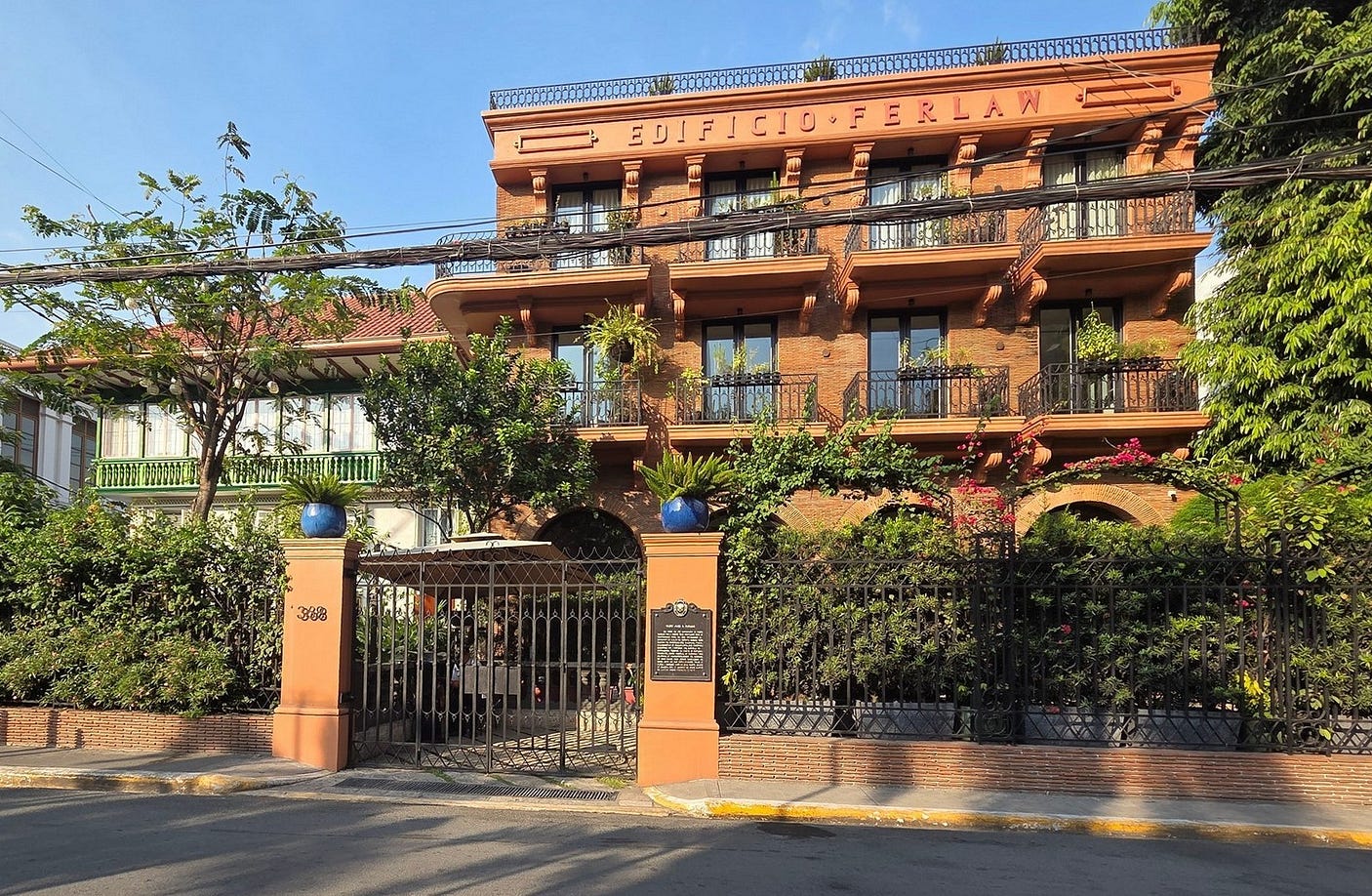
The National Museum of Fine Arts is on Padre Burgos Street, on the edges of the Intramuros. Padre Burgos was another national hero, executed by the Spanish in 1872. From 1865 to 1872, he lived in the Edificio Ferlaw, the beautiful warm-toned building in the next photograph.
But as I said in Part 1 of Thrilling Manila, Manila is not all old stuff. I loved the striking exterior of one of the buildings of De La Salle University, in Makati.

I got a lucky shot of De La Salle’s Green Archer Statue, which stood out against the foliage.

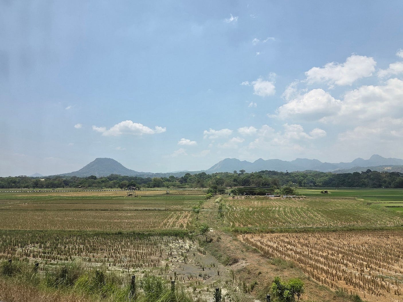
From Manila, I then headed south to the city of Tagaytay, next to Taal Lake, the third-largest lake in the Philippines.

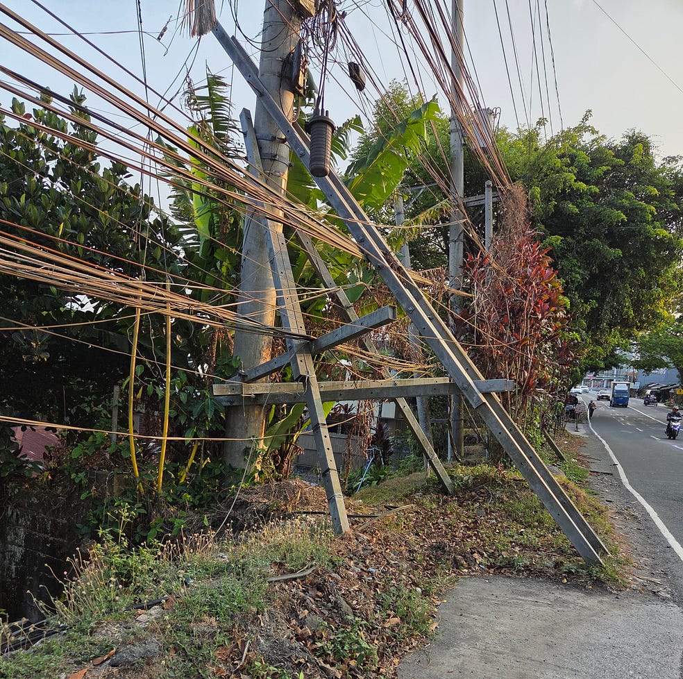
Tagaytay seemed a bit slummy compared to downtown Manila, with some of the world’s dodgiest wiring.

Though it does have a good supermarket, and outdoor markets as well.
I finally managed to catch a ride on one of the famous Philippine jeepneys, or small informal public transport buses. The local drivers are really friendly, and I made a video or two. It was only 25 Pesos, but they can get crowded. I also rode around on a more taxi-like Tuktuk for a while, after negotiating the price.

The Taal (pronounced Ta-ahl) Lake is beautiful, about the same size as Lake Taupō in New Zealand, 25 km by 18 km in the case of Taal Lake, and with a similar history in the sense that Taal Lake was formed by a collapsed volcanic caldera, a legacy of huge eruptions that took place thousands of years ago.
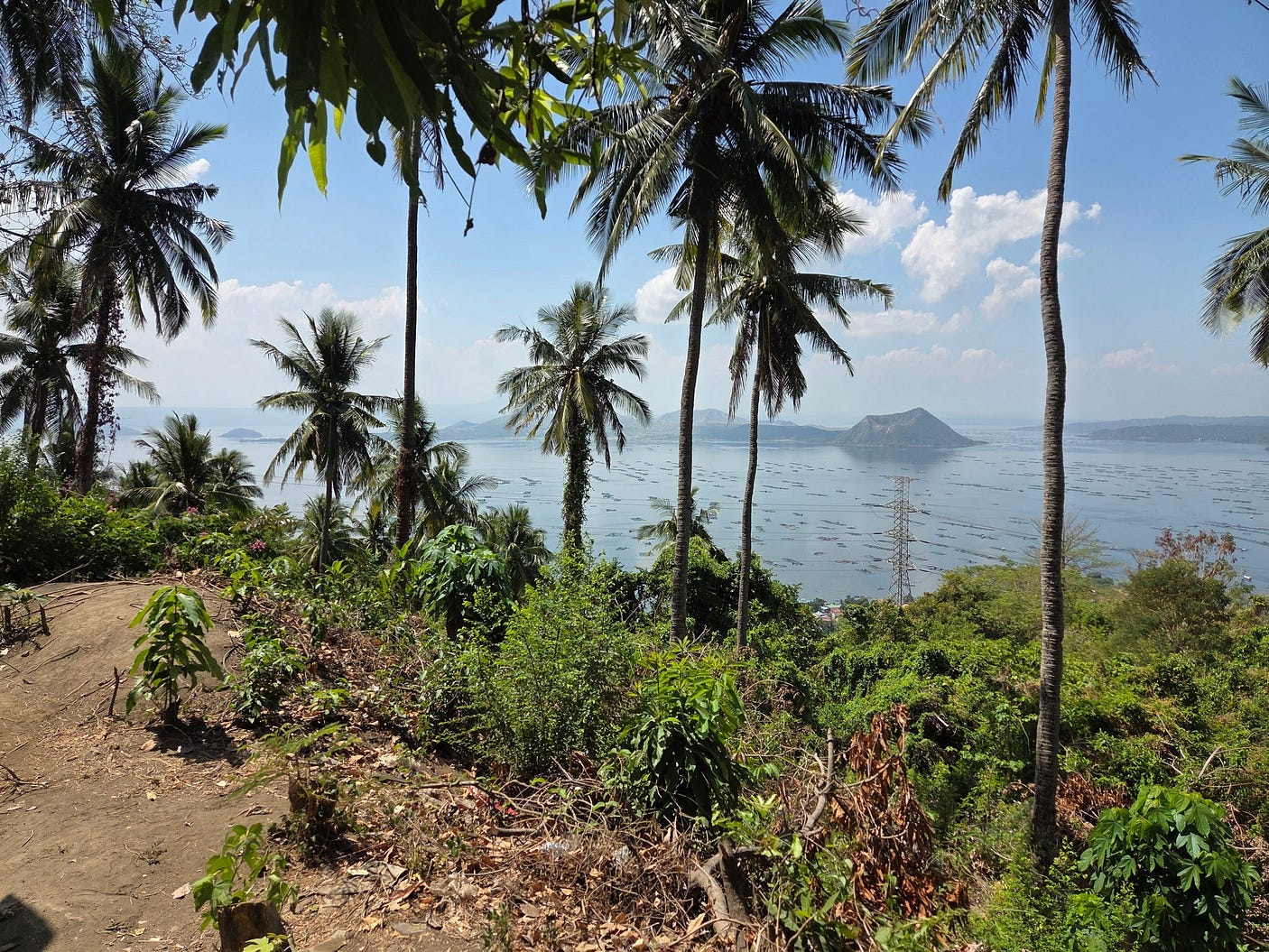
You can get a good view of the lake from the People’s Park in the Sky, at the top of Mount Sungay, in Tagaytay. The island on the sign below is Volcano Island, which now occupies the middle of the lake. At the right, you can see Volcano Island’s tallest peak, the Binintiang Malaki or Giant Leg cone, now dormant apparently.

It might be a bit rough and ready, but Tagaytay clearly has its attractions, and it is where many Filipinos go on their holiday. Though, I saw hardly any foreign tourists there, or none that I could identify.
I stayed very economically for three nights at CityLand, in an air conditioned apartment of my own. Though I didn’t really need the air conditioning as it wasn’t that hot, perhaps because Tagaytay is near the highlands, or because the lake keeps things cool.
Taal Lake used to be an inlet of the sea, but the passage to the sea was blocked by a 1754 volcanic eruption, and it has now become a freshwater lake, standing 5 metres above sea level.
The 1754 eruption wasn’t the only one in more recent times than those in which the caldera formed. Since the Spanish made the first written record of an eruption at Taal, in 1572, there have been more than thirty others, with the most recent ones caught on camera as well.
These days, the eruptions come from Volcano Island in the middle of the lake, which has a mini-lake within, save on the odd occasion when the water leaks out through cracks caused by the latest earthquake or eruption.
A video, here, shows a 26 October 2025 eruption bursting through the central lake of Volcano Island with the force of an atomic bomb.
In fact, the Taal Volcano is regarded as one of the most potentially dangerous in the world, mainly because of its proximity to Tagaytay and other cities on the densely populated island of Luzon: more than 24 million people currently live in the potential hazard zone of a large eruption.
About 6,000 people are thought to have been killed by the Taal Volcano over the years since 1572.
Volcano Island, the source of all the eruptions since 1572, is clearly at least as dangerous as Whakaari / White Island, where many tourists were killed by a similar eruption to the one in the video above in 2019.
The worst eruption in modern times was in 1911, destroying several villages that were on the island at the time and killing at least 1,000 people, probably more in reality, and creating the present crater lake on the island.
Nobody is officially allowed to live on Volcano Island these days. Even so, some do.
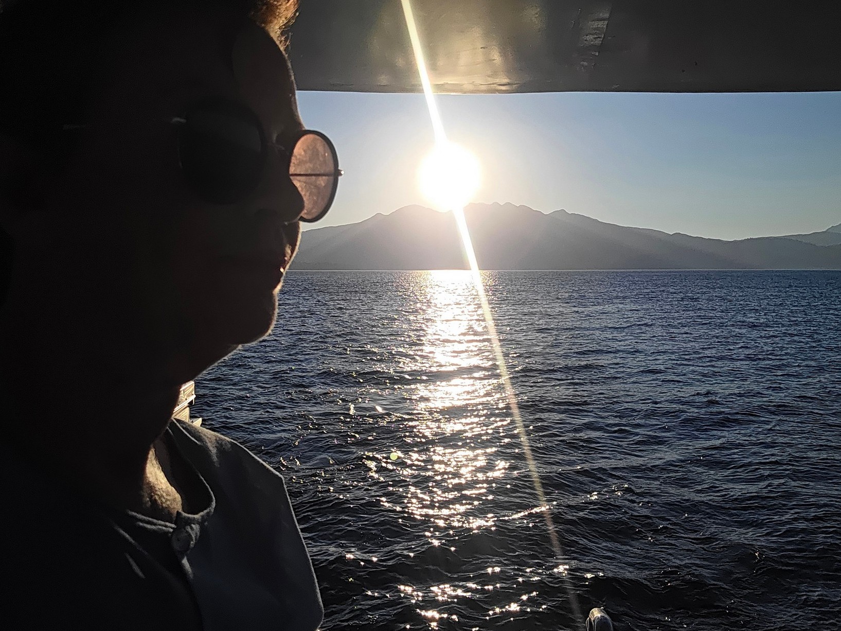
I went for a ride on Taal Lake, in the distinctive motorised double outriggers that sail on the lake. It would have been cheaper if I had joined a tour, by the way: they call these ‘joiner fares.’
Motorised outriggers are really common in the Philippines, where they are known as ‘pump boats.’
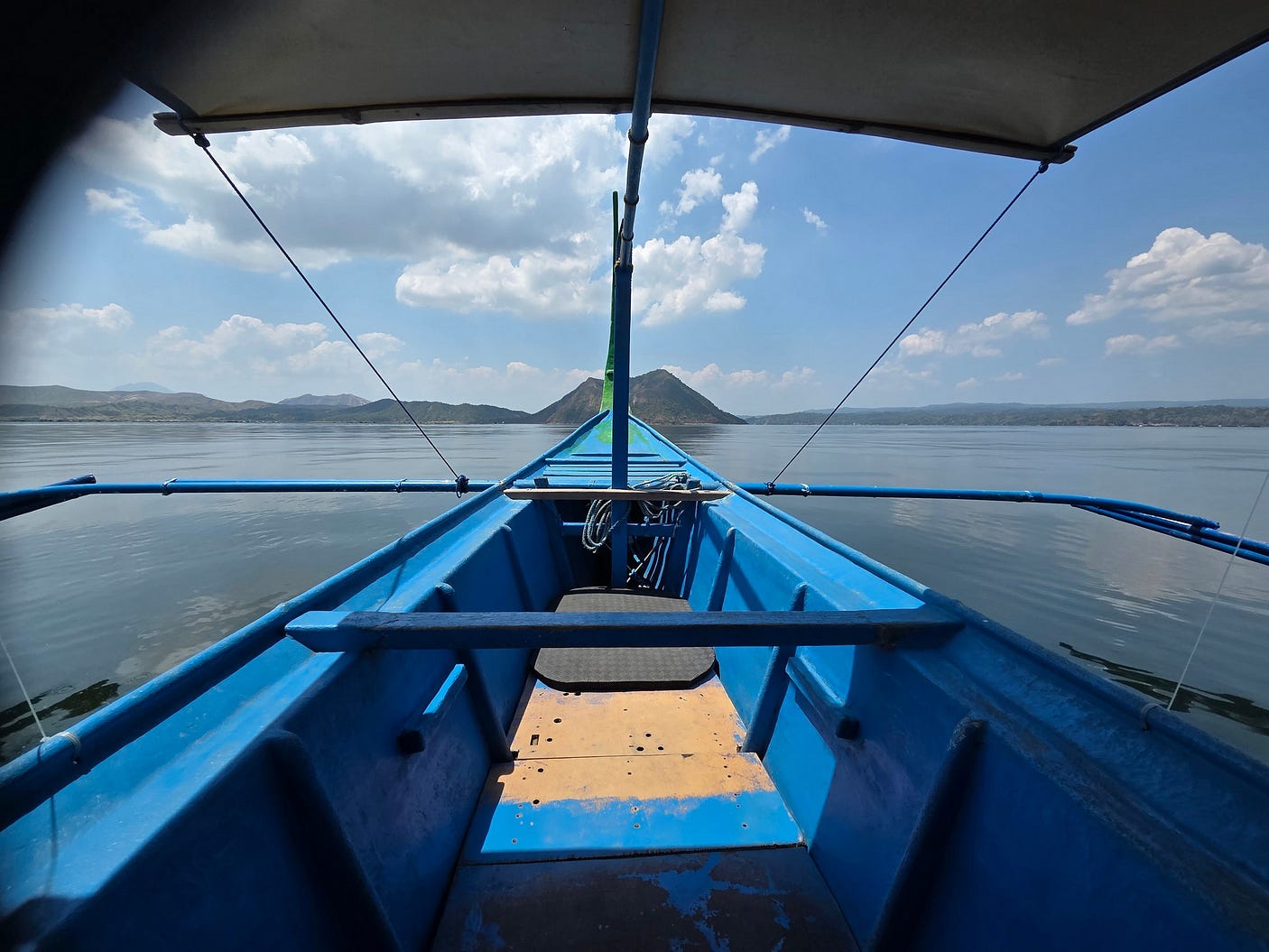
The prow of the pump boat in this shot is pointed toward Volcano Island with its tallest peak, the Binintiang Malaki or Giant Leg cone, dead ahead. There are lots of cones and craters on Volcano Island, and the lake through which recent eruptions have blasted is in the middle.
Here is another photo of a double outrigger on Taal Lake, a pink one.

The lake was very placid when I was there, and I was able to get some lovely shots of reflections in the water.


Here’s a video I made of Taal Lake, heading there by jeepney and tuktuk, taking in the view from the People’s Park in the Sky, and then going on my boat ride.
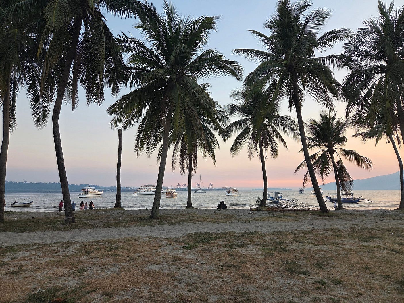
After Taal Lake, I headed out to Subic Bay, the site of a former US military base and a present-day Philippines naval base, but also something of a beach resort as well. It was very quiet because of Easter.

I stayed at the Subic Bay Hostel, and explored the Harbor Point Mall and local places to eat.


It was quite easy to walk around.
I went for a couple of boat cruises on the bay.
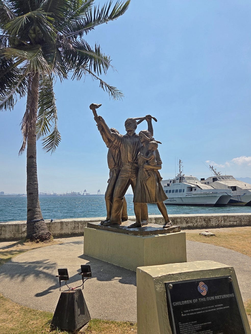
There were lots of monuments: this next one is a patriotic monument to resistance movements, called ‘Children of the Sun Returning,’ a line from the English-language version of the Philippine National Anthem.
And this one was an Australian monument to prisoners who were transported on ‘Hell Ships’ to Japan during World War II.

And the ‘Filipino Shipmate’ memorial, commemorating 35,000 Filipinos who served in the US Navy between 1901, when the practice began under US colonial administration and 1992, the year the US military departed from the Philippines.

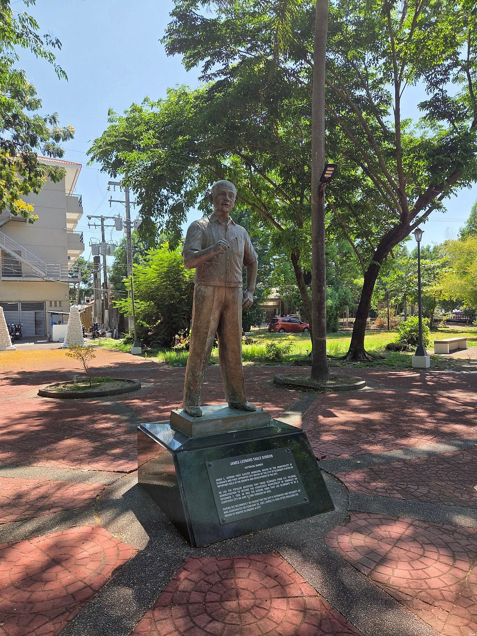
And to James Leonard Tagle Gordon, a local mayor and Filipino patriot who fought corruption and was assassinated in 1967.
Some of the Filipinos in Subic Bay didn’t want to talk to me. They thought I was American, and are uneasy about what Trump is doing.
Another thing I heard was that in the countryside, wages are three times lower than in Manila. On the other hand, as I heard from an American on the cruise boat, rural rentals are very cheap.
Here’s a video I made of my boat cruises on Subic Bay!
Next week, I head to some tiny islands north of Luzon, the Batanes, which are the northernmost islands in the Philippines.
Subscribe to our mailing list to receive free giveaways!
