Giveaways
IF you are in Queenstown and want to do a road trip that takes in the essence of North Otago, this is the journey for you!
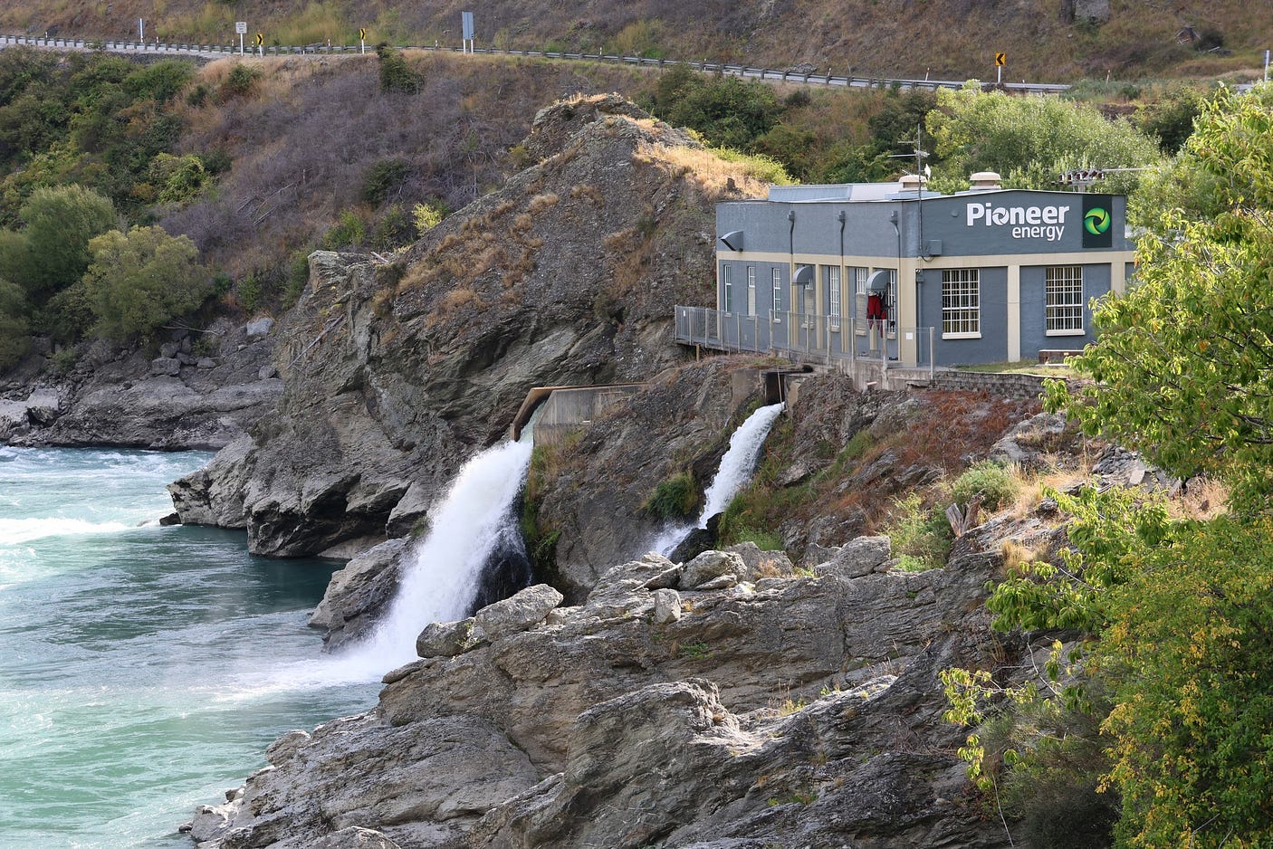
Here is the northern part of the loop, which runs through the Lindis Pass and Ōmārama and then down the Waitaki River — you can detour and take side roads to see more of the sights— to Kurow and Duntroon, before turning back through Danseys Pass. (Oamaru, the subject of a recent post of mine called ‘“Whitestone City:” the wonderland of Oamaru,’ is also well worth visiting if you want to take another day!)
Here is a map that includes the southern part of the loop, returning to Cromwell and Queenstown by way of a road called the Pigroot, which you would join at Ranfurly from Naseby and Danseys Pass.

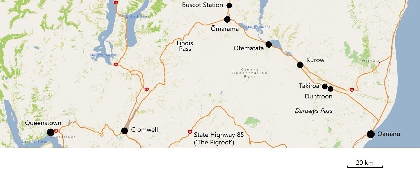
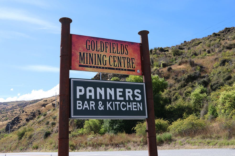
Starting and returning, between Queenstown and Cromwell, you go through the Kawarau Gorge. In the gorge, there are couple of good stopoffs, each quite close to the other. These are the Roaring Meg Lookout and the Goldfields Mining Centre: a gold fossicking area with a café called Panners Bar & Kitchen.
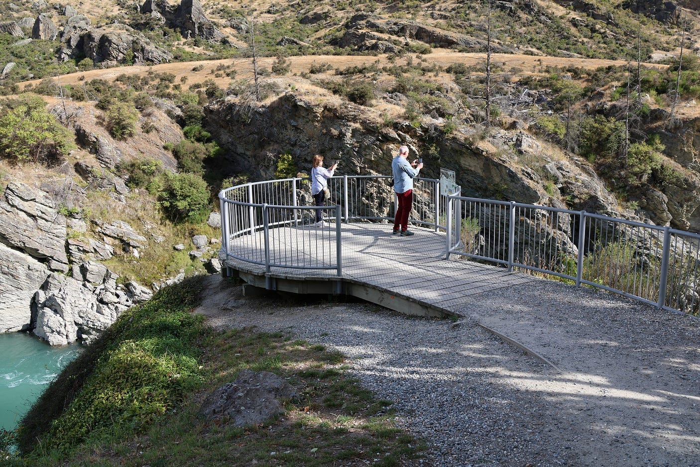
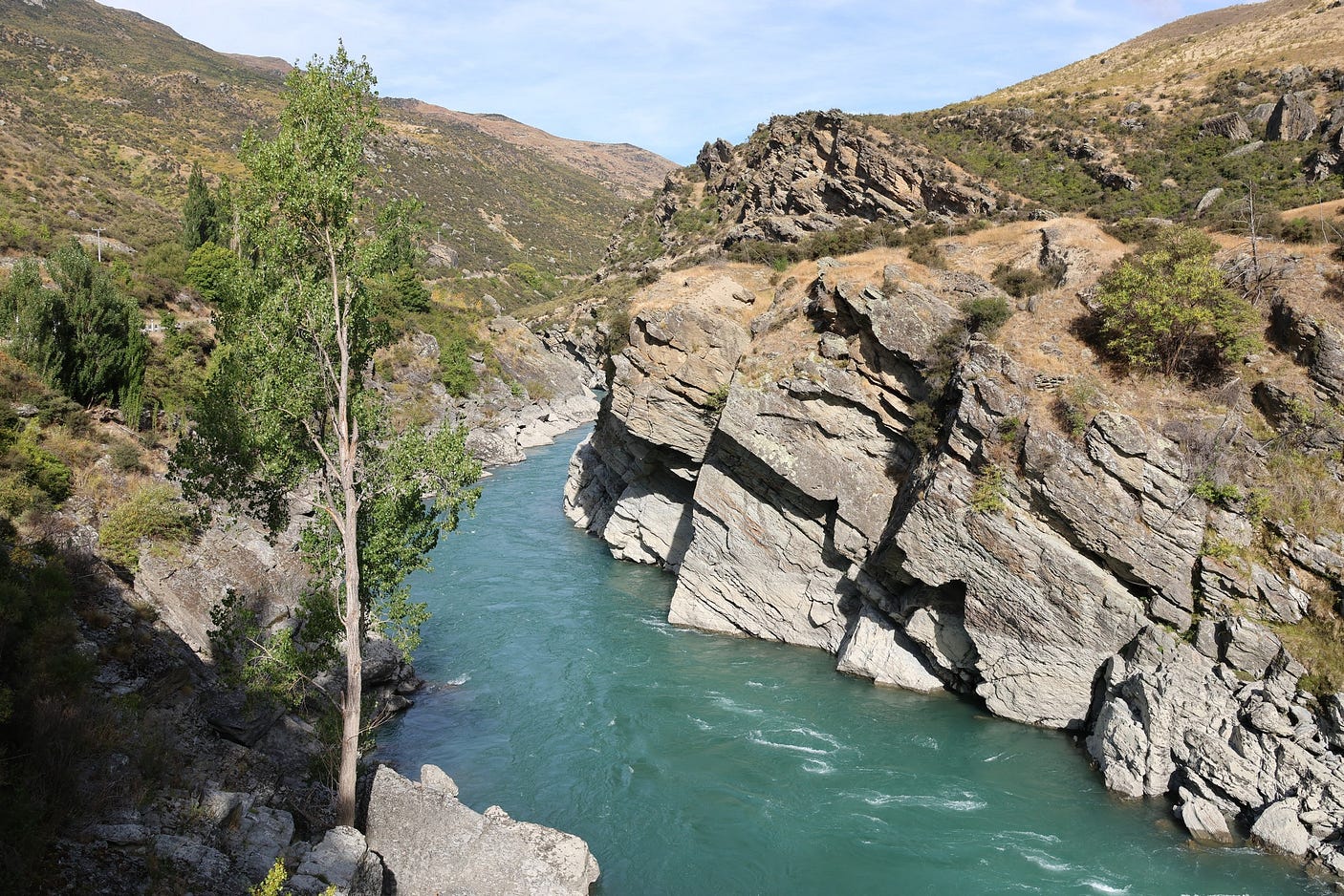

The Roaring Meg Power Station, now operated by Pioneer Energy, was built in the 1930s. It is fed by a pipe that extends up the mountainside on the other side of the road. At times, it has been flooded by the risen river, which must be a sight to behold.
Information signs at the Roaring Meg Lookout say that South Island Māori, following their traditional trails for pounamu and seasonal resource-gathering, used to cross the Kawerau River near the present-day Roaring Meg by way of a natural arch with a narrow gap in the middle, which must have required courage to jump across. The arch has since fallen, so you can’t jump across the river anymore!
A few kilometres further on in the direction of Cromwell from the Roaring Meg, you come to the Goldfields Mining Centre, where you can still pan for gold, and Panners Bar & Kitchen.
You get to the Goldfields Mining Centre and Panners by crossing a narrow footbridge from where you park your car:

Here is some information, just before the footbridge:

Here’s a video of both attractions:
From the southern outskirts of Cromwell, a few kilometres further on from the Goldfields Mining Centre, you can take a side trip across the Kawerau River to visit the town of Bannockburn and the Bannockburn Sluicings, another old goldmining area:
All three of these attractions are perhaps best visited on the way back, as they are all on the left side of the road as you are heading westward to Queenstown. Of course, it really depends on the weather.
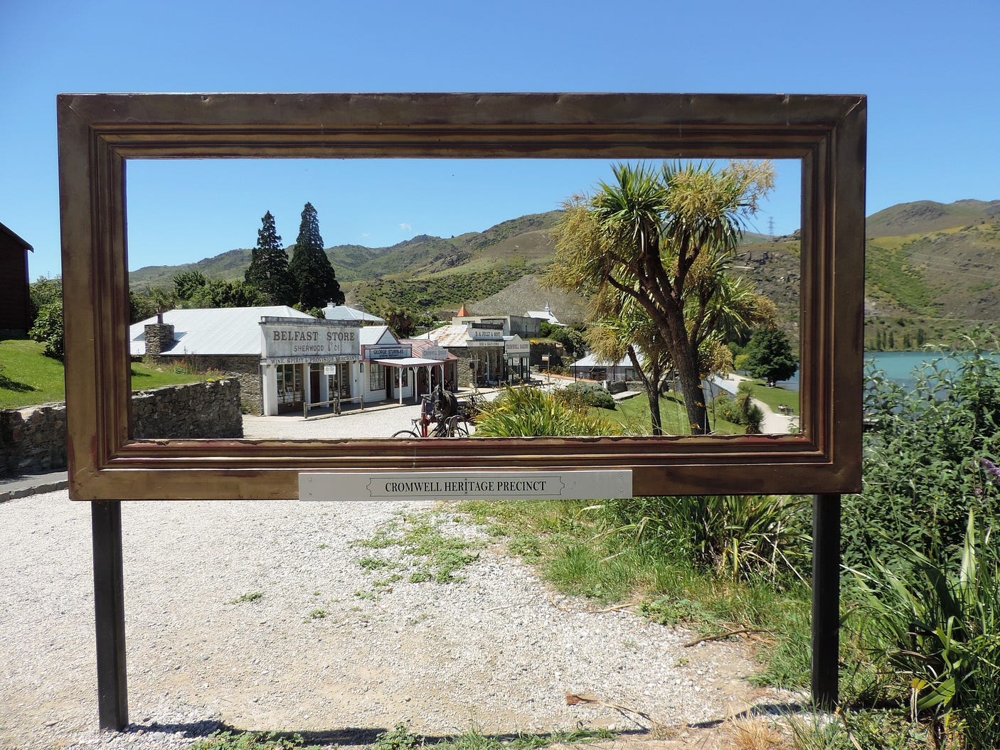
In Cromwell, it pays to check out the Heritage Precinct, which I’ve blogged about in ‘Cromwell and the Paradise Valley: or, Xmas in New Zealand.’
After Cromwell, you go north along the shores of Lake Dunstan, an artificial lake created by the Clyde Dam, which began generating power in 1992. At the top of the lake, there’s a road on your right as you are heading north, called Bendigo Loop Road, which joins the main highway at two points. This leads to some wineries and farmstays and to an old mining area called Bendigo, one of many in this part of New Zealand.
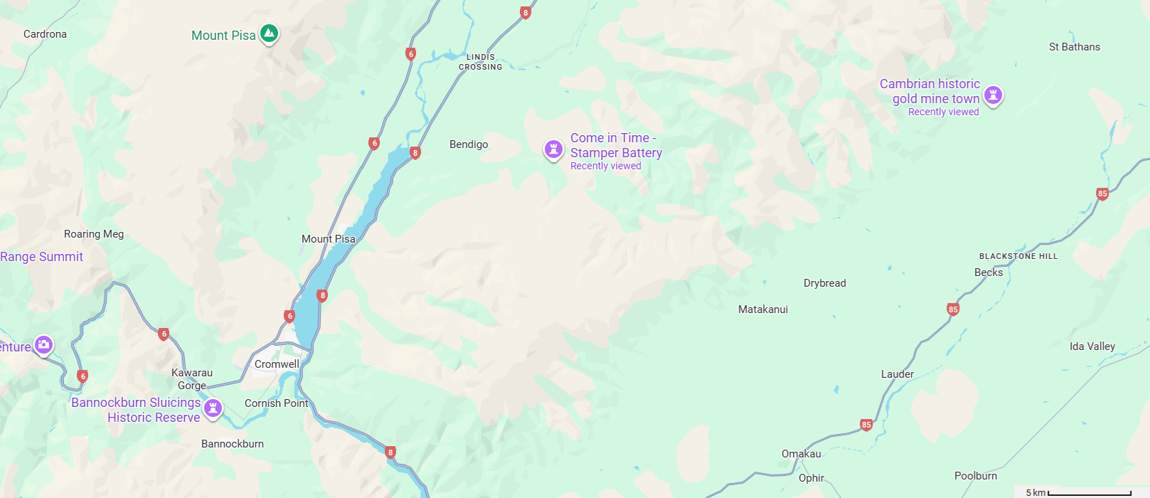
I’ve blogged about Bendigo lately, in a post called ‘A New Mine at Bendigo?’ The name was conferred by Australian miners, as there is also a Bendigo in Australia.

Back on the main road again, after Bendigo, you pass through the tiny village of Tarras, which is primarily a food stop these days, and on toward the 965- metre summit height Lindis Pass, a traditional Māori pounamu route and, after that, a goldminers’ route.
The Lindis Pass is sometimes closed to vehicles in winter, but it seems that the old-timers used to trudge through it in all weathers. I’ve written about it recently as well, in a post called ‘The Romantic Lindis Pass.’

Here is a video showing the remains of the Lindis Pass Hotel, a welcome stop in the old days (see ‘The Romantic Lindis Pass’ for how to get there).
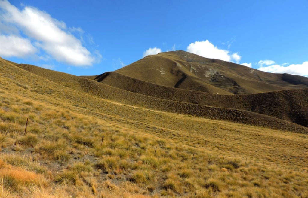
As you get near the top of the Lindis Pass, where there is a lookout, the landforms get very sculptural.
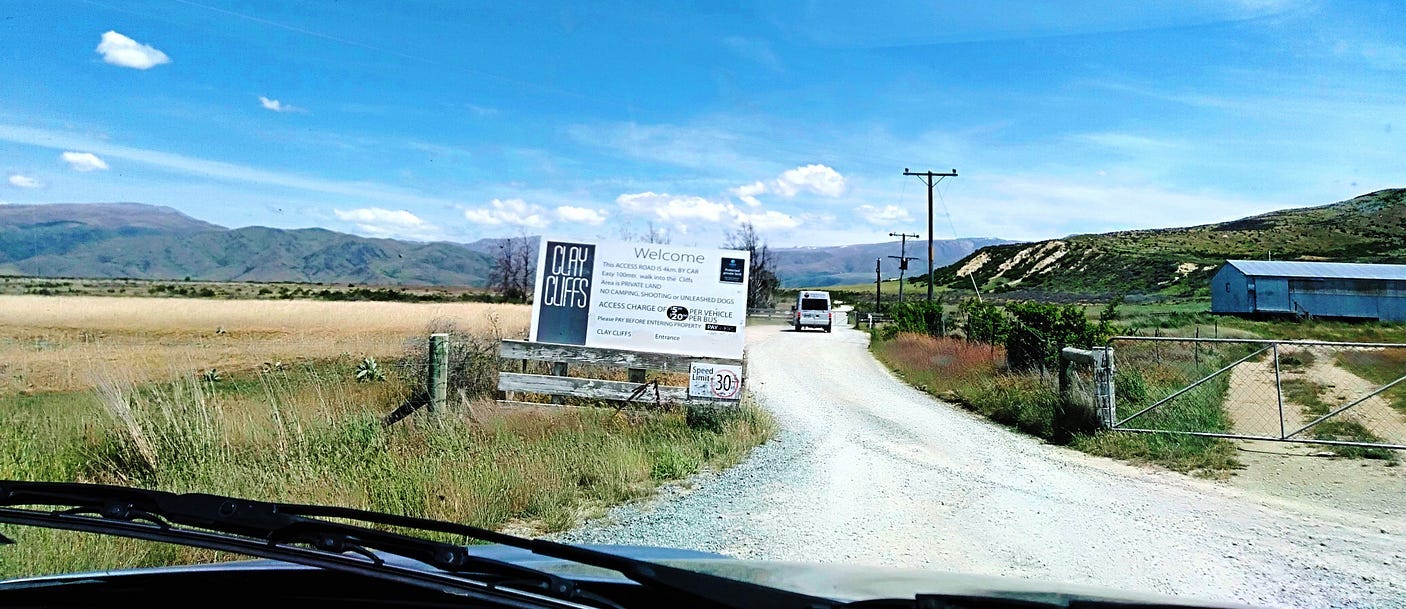
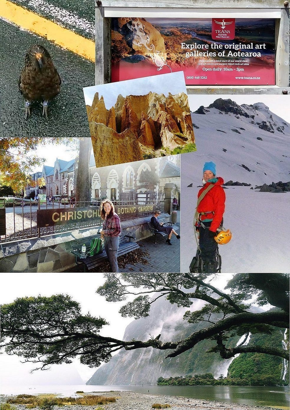
Another must-see once you are through the Lindis Pass is the Cappadocia-like Clay Cliffs, which a newspaper article describes as being roughly ten kilometres from Ōmārama, “off SH83 onto progressively smaller roads . . . beside the impressively braided Ahuriri River.” Perhaps because the Clay Cliffs are up a back road, they’re easy to miss. But don’t miss them!
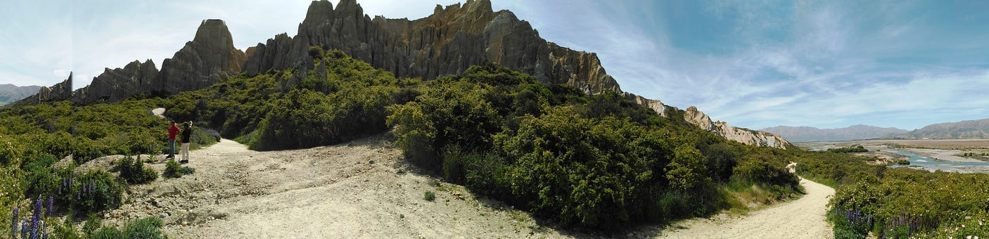
Here is a panorama of the clay cliffs:
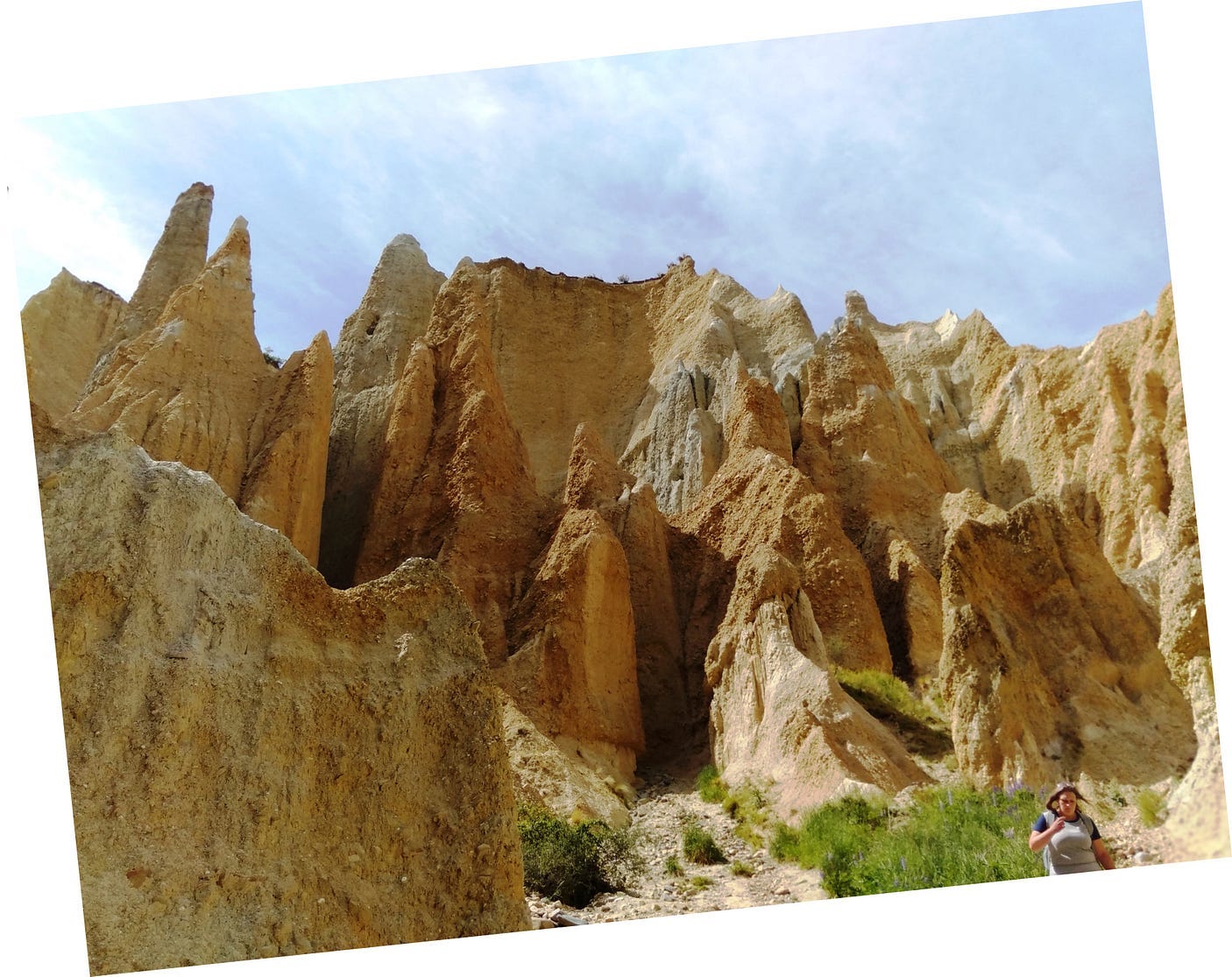
And a closer view:
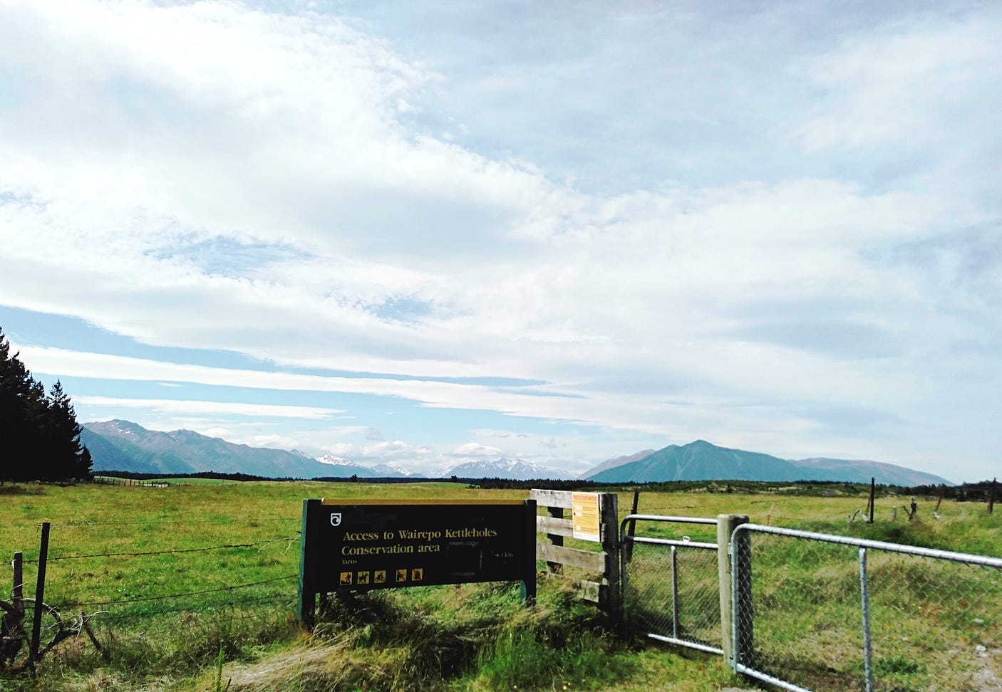
Also down a back road are the Wairepo Kettleholes, in the Ahuriri Conservation Park. Wairepo means ‘swampwater’ in Māori: a clue to why this area is interesting to the nature-lover, even if it isn’t quite as spectacular to look at.
Kettleholes, or kettle holes, are holes in the ground created by gigantic blocks of ice, like icebergs but sitting on the land, which occupied the site in the Ice Age and melted thereafter.
When it rains heavily, the runoff from the land nearby flows into the kettle holes, which thus act as cisterns. The holes now have marshes on top. The result is an ecologically significant system of permanent wetlands. A permanent oasis, in what’s otherwise a fairly arid region where the grass isn’t always green or lush by any means.
Past the Clay Cliffs and the Wairepo Kettleholes, you get to Ōmārama, a somewhat larger village with a big cafe and souvenir shop, from which you can either head northward to Twizel or eastward down the Waitaki Valley.
The origin of the name Ōmārama is unclear. Depending, also, on exactly how it is spelt, it could mean several things. But most people seem to think it means ‘place of light,’ a reference to the clear skies over the village. Freezing mists regularly lie over other places nearby for days in winter, as described in another post of mine called ‘A Trip to the Mackenzie Country,’ but Ōmārama doesn’t seem to suffer from that problem.
Because it is so dry and clear, Ōmārama is also one of the few places in New Zealand where merino sheep thrive (they can’t stand the wet).

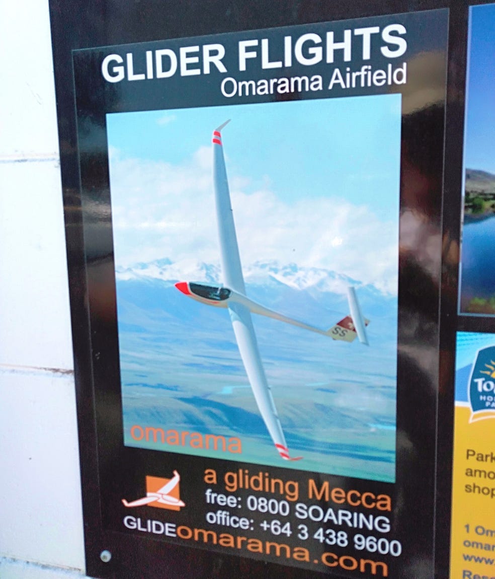
Another thing Ōmārama is famous for is gliding. Westerly winds blowing over the nearby mountains create both updrafts and downdrafts. Gliders can remain aloft over Ōmārama for hours by returning to the updrafts.
Several world gliding records for distance and time aloft have been set over Ōmārama. And the area is very scenic as well, so it’s not as if the pilots or their passengers would get bored. You can see more about this rather special local attraction on the website of Gliding New Zealand.
The Department of Conservation has a great brochure on all the things you can do in the vicinity of Ōmārama: you can download it here.
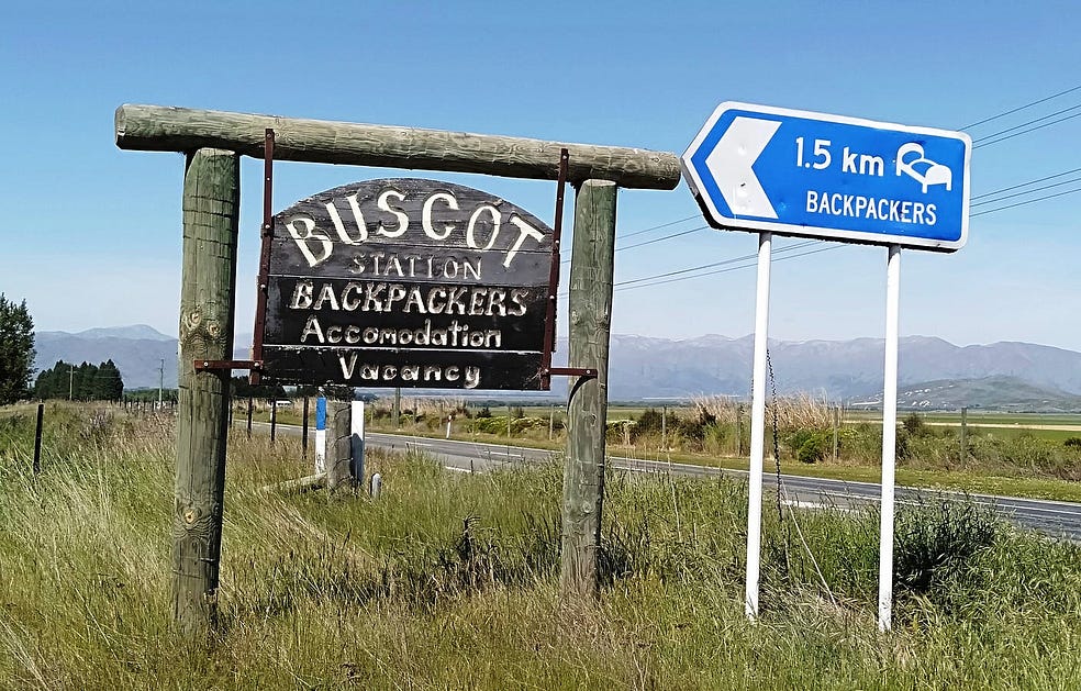
Sometimes, when in Ōmārama, I have driven a short distance northward to Buscot Station to stay. It’s a friendly place, run, as of the time of writing, by a gent named Tony Gloag.
Turning eastward from Ōmārama, you enter the Waitaki Valley, with its historic towns and the lakes of three great power stations: Benmore, Aviemore, and Waitaki. I will have more to say about the Waitaki Valley, and the homeward route over Danseys Pass and the Pigroot, next week!
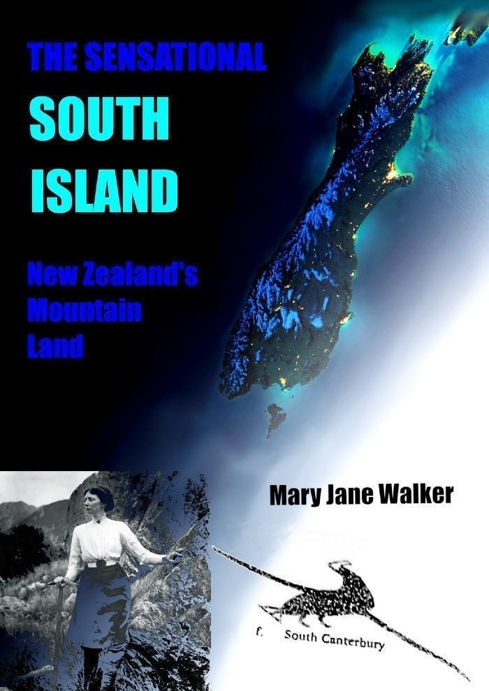
If you liked this post, check out my book about the South Island! It’s available for purchase from this website, a-maverick.com.
Subscribe to our mailing list to receive free giveaways!
