Giveaways
AFTER Kahurangi National Park and Reefton, I travelled down through Greymouth and Arthur’s Pass, into the Canterbury Plains west of Christchurch. There’s an inland scenic route that takes you past many of its attractions, and you can spend as much as a week exploring them all.

In this post, I’m just giving a quick introduction, starting in the south and working northward.
Fairlie and Geraldine are a couple of my favourite country towns.

My absolute favourite stop on this stretch is the Fairlie Bakery with its equally famous Fairlie Pies (amazing, big bits of steak).

There’s a statue of James McKenzie, the accused rustler after whom this part of the country is known, and his dog Friday. In folk memory, McKenzie is New Zealand’s equivalent of Ned Kelly, though essentially harmless other than to those whose sheep he may or may not have stolen.

After five months in Lyttelton Gaol, certain irregularities in McKenzie’s prosecution were discovered, and he was set free on the condition that he leave New Zealand. No-one really knows what happened to him after that.

Known in Māori as Te Manahuna, meaning the place of enlightenment (it does have a certain energy), this part of New Zealand is known as the Mackenzie Basin in English and, more informally, as the Mackenzie Country.
This time around, my travelling companion, Grant, said we should go to the Peel Forest. The facilities at the New Zealand Department of Conservation (DOC) campground were amazing, including hot water showers, for only NZ $20 a night.

We saw ancient tōtara; there must have been selective logging at some time but now most of the forest has grown back. There are about 5 different walks, which were muddy when we were there.
And the birdsong is amazing!
Here’s a view of the trail, next to another of the conspicuously red-brown trees of the kind that appears in the thumbnail above.

These are a species known as the mountain fuchsia, tree fuchsia, or kōtukutuku. It is one of the few New Zealand trees that sheds its leaves in winter.
This time around, I also visited the Hakatere Conservation Park, which includes the popular camping area of Lake Clearwater, where I spent a night: the campground only cost NZ $10. It had flushing Portacom toilets, but there was no cooking area. So it was fairly basic. On the other hand, the area has wonderful skies.


There were quite a few people there who were local. I wanted to do a 23 km walk to Mt Potts Hut but Grant wasn’t keen. The Mount Potts Station sign said that the roads were open but we went up and they were closed, so we had to go back and stay at Lake Clearwater.
Thomas Henry Potts, after whom Mount Potts and the Potts River are named, was an early sheep farmer and a pioneering conservationist whose Te Ara biography, as of the time of this post, includes the following passage:
While other cataloguers of threatened species calmly accepted their extinction as inevitable, Potts stressed how much more ‘the student can read from the original text’. In 1872 he proposed that Resolution Island become a reserve ‘under tapu from molestation by dog and gun’, a suggestion realised in 1892. His article on ‘National Domains’ (1878) marshalled together the ideas that precipitated the foundation of national parks in New Zealand from 1894.
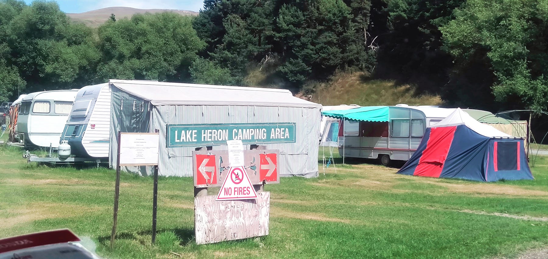
The old buildings of Potts’s main farm, Hakatere Station, are publicly accessible near the spot where the Ashburton Gorge Road becomes the Hakatere Potts Road, with the Hakatere Heron Road branching off toward Lake Heron from the same locality.


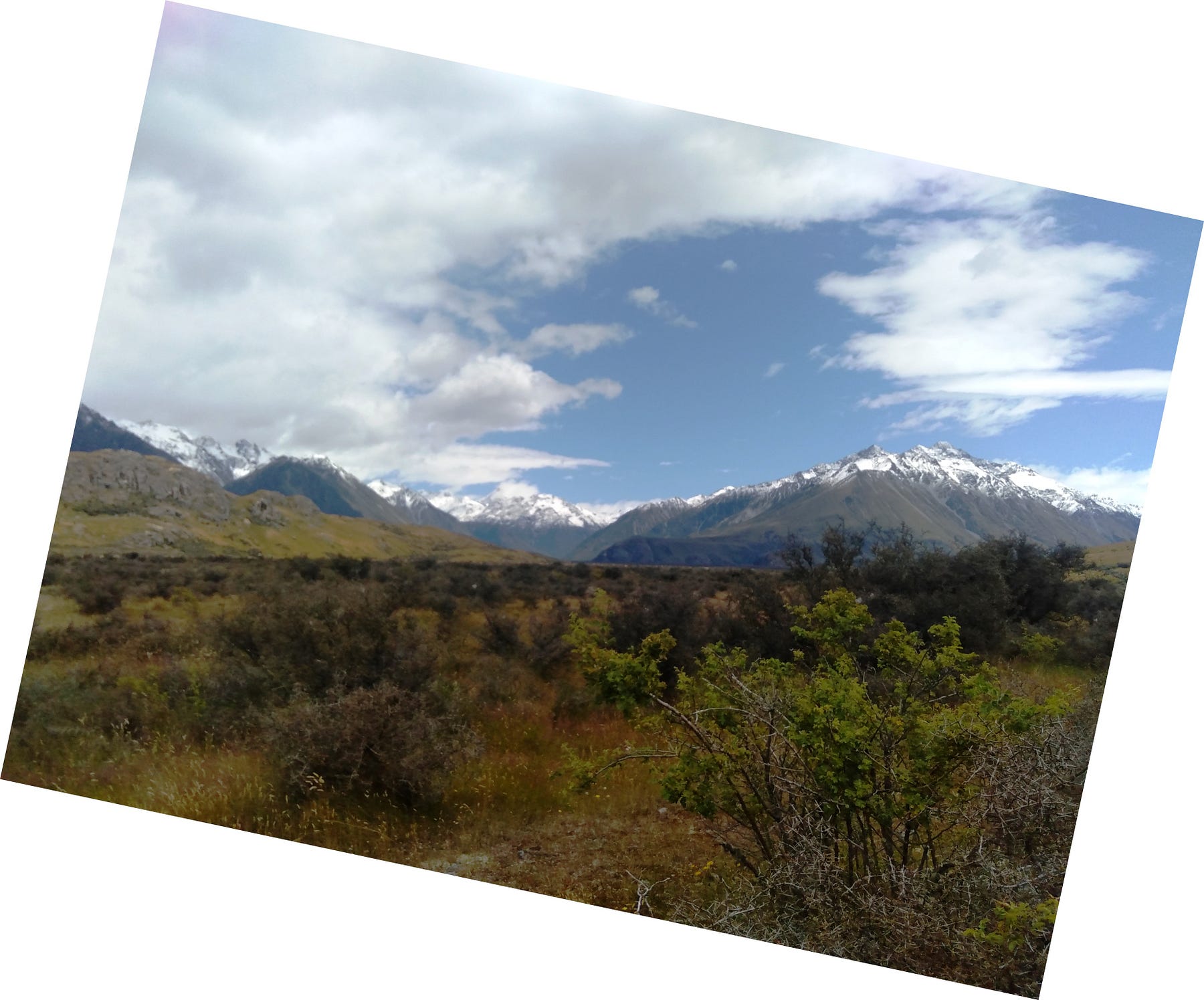
We went past a road called Public Easement Track, which went uphill toward the summit of Mount Potts. We climbed up the Public Easement Track and back for about two and a half hours. It had great views of Mount Sunday and the headwaters of the Rangitāta River.
A little further on, on the other side of the Hakatere Potts Road, is a road called the Mount Sunday Track, which leads to Mount Sunday (it does not look as if the last bit is passable by vehicles).

Mount Sunday is otherwise best known as the site of Edoras in the Lord of the Rings movies. They say that this is one of the most remote LOTR sites that you can easily get to.

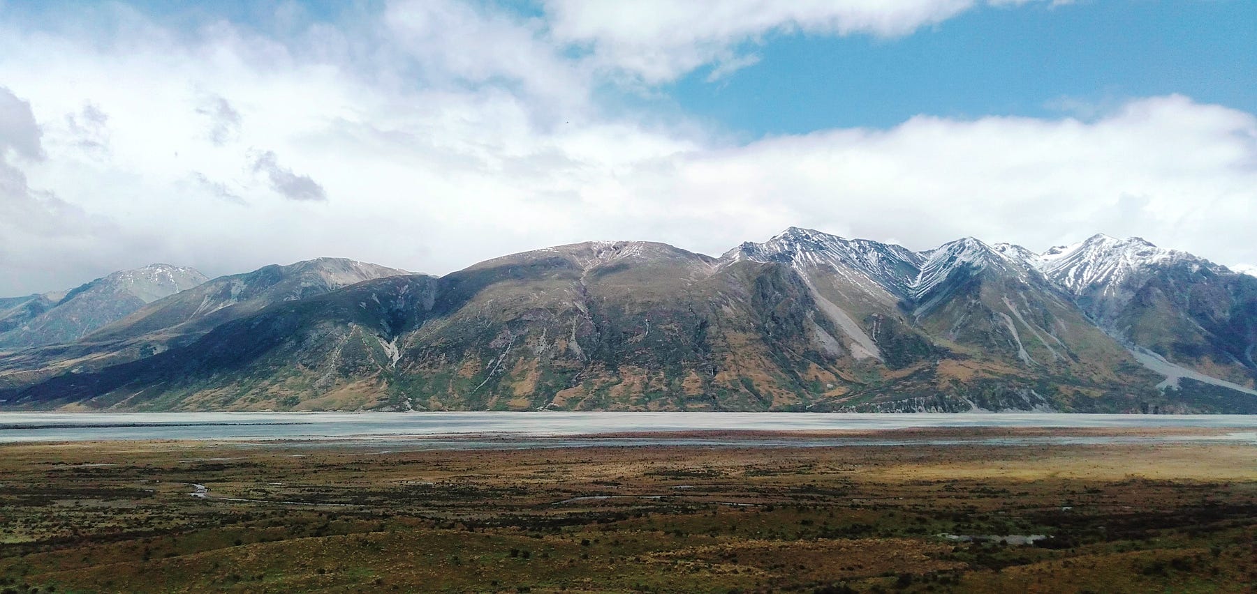
The Hakatere Conservation Park includes the Ō Tū Wharekai/Ashburton Lakes region, where Mount Guy (1319 m/4,327 ft) and the chilly Lake Clearwater (667 m/2,188 ft) are in the middle of a nexus of tracks, with several other lakes and peaks nearby.

DOC describes the Ashburton Lakes area, with its twelve lakes (the usual count), the headwaters of the Rangitāta River, plus many smaller hollows and occasional ponds called kettle-holes left by melting blocks of ice, as a nationally significant intermontane (between-mountains) wetland system.
Whence, the Māori name Ō Tū Wharekai, which builds on the word for banquet hall or dining room (wharekai) and refers to the fact that the wetlands in this area were an important source of food in earlier times. The area is also one through which people used to travel on the way to gather pounamu on the West Coast, stocking up on food as they did so.
There are several campgrounds in this area, including sites at Lake (not-so) Clearwater, Lake Camp and Lake Heron.

Surprisingly enough, I found Lake Clearwater to be unswimmable and unfishable. There is a little village next to it (handy for some things), and it seems that it has become polluted by excess nutrients from septic tanks as well as from nearby farmland, both of which have lately combined to convert the lake into “pea-brown soup.” Which is indeed ironic, in view of the lake’s name.
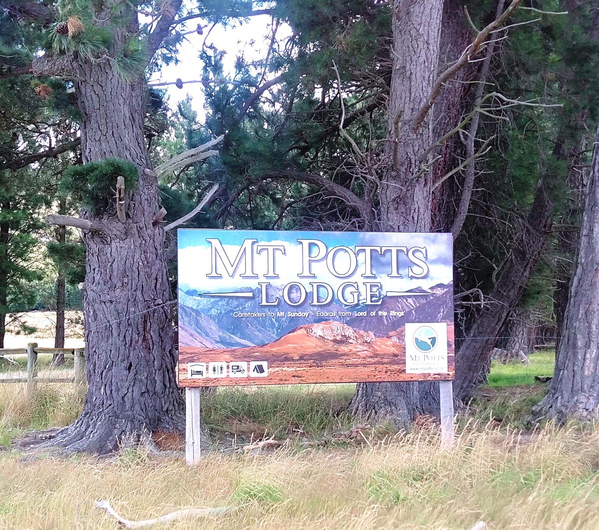
There is also accommodation at Mount Potts Station, now a back-country ski area in winter and the site of the Mount Potts Station Campsite and the Mount Potts Lodge.
Of all the public campsites I would suggest Lake Camp, but most vehicles have to be self-contained. At Lake Heron, you can’t camp between the first of April and October, and it’s too cramped and confined.
So, I would suggest Mount Potts Station Campsite. It’s a much nicer spot for camping and a caravan, though a bit more upmarket and pricey as well. If you feel prosperous enough, you can also stay in various levels of fixed accommodation at the Lodge.
Along with Mount Guy, some of the best-known mountains in this area are Mount Harper/ Mahaanui which, despite being 1,829 m or 6,001 feet high, is comparatively easy to ascend, and Mount Somers (1688 m / 5,538 ft) which is the location of a popular circuit walk past craggy outcrops and old mine workings.
Hakatere is the Māori name of the Ashburton River, which flows past the large country town of Ashburton, and is also an official name of the river. The exact origins of the name Hakatere are up to interpretation, but its most commonly accepted meaning is to move or dance swiftly along.
This locality is close to Erewhon, the setting of the English writer Samuel Butler’s fictional utopia Erewhon, but also an actual place.

Indeed, when it comes to fantasy tales it’s worth mentioning that this district includes an isolated hill with sweeping views called Mount Sunday, so-called because riders from several areas would meet up there each Sunday to swap news.
One of the advantages of staying at Mount Potts Station, though pricey, is that you are particularly well-placed for going up Mount Sunday and also up to the nearby Mount Potts Skifield. Though having said that, the lake campsites aren’t too much further away.
The Te Araroa Trail runs through here, and from Lake Clearwater you can venture along a section of the trail. And also do the Mystery Lake track, which runs along the edge of the stunning ravine of the Potts River for part of the way, and then via the Mystery Lake Link Track to the Potts Hut Track, which leads in one direction to the Boundary Creek Hut, and in another to the Potts Hut on Mount Potts.
The following topographical map gives you an idea of the incredible nature of this country. The Potts River ravine, which dominates the left side, has banks that plunge down below the flat land for two hundred metres or more in places, before you get to the Potts River.
Lake Clearwater is also toward the bottom of the map, at centre. Toward the top right, you can see a gorge of the South Branch Ashburton River, or Hakatere, which helps to explain the name of the road by which this area is generally accessed from the town of Mt Somers in the Canterbury plains, namely, the Ashburton Gorge Road, which eventually becomes the (unsealed) Hakatere Potts Road, terminating at Erewhon.

Here’s a 3D Google Earth aerial image.

And a video from the Public Easement Track looking toward Mount Sunday and up the Rangitāta River, which I liken to a view over the Glenorchy area at the head of Lake Wakatipu, much further south.
See, further, the DOC webpage on ‘Potts River tracks’. The Potts River, Mount Potts and Mount Potts Station are all named after Thomas Henry Potts, an early runholder and conservationist.
This is an iconic part of the Canterbury High Country. It looks best in the snow season, when the hero image on the DOC website was photographed. I would love to come back to this area in the snow season and get some more photos of my own. See, further, the DOC pages ‘Hakatere Conservation Park’ and ‘Lake Clearwater tracks’.
Part 2 was published on 6 June 2025. If you liked Part 1, you might also wish to check out my book about the South Island! It’s available for purchase from this website, a-maverick.com.


Subscribe to our mailing list to receive free giveaways!
