Giveaways
AFTER the Philippines, I flew to Taiwan, the island from which the Austronesian peoples first set out to settle the Pacific.

The island of Taiwan lies approximately 120 to 220 km from the mainland, across the Taiwan Strait from Xiamen and Quanzhou.
As readers may know, is a de facto independent, mostly Chinese-speaking state, politically aligned to the West in what would be an unproblematic manner, similar to Singapore, were it not for the fact that Taiwan is regarded by the People’s Republic of China, on the mainland, as a rebel province.
Politically, Taiwan includes the Penghu or Pescadores islands to its southwest, as well as the Matsu Islands to the northwest, which are as little as 10km off the coast of the mainland near Fuzhou. The People’s Republic used to shell the Matsu Islands from time to time, though I don’t think they bother these days. As with a rumbling volcano, relations between the People’s Republic and Taiwan go through good patches in which there is quite a lot of trade and tourism, and bad patches in which Matsu may get shelled and the mainland Chinese drop hints of invasion. No-one really knows how all this is going to turn out in the long run.
Here is a more detailed map of Taiwan that includes its offshore islands, as well as a little bit of the mainland at the top left. The ferry routes from Keelung, just east of the capital, Taipei, run to Matsu, which is off the map.

On my travels, which I am going to describe in the next few posts, I went to Taipei and then, in an anticlockwise direction, to Taichung, Kaohsiung in the south, and then across the southern tip of the island — the Hengchun Peninsula — and back up the east coast to Taitung, after which I travelled northward and back to Taipei.
There are hardly any roads in the interior, which is very mountainous.
The west coast is where nearly the whole of Taiwan’s population of around 23-and-a-half million lives, on fertile plains that are now heavily built-up.
On the east coast, from the Hengchun Peninsula to Yilan County, the mountains tumble almost directly down to the sea. As a result, this section of coast has much smaller towns than the west coast. Some of the east coast towns are in the Huadong Valley, a narrow rift just inland from the coast itself.
The presence of the indigenous Austronesian population of Taiwan is most evident these days on the east coast, especially in the area around Taitung.
The Austronesian population now only makes up about 2.5% of Taiwan’s total, which is otherwise around 95% ethnically (Han) Chinese, and about 2.5% of others, mainly resident foreigners.
The Chinese on the mainland began visiting Taiwan for trade from the time of the European Middle Ages, and to settle on Taiwan from the early 1600s.
Much like mainland China, Taiwan these days is a mixture of the old, or old-seeming, and the new.
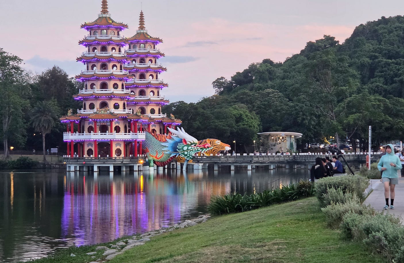
For instance, the Dragon and Tiger Pagodas at Lotus Lake in Zuoying, just outside Kaohsiung. These were erected in 1976, near the site of an old Confucian temple from the 1600s, which fell into disrepair under Japanese rule (more on that below) and which also had to be rebuilt. Tradition holds that the pagodas should be entered through the mouth of the dragon and exited through the mouth of the tiger, to dispel bad luck.
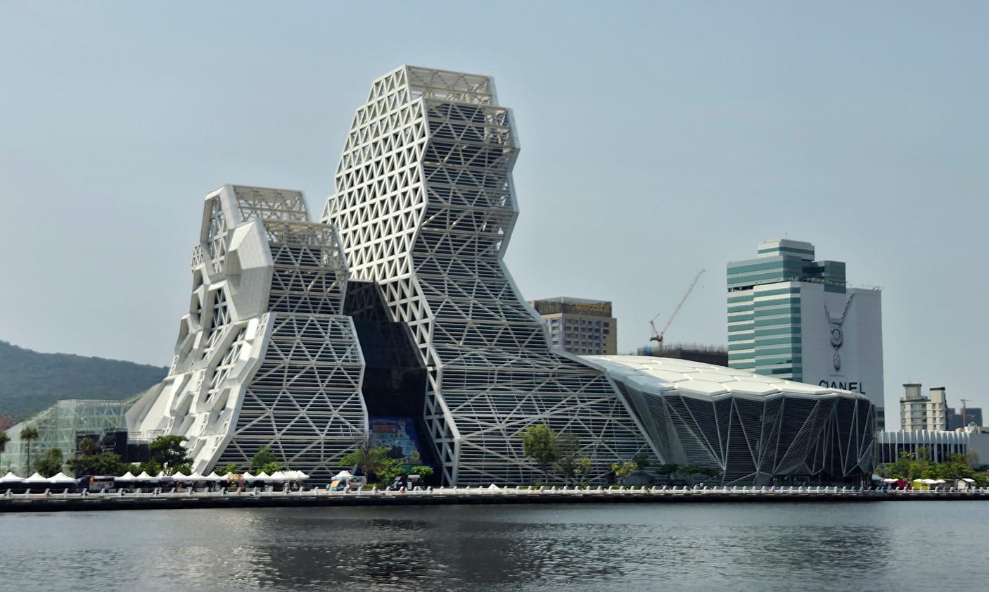
And then there is the ultra-modern — in this case, the Kaohsiung Music Center (KMC).
Taiwan first became known to Westerners when Portuguese explorers arrived in the 1500s. The Portuguese named it Formosa, meaning ‘beautiful.’ Taiwan was then colonised in parts by the Dutch and the Spanish, at about the same time as Chinese people from the mainland began settling, mainly from the adjacent provinces of Fujian and Guangdong.
In 1683, Taiwan was annexed by China. Over the next two centuries, Chinese people from the mainland became the majority on Taiwan.
Following a war between China and Japan in the mid-1890s, which the Chinese lost, Taiwan was ceded to Japan.
The preferred area of settlement was along the plains of the western coast, which even today form the most densely populated part of Taiwan. The central and eastern parts of the island are more mountainous and much less densely populated.

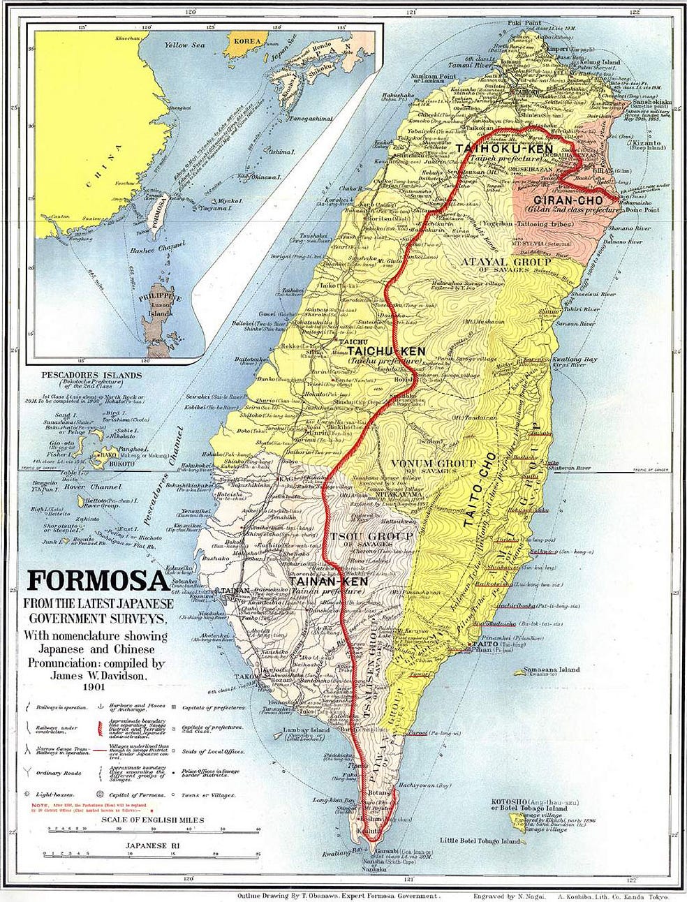
In fact, for much of the island’s history, after the beginning of its colonisation in the 1600s, the eastern half of Taiwan was treated as a sort of reservation for the Austronesian population, described as ‘Savages’ in the following map from the Japanese period. The map includes a red line describing a pale of settlement, to the east and south of which lay what the map called the “Savage District.”
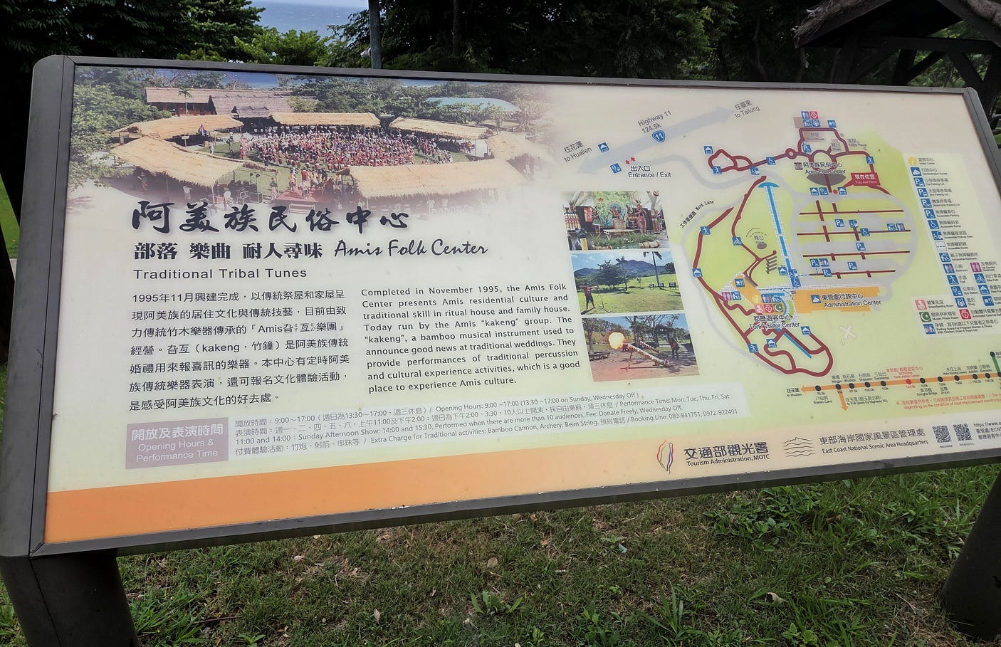
On this trip, I visited quite a few indigenous sites, such as the Amis Folk Center at Taitung, on the east coast. The Amis people are one of the sixteen recognised indigenous groupings in Taiwan.
The more traditional name by which the Amis used to know themselves is Pangcah, meaning ‘people.’ It is probably no coincidence that Pangcah looks like tangata, itself an older self-name for the Māori when it appears in the phrase tangata whenua, ‘people of the land.’
(Many Austronesian words don’t change much, even over vast distances. For instance, Captain Cook’s Tahitian navigator and interpreter, Tupaia, could converse with the Māori in New Zealand. And the name of the nation of Vanuatu means the upright land, which in Māori would be Whenua Tū.)
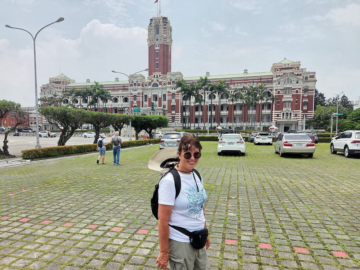
Taiwan’s economy developed significantly under Japanese rule, which ended in 1945. Many of the island’s most notable older buildings, such as the Presidential Office Building in Taipei, were also built by the Japanese: in this case, to house the Japanese Governor-General of Taiwan. Nowadays, it is, as the name suggests, the office of the President. So, in effect, it is still serving the same function.
At the end of World War II, the island of Taiwan and the Penghu or Pescadores Islands off Taiwan’s west coast, also under Japanese rule until 1945, were immediately occupied and annexed by China.
Many people thought that was a reasonable outcome, though, strictly speaking, it was never formally agreed to in any peace treaty.
The most likely alternative, never put to the vote, would have been Taiwan’s independence from both China and Japan.
With the success of Chairman Mao’s Communists on the mainland in 1949, the Kuomintang (KMT) government of what was then known as the Republic of China (ROC) fled to Taiwan, along with two million of its supporters.
The KMT had been quite radical and democratic when first founded in the early years of the 20th century by Sun Yat-Sen, the founder of the ROC after the overthrow of the last Chinese Emperor in 1912.
But after Sun Yat-Sen died in 1925, the KMT became quite brutal and corrupt.
Whence the rise of the Communists, who, to underscore their differences with the KMT, renamed the ROC the People’s Republic of China.
After 1945, Taiwan’s latest wave of colonisation, by the ROC and the KMT, sparked resistance from the local Taiwanese, many of whom did favour independence and felt that they had been cheated out of it.
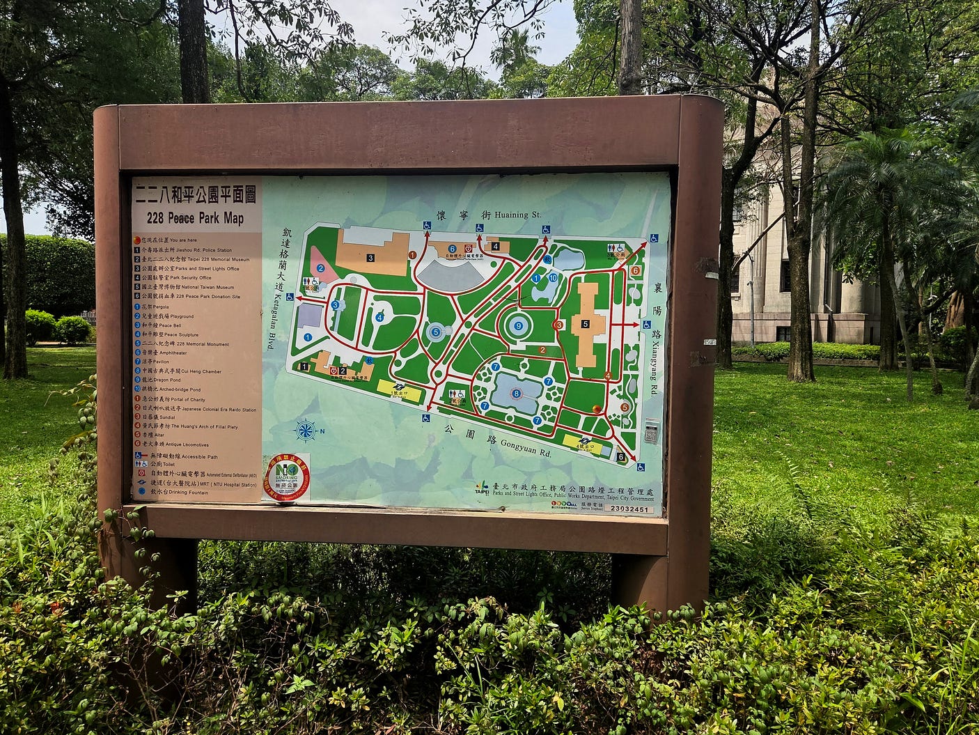
In an episode that began on 28 February 1947, an uprising against the mainlanders was put down with great violence. This came to be known as the February 28 incident or, more bluntly, the February 28 massacre, and is known today as 228.
Whence the name of the 228 Peace Park, in Taipei.
For 38 years, from 1949 until 1987, Taiwan was ruled both as a dictatorship and a colony by the exiled KMT, whose loyalties were not so much to Taiwan, if at all, but to a mainland they hoped to reconquer.
Chiang Kai-Shek, the leader of the KMT when it occupied the island, died in 1975, the same year as his contemporary and arguable soulmate General Franco in Spain.
As in Spain, a process of liberalisation followed the death of the old tyrant. It took longer in Taiwan’s case, but was helped along by the constructive attitudes of Chiang Kai-Shek’s son Chiang Ching-Kuo, his father’s successor as leader of the KMT and the next-but-one President.
In Taiwan, liberalisation included the ‘Taiwanisation’ of the regime, or in other words, putting more and more of the locals in charge. This was an inevitable development as Taiwan became more democratic.
Taiwanisation also fuelled demands for independence, the great might-have-been of 1945, which was now being strongly resisted by the Communists on the mainland.
The Communists came to see the mainland as a country boxed in by long strings of islands controlled by pro-Western governments, from the Philippines to Japan.
Japan doesn’t own as many islands as it did before 1945. But it still controls a surprising number of the smaller ones in the Western Pacific, including the chain known as the Ryūkyū Islands, which stretches all the way from the main island of Japan to Taiwan.
Every one of the Ryūkyū Islands is still considered part of Japan.
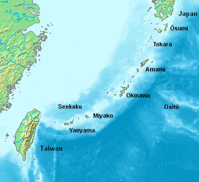
Of the Ryūkyūs, Yonaguni, a speck just to the east of Taiwan in the following map, has the honour of being the westernmost place in Japan, though it is more than 1,000 km from the main islands of Japan.

Regaining control over Taiwan and turning it into an unsinkable aircraft carrier for its own armed forces would enable mainland China to break past the island barrier more easily, in the event of any future war.
So, that’s what all the fuss over Taiwan is about.
Next week, I explore Taiwan in person!
Subscribe to our mailing list to receive free giveaways!
