Giveaways
THIS February, I went out on the ferry with a couple of friends named Lorraine and Roger to Great Barrier Island, known as Aotea in Māori.
The name Aotea means ‘white cloud.’ It recalls the voyaging canoe Aotea, on which some of the ancestors of the Maori were said to have first come to New Zealand: itself known in Māori as Aotearoa, or the land of the long white cloud.
Although it is only 90 km to the east of Auckland, the Barrier, as it’s also known, is the perfect place to get away from things!

I like to base myself at a place called Okupu, on the southwest coast near Blind Bay, where I have a share in a tumbledown shack.
The island is subtropical, with jagged green mountains.
Giant tree ferns:

And nīkau palms — the only palm endemic to New Zealand, and the southernmost palm in the world as well.

Once covered in forests of the valuable kauri tree as well as nīkau palms, the Barrier was heavily logged in colonial times.
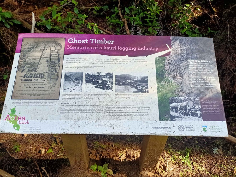
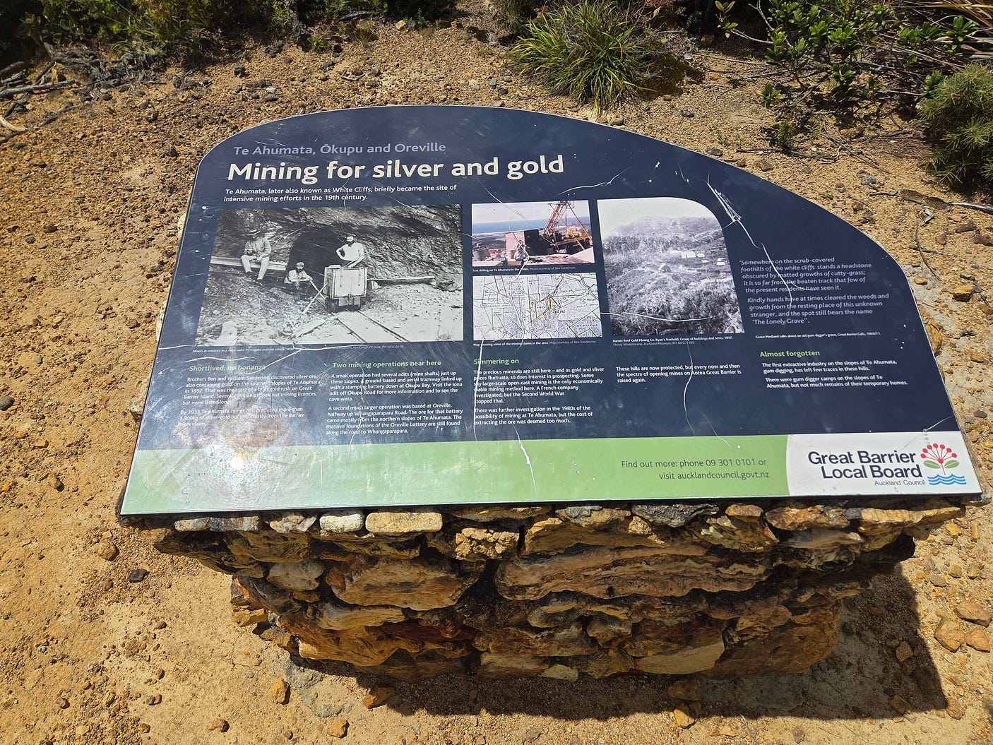
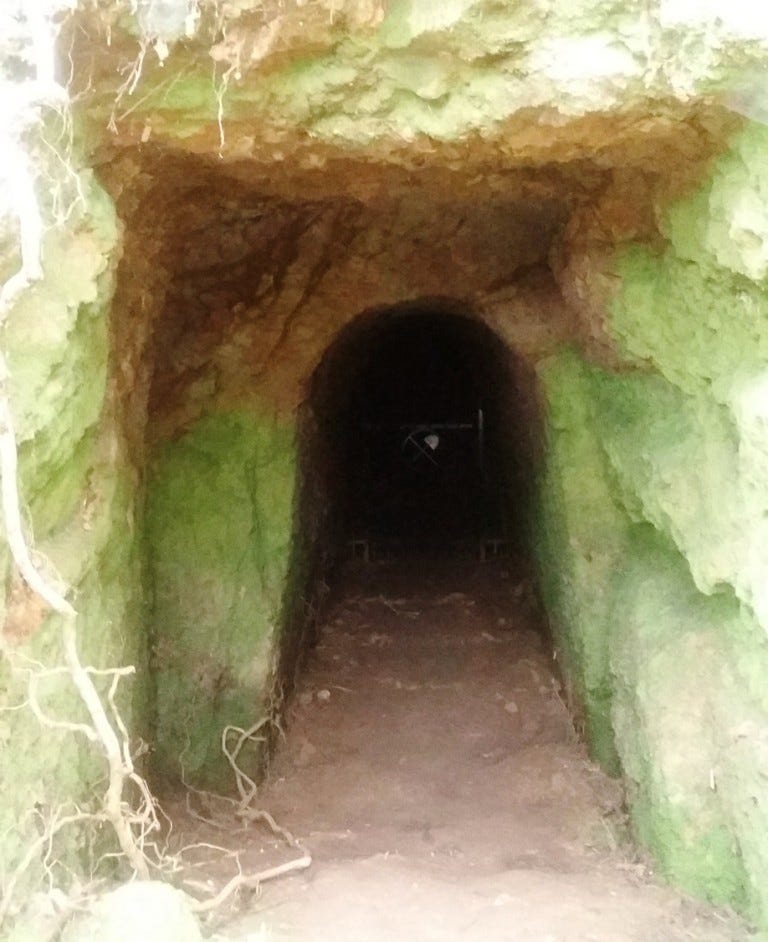
There was also a lot of mining. To this day, the Barrier is riddled with disused mineshafts. This is something it has in common with the nearby, equally rugged, Coromandel Peninsula.

On this trip, after arriving on the ferry, we picked up our hired car (essential) and drove to Awana, a ‘beach with extras’ in the form of “significant natural, Māori and cultural heritage” on the eastern side of the island.

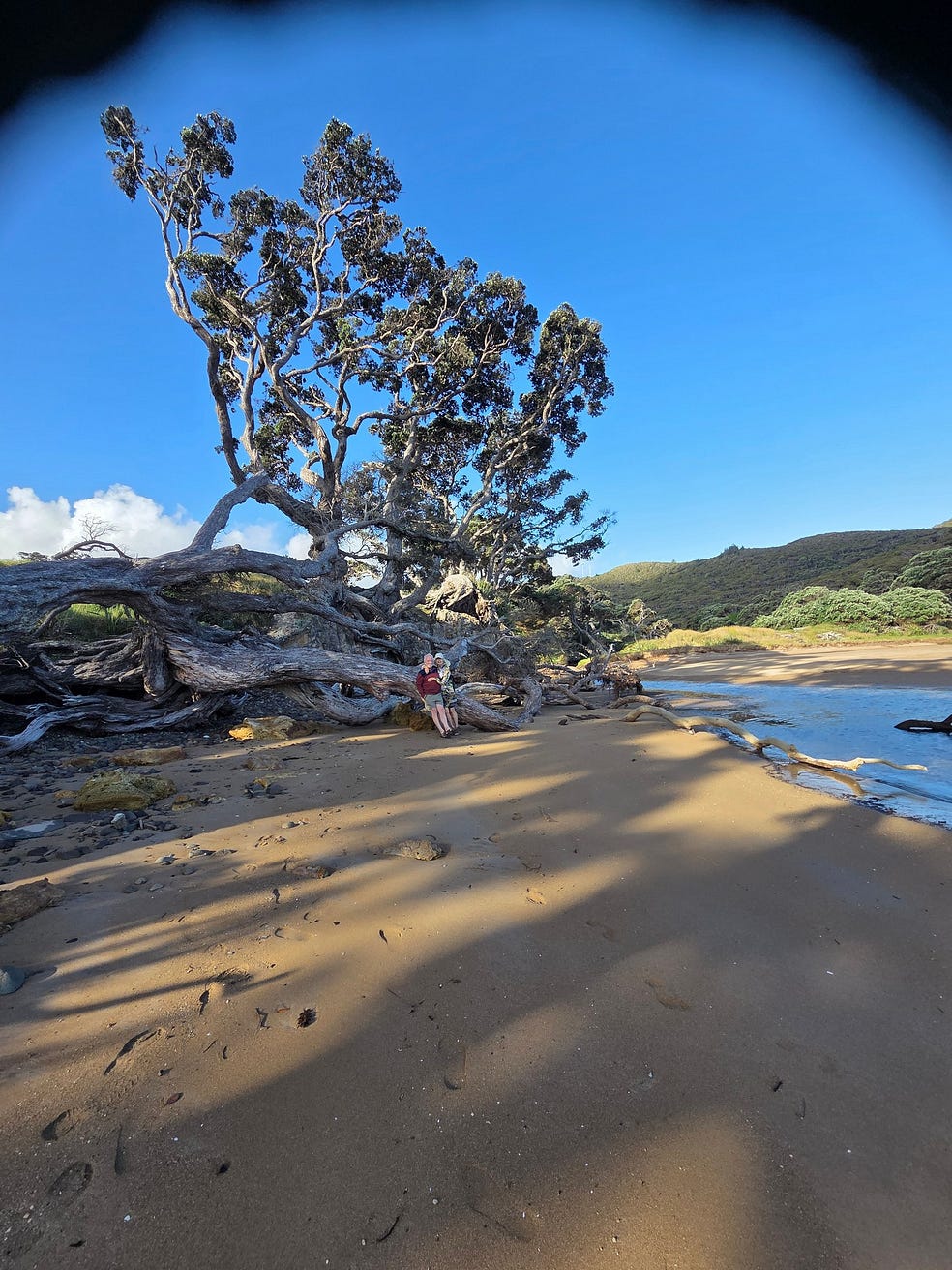
Gnarled pōhutukawa at Awana spread branches and roots all over its upper sand — you couldn’t tell which was which!

Here’s a video I made this February:
Though the Barrier is warmer than Auckland, the weather isn’t always sunny and idyllic, by any means!

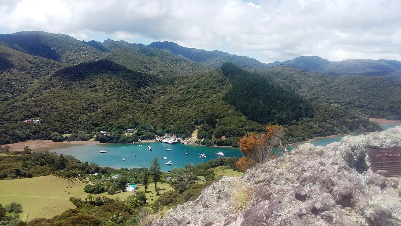
The next day, on this latest trip, we drove to the township of Port Fitzroy on the western side of the island. The township is located on an inlet with two Māori names, Rarohara Bay (sometimes also Ungunu Bay), and the whole area is called Port Fitzroy as well.
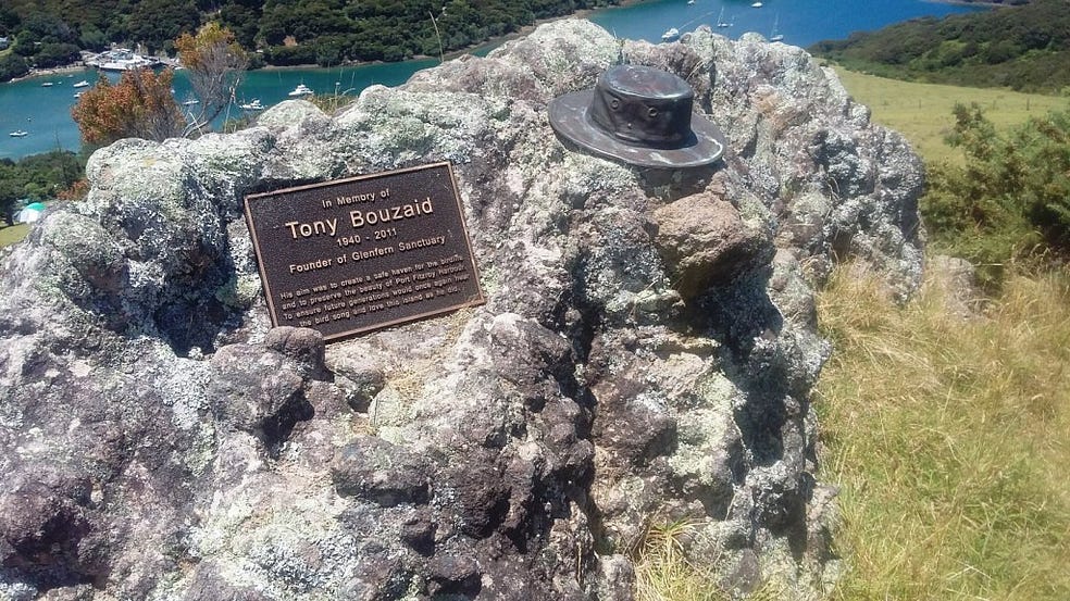
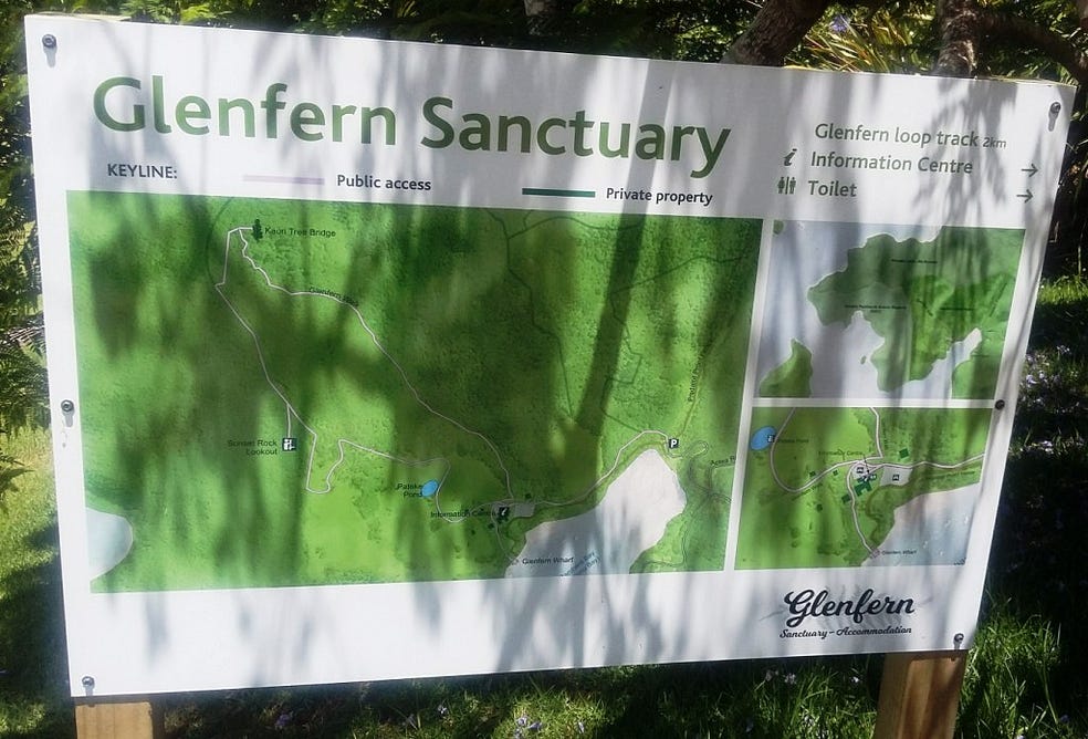
On the other side of Rarohara Bay from the township, there is a private conservation sanctuary called Glenfern, founded by the late Auckland yachtsman Tony Bouzaid.
Unfortunately, we missed out on the Great FitzRoy Mussel Fest and the FitzRoy Family Festival, held at Port Fitzroy. They, too, deserve an honourable mention!
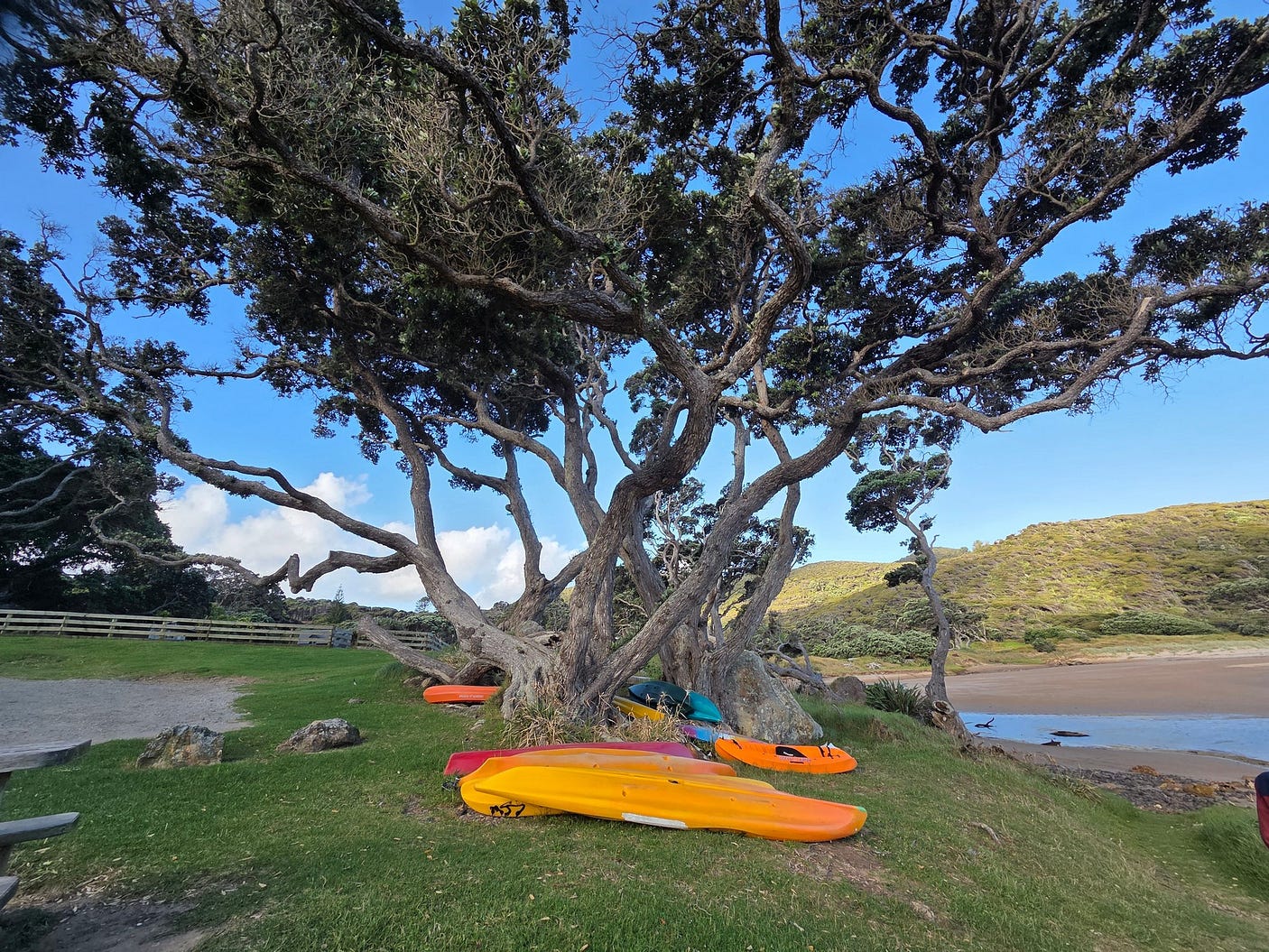
At the end of the road, just past Port Fitzroy, we arrived at the Kaiaraara Kauri Dams Car Park, where a network of tracks begins.

From Port Fitzroy to Whangaparapara and across the interior, a number of these trails have been bundled together as the Aotea Track, shown in red in the map above. It is called the Aotea Track even though it is really a network of tracks.
In 2015, the New Zealand Government created the Aotea Conservation Park on the island. The Park’s advisory body, the Aotea Conservation Park Advisory Committee (ACPAC), is now lobbying for the Aotea Track to be proclaimed a Great Walk, which would give it the same status as the Milford Track and the Routeburn Track.
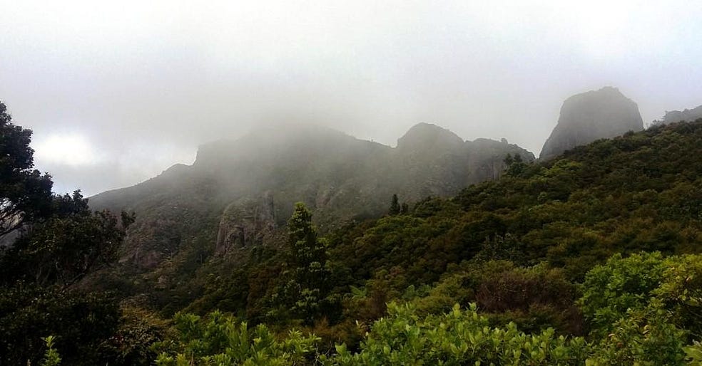
We hiked into the interior from the Kaiaraara Kauri Dams Car Park, under gloomy but atmospheric skies and through all-encompassing jungle.

Back in town, we saw a poster for a rally on the upcoming Waitangi Day (6 February), as well.

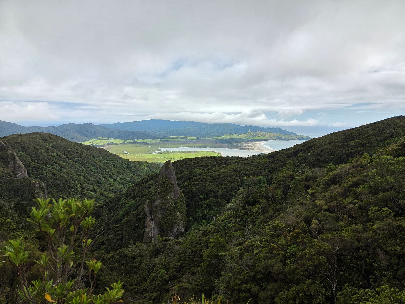
On the 3rd, we went to Windy Canyon, which is this amazing crack in the earth, about 200 metres below the summit of Hirakimatā, or Mount Hobson, the highest point on the island.
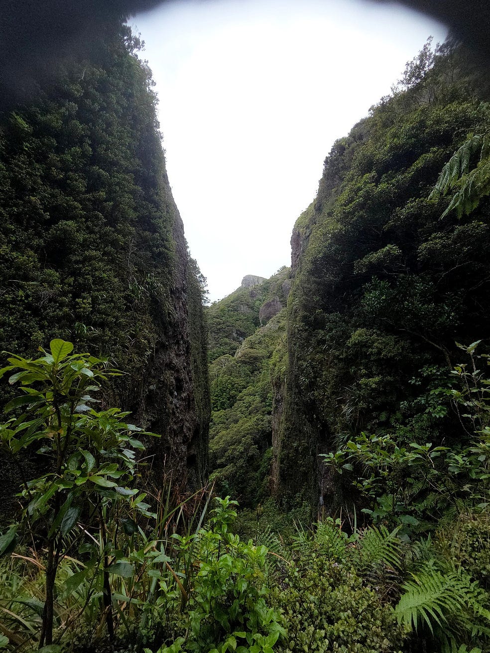
It’s called Windy Canyon because the wind whistles through it, and it is a Lord of the Rings filming site. Getting all that bulky filming equipment into it must have been quite epic!

There are great views from Windy Canyon. For instance, check out this view toward the locality known as Ōkiwi.
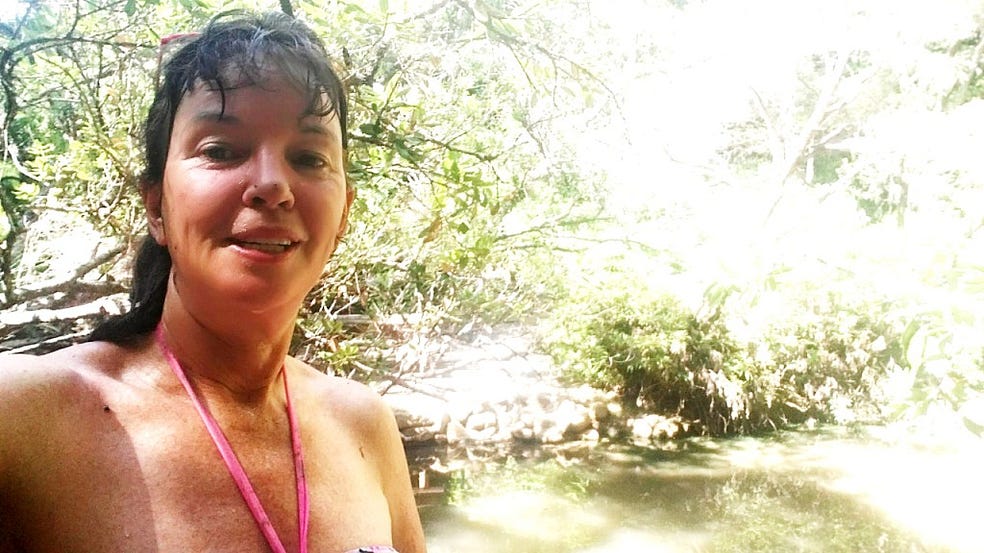
And toward Awana, in the background of this selfie.

I also made a video at Windy Canyon:
You can also see Rakitu, or Arid Island, further offshore to the east.

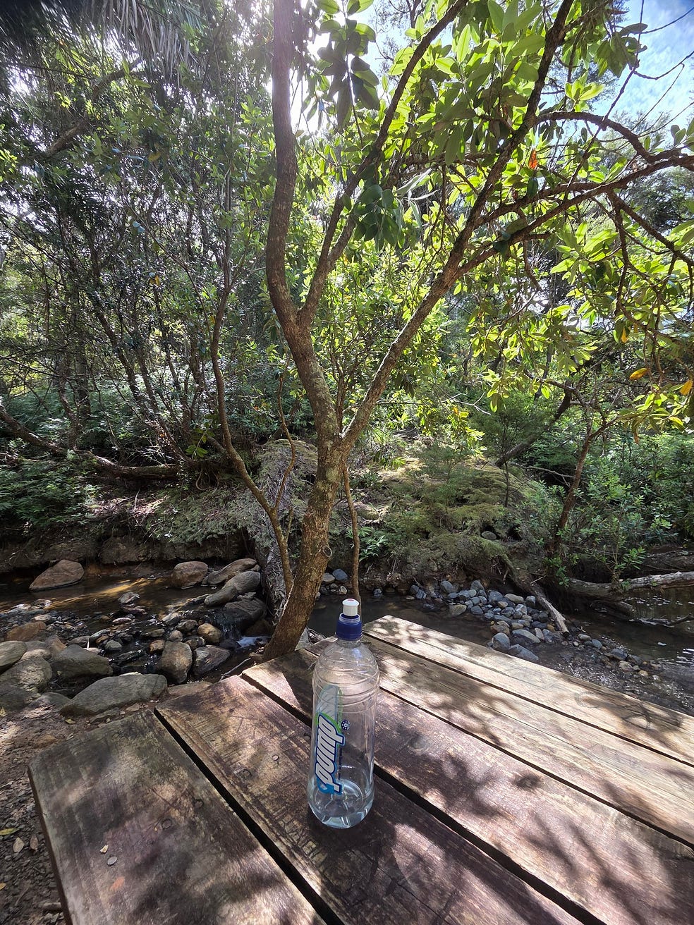
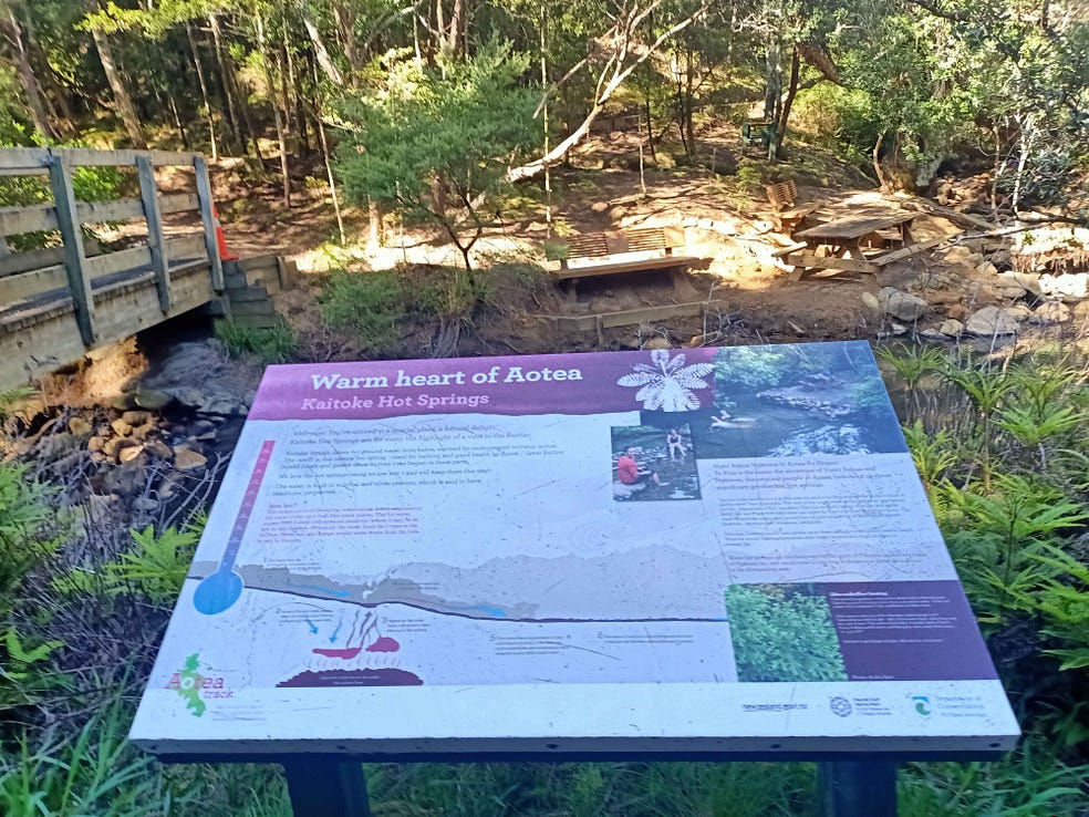
We then came down from Windy Canyon and hiked the very popular Tramline Track near Whangaparapara, which includes a lush Nikau Palm forest next to a stream, and hot pools.
The easiest hot pools to find are the Kaitoke Hot Pools, actually on the track.

Once upon a time, another friend and I found a well-formed bath with hot water flowing into it that had been carved into the rock by a Victorian gentleman, at a place called the Peach Tree Hot Springs. The bath is at a hidden location, now somewhat overgrown and quite hard to find, just above the more accessible Kaitoke Hot Pools.
By now things were starting to fine up, at last.

On the 4th, we headed out to Medlands Beach, on the east coast once more.


Medlands, also known as He Wai-o-Ruawharo, is a really beautiful white-sand beach, and the weather turned on a good show for us.

Here it is with a bottle-green wave.

And dramatic shadows.

And boulders.

We then repaired to the Claris Club, in the centre of the island, under the exotic-looking green mountains of the island's spine.


The nearby village of Claris is home to the island's airport and to the Great Barrier Island Community Heritage and Art Village, which also includes the Gray House Museum.


On an earlier trip, I went to a fair at Claris, which was being organised to raise money for the Aotea Family Support Group Charitable Trust. At the fair, a world champion breaks singer from New Zealand was performing.
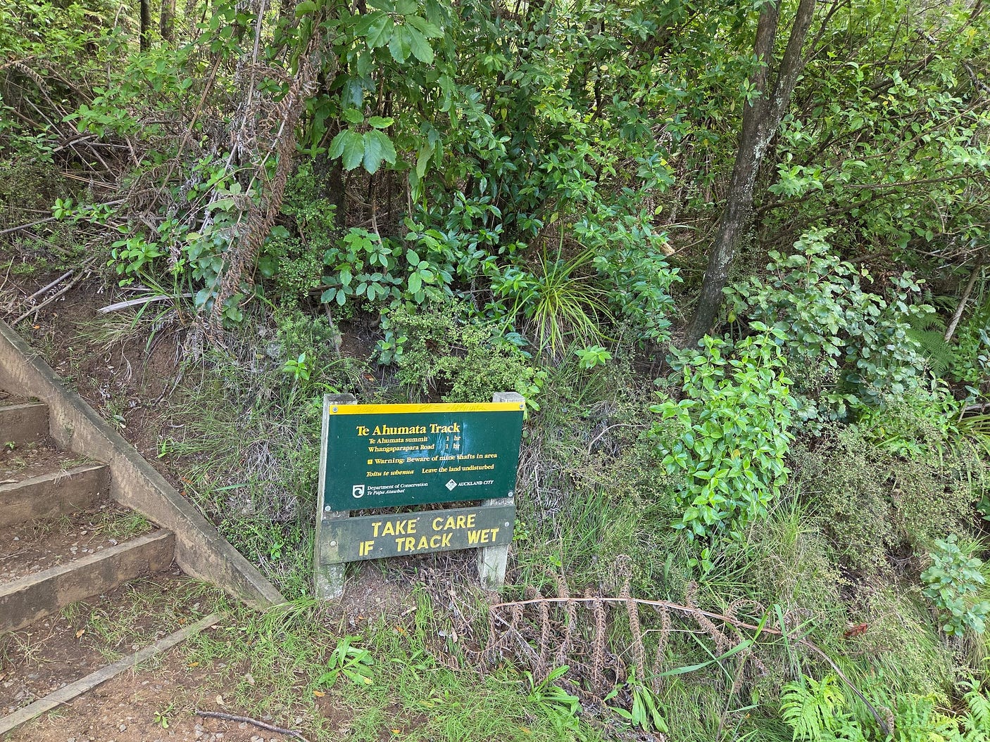
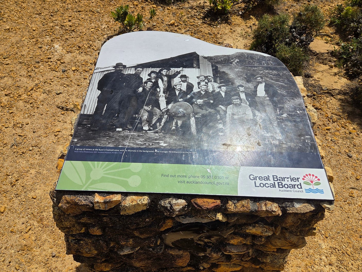
On the 5th, we didn’t do anything much. And then on the 6th, Waitangi Day, we explored the mines near Okupu, via the Te Ahumata Track.
There were several plaques at industrial sites on the track.
These guys look like they were characters.
And here is a video I made there:
Because Great Barrier Island is so isolated, one of our most destructive introduced pests, the brushtail possum, never made it ashore. It is also without stoats or ferrets. On the other hand, rodents are there, as they are almost everywhere in New Zealand.
No dogs are allowed onto conservation land on the Barrier. Though, that does not stop some people, who perhaps fail to read the signs.
There are plans to exterminate all the rodent pests on nearby Rakitu or Arid Island, so that the island can be re-populated by native species. There is some opposition to this, and there’s a story on the controversy here.
I read in a December 2014 New Yorker article I found at that Mt Heale (‘ The big kill: New Zealand’s crusade to rid itself of mammals’) that New Zealand conservation was indeed to a very large extent a matter of calling in the exterminators.
The New Yorker article gives a rather negative impression of the humanity of this approach. However, a more recent (paywalled) article in the New Zealand Listener by Rebecca Macfie, ‘ Natural born killers ’, 26 November 2016, makes clear that many of the introduced predators in New Zealand experience boom and bust cycles; if they are not poisoned, they will starve, after first eating as much of the native bush and wildlife as possible.
Another article by Rebecca Macfie in the 3 December 2016 issue of the New Zealand Listener, Saving our species, not paywalled at the moment, follows up on such long-term solutions.
To round off, Aucklanders have long marvelled at the Barrier’s starry skies, crisscrossed with clearly visible wandering satellites and streaked by meteors. A small population, lack of mains electricity, and hardly any streetlights, all help to keep the skies desert-dark even though the island isn’t really all that remote.
In 2017, Great Barrier Island was awarded Dark Sky Sanctuary status by the International Dark Sky Association (ISDA), which will encourage astronomically-minded visitors. At the time of writing, there are twelve IDA Dark Sky Reserves including one at Lake Tekapo in New Zealand, but only three Dark Sky Sanctuaries, astronomical viewing sites which are even more pristine. The three Dark Sky Sanctuaries are at Cosmic Campground in New Mexico, at the Elqui Valley in northern Chile, and now at Great Barrier Island as well.

The summer is normally the time to go to the Barrier, because pōhutukawa trees are everywhere and they blossom at Christmas. It’s also the summer holidays, of course.
The locals hope that Dark Sky Sanctuary status will increase winter tourism as well, since the winter nights are longer. At that time of year, it’s also possible to see the core of the Milky Way, which lies in the constellations of Scorpio and Sagittarius; whereby the Milky Way comes to look like a poached egg seen side-on rather than just a band of stars.
These constellations are most visible at mid-year and are more easily seen from the southern hemisphere than the northern because the nights at that time of year are longer in the south, it being winter downunder. The view from the Barrier should rank with the clearest in the world, and of course one advantage of the Barrier as a Dark Sky Sanctuary is that it is, as National Geographic says, only 55 miles (90 km) from the big city of Auckland.
For more, including upcoming events, see greatbarrier.co.nz and greatbarrierislandtourism.co.nz.
I’ve got an earlier post on the Barrier, ‘Auckland’s Great Barrier Island (not the Great Barrier Reef).’
If you liked this post, you might want to check out my book The Neglected North Island: New Zealand’s Other Half!

Subscribe to our mailing list to receive free giveaways!
