Giveaways
FROM Ōmārama, on this road trip (Part 1 is here), you then head down the Waitaki River on State Highway 83, where you soon find yourself running alongside Lake Benmore and the Alps 2 Ocean Cycle Trail.
An information display beside the lake describes how it is part of the Waitaki Power Scheme, which comprises nine power stations, about sixty kilometres of canals, and several artificial lakes, including Lake Benmore.

The information panels, by Meridian Energy and the South Island’s largest iwi or tribe, Ngāi Tahu, also show images of a nineteenth-century Māori leader named Te Maiharoa and his followers: the actual founders of the township of Ōmārama, camping there for two years in a settlement they called Te Ao Marama, the world of light, to protest the alienation of the interior of the South Island to settler sheep-farmers.
At the township of Otematata, you turn left up Loch Laird Road to the truly awesome Benmore Dam, which began producing power in 1965.
The lakes behind the Benmore Dam and behind the Aviemore Dam, downstream, are not just there to store water for hydroelectricity.
They are also lined with campgrounds and boat ramps.
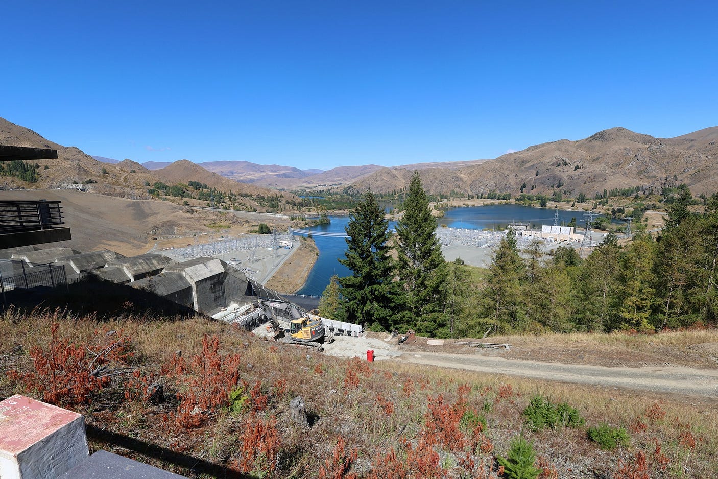
And there are several hiking trails and scenic lookouts near the Benmore Dam, including one of the best sections of the Alps 2 Ocean Cycle Trail. Here’s an aerial view: for scale, the Benmore Dam is nearly a kilometre long.

At 118 metres high, the Benmore Dam is 20 metres shorter than the Great Pyramid in Egypt. But at 957 metres long, it contains nearly five times as much material and is indeed an awesome sight.
Here’s a short video tribute, set to the theme music of This is New Zealand, a film made in 1969 to showcase New Zealand’s achievements at the time.
Here’s the crane at the top of the dam, the first thing you see as you start to cross it from the Loch Laird Road side.

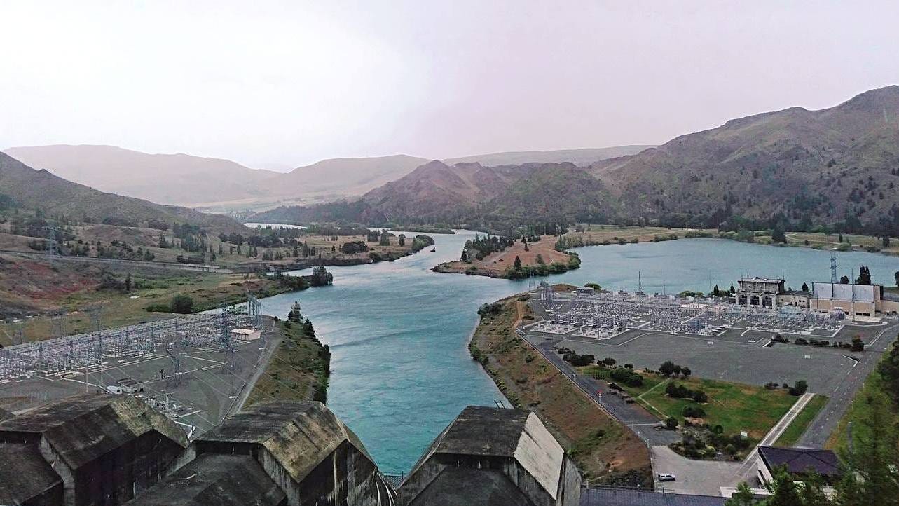
And a couple of views from the dam, from this year and from an earlier visit.
Here is the dam from the other side, which is called Te Akatarawa Road.

And the spillway, built to handle overflows.

The Benmore Dam feeds the southern end of the High Voltage DC (HVDC) link to the North Island, commonly known as the Cook Strait Cable. This was one of the first of its kind in the world.

Here’s a panorama we made just this February:
As a friend notes,
Yeah, it’s pretty awesome, isn’t it? Watching it rise as a child; it left me convinced that we Kiwis could do anything.
What the hell happened?
Carrying on down Te Akatarawa Road from the Benmore Dam to the Aviemore Dam, you go past a nearly unbroken series of campgrounds.
The campgrounds were established by the New Zealand Government, but these days, they are run by the local council.

This route is also part of the Alps 2 Ocean Trail.

Further on down, you get to the Waitaki Dam, the first dam on the Waitaki River, which was completed in the 1930s.
And from there, to the town of Kurow, from the name of the nearby Kurow Hill: a Māori name which in standard Māori would be spelt Kuirau.
I stayed with a friend at the Kurow Holiday Park, which was quite nice but probably not so good for anyone in a small tent, as the recreation lounge had been turned into a dormitory for agricultural workers. Maybe at a different time of year it would be a lounge.
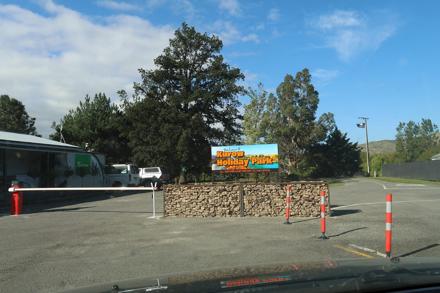
You have to be especially careful crossing the road near the Kurow Holiday Park, and it is better to stay on the Holiday Park side until you are in the middle of town, which is within walking distance anyway.
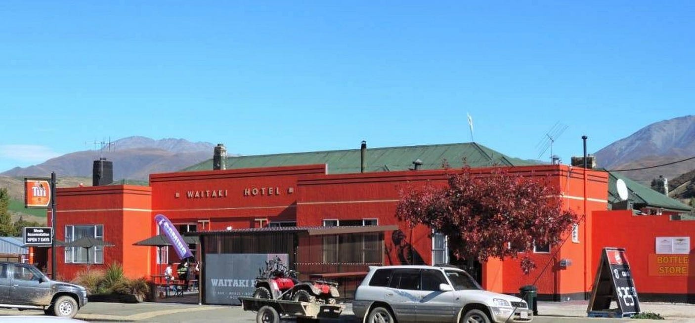
In town, the Kurow Hotel is one of the two main pub-restaurants, the other one being the Waitaki Hotel, which was a lovely orange colour when I visited in 2017 but has now been repainted in a more austere blue-and-white scheme reflecting a change of corporate owners from Tui (a branch of Dominion Breweries) to Speight’s.
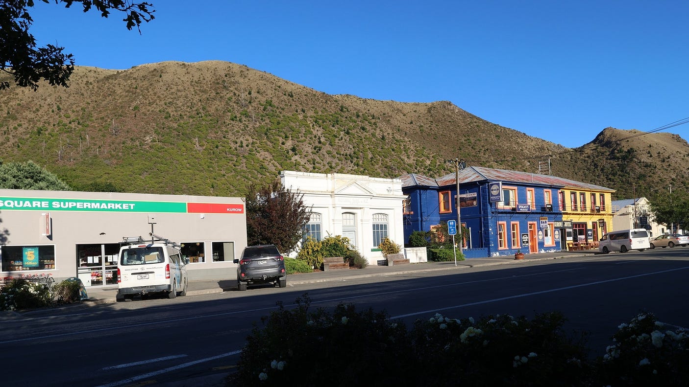

There are also two or three nice cafés and a takeaway shop, as well. And a laundromat, on the corner of Liverpool St and the main drag.
As to why the town is called Kurow and not Kuirau, South Island Māori placenames often have distinctive local spellings, since standard Māori is based on North Island pronunciations. The most famous, surviving, and well-attested difference between the two islands is the way that ‘ng’ becomes ‘k’ in the South Island.
There are other differences recorded in names of places and things, such as the voiced ‘g’ in matagouri, a thorn bush prevalent in Otago, and in the name of Otago itself, plus the Hawaiian-looking ‘l’ in Waihola, the name of a lake just outside Dunedin.
The Alps 2 Ocean Cycle Trail goes past the Kurow (or Kuirau) Hill, which also has a walking track all the way to the top.

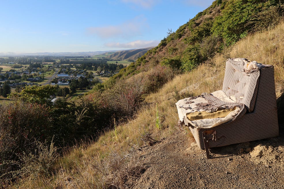
You can get some great views of the town and the Waitaki Valley from the Kurow Hill.

Sofas have been set out at the best viewpoints, though I think some are in need of replacement.
As the 1930s architecture of the Waitaki Hotel, and for that matter an old cigarette ad saying ‘Time for a Capstan’ both suggest, Kurow really took off when the Waitaki Dam was being built, although these days people mainly go there for holidays.

There’s another recreational area called Kurow Island, which you can drive to by way of the bridges leading northward into the Hakataramea Valley. However, the river is off limits, because spillage from the hydro dams can make its flow surge up and down without warning.
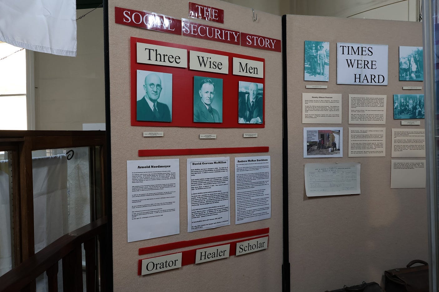
The town’s one big claim to historical distinction is that it is where the foundations of New Zealand’s welfare state were laid, by the ‘three wise men of Kurow:’ the local headmaster (Andrew M. Davidson), the local doctor (D. Gervan Macmillan), and the local Presbyterian minister, the Reverend Arnold H. Nordmeyer, who went on to become the leader of the Labour Party in the 1960s.

In reality, there was a fourth wise man, the local trade unionist Jerry Skinner, and a wise woman, Gervan Macmillan’s wife Ethel. Together, even if the last two have been somewhat left out of the subsequent legend in favour of the three professional men, they established a medical insurance scheme for the workers on the Waitaki power scheme.
Their ideas were then taken up by the Labour government of the time and applied nationwide via the Social Security Act of 1938. There is a display about all this in the local museum, which is also billed as New Zealand’s museum of social security.
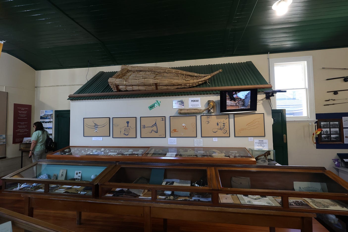
The museum also has an example of a mōkihi, a reed boat that local Māori used to travel up and down the river, even into the twentieth century, as they were simple to make and probably more of an adventure than going by bus. No doubt, the hydro dams finally finished this custom off.
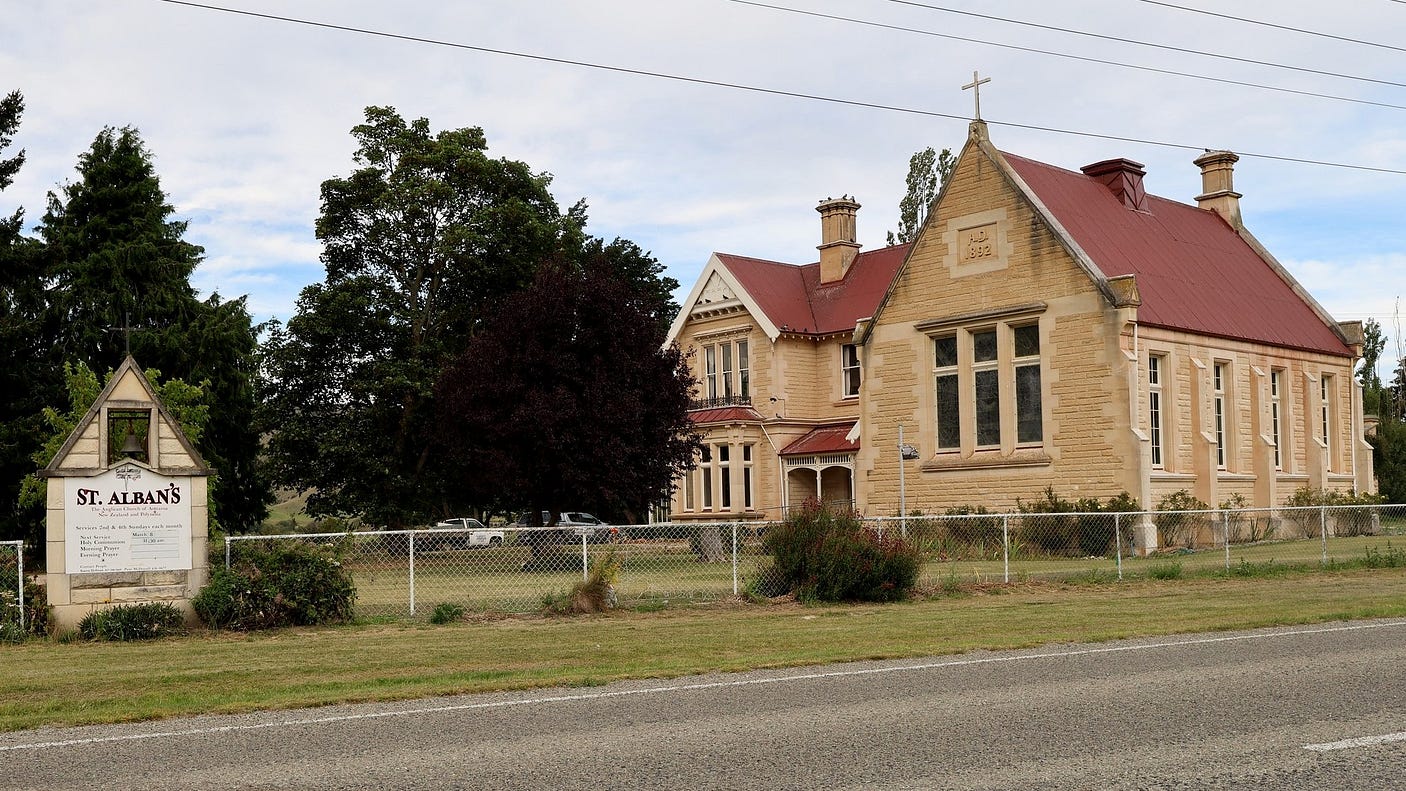
Just east of town is the St Albans Chapel and Vicarage, a listed building dating back to 1892, with the distinctive rough-hewn stone exterior walls that are common in these parts, even the buildings of the old Waitaki Power Station hydro village.
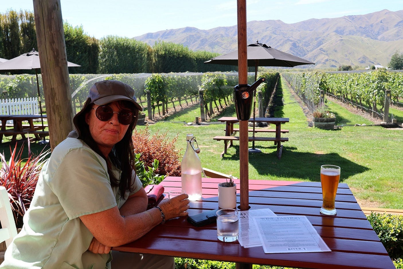
We tried to get some Scotts beer, the product of a Waitaki-area brewery in Oamaru, but neither pub in town sold it because of their corporate ownership, which precluded giving much shelf space to independents. We were able to get some, however, at the River-T winery, a few kilometres east of Kurow past St Albans, where you can also get meals.


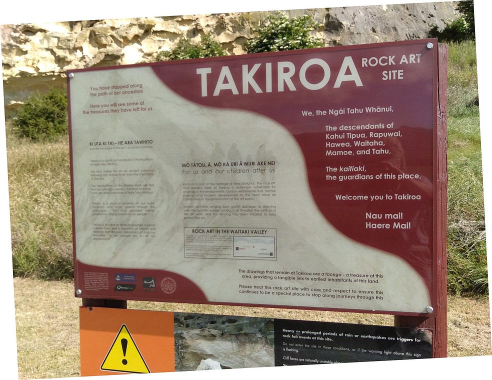
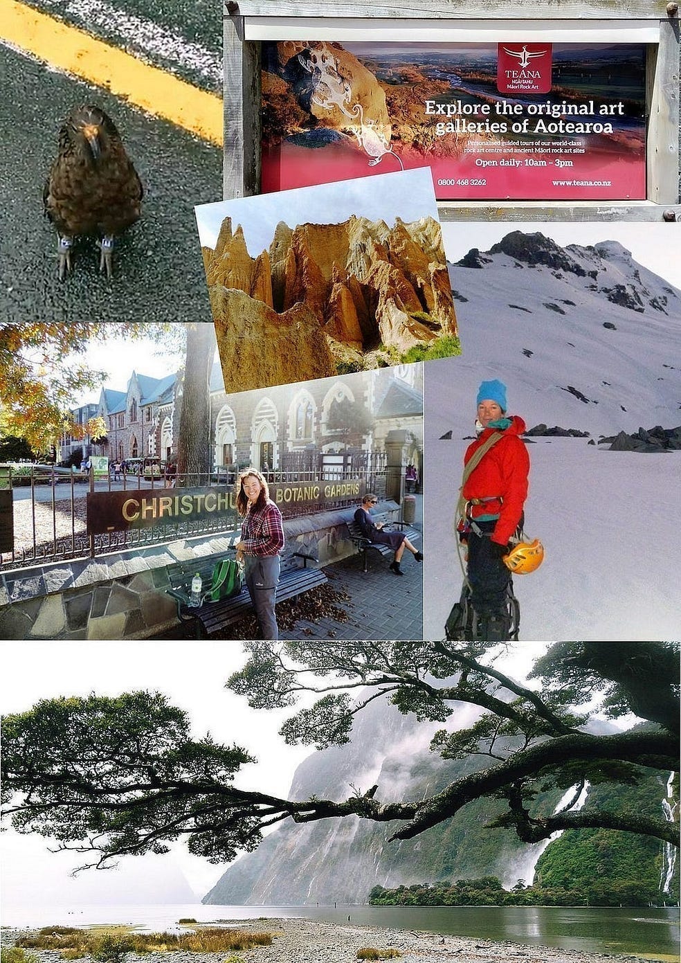
Further down the Waitaki River, you get to the Takiroa Rock Art Site, where there are ancient drawings on the rock. Some of these can be seen in the photo just above, along with the mōkihi.

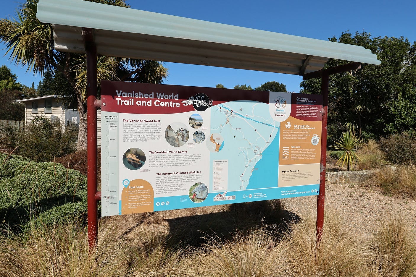
And then to Duntroon, where there is a natural history museum called the Museum of the Vanished World, or the Vanished World Centre.

The local white limestone, from which the town of Oamaru was built and which is commonly known as Oamaru Stone, is a treasure trove of fossils.
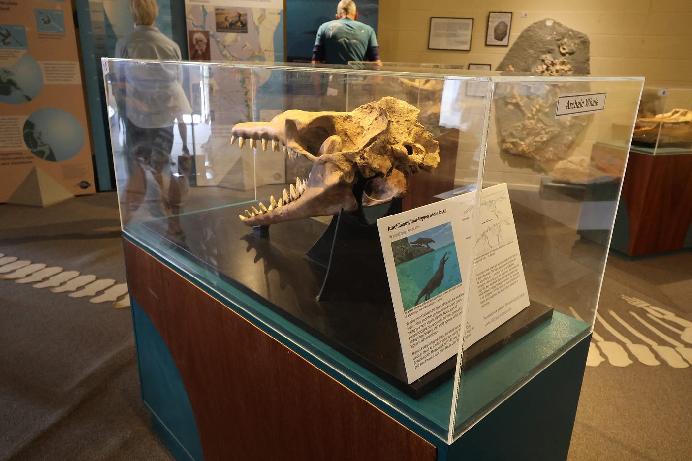
In fact, so remarkable is this formation that it is UNESCO-listed, in the form of the Waitaki Whitestone UNESCO Global Geopark.
Duntroon is also at the heart of a trail called the Vanished World Trail, where you can explore the surrounding limestone country.
One of the biggest attractions in the limestone country is the site known as the Elephant Rocks, 6 km from Duntroon.

The Elephant Rocks are quite surrealistic.

You really have to get out of the car and go down among them to appreciate them. Here’s a photo with me in it for scale.
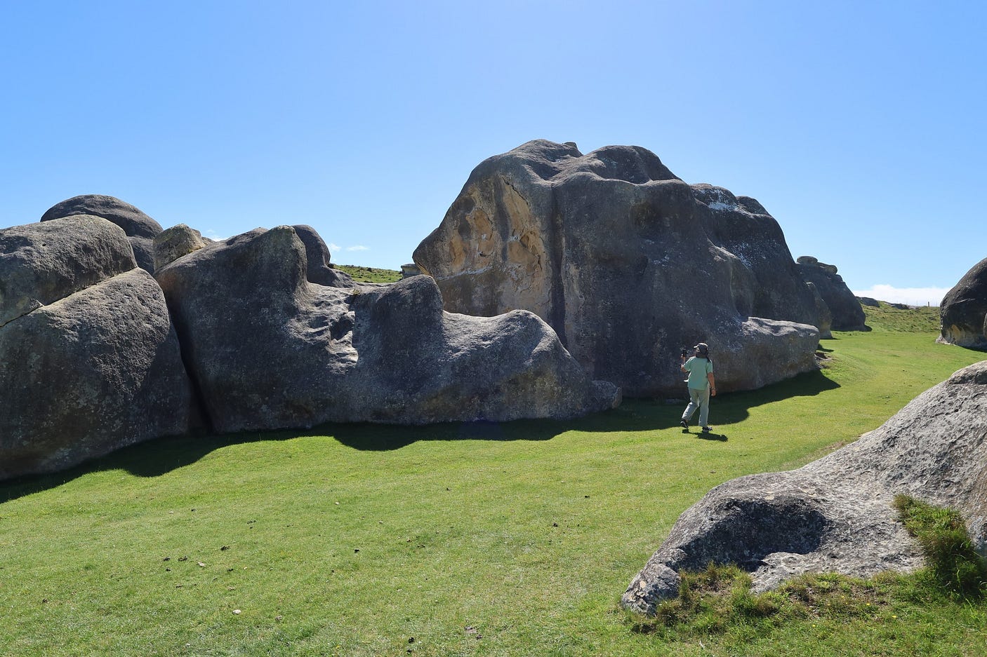
And a couple more, showing how the rocks look a bit like modern sculptures.


And a video:
Back in Duntroon, there is also an old historic blacksmith’s shop for machinery buffs.


There’s also a spacious tree-lined campground with good facilities, the Duntroon Domain, where I think I would like to stay next time. Signs point to it on the main road.

Duntroon is generally quite a pleasant place to linger.
A wider list of things to see in the village itself can be found on duntroon.co.nz.

Pressing on to complete the loop, you can either head for the coast and Oamaru, heading southward to turn onto the Pigroot at Palmerston, or, alternatively, head over Danseys Pass to the Pigroot via Naseby.
The latter is a lot more adventurous. It’s also one of those roads that is often closed in winter. So, naturally, we gave it a crack, admittedly on a warm sunny day.
You start by going up the Livingstone-Duntroon Road, which mostly runs beside the Maerewhenua River, a tributary of the Waitaki and eventually turns off into the Danseys Pass Road. Almost immediately after Duntroon, you come to the Meaerewhenua Rock Art Site.
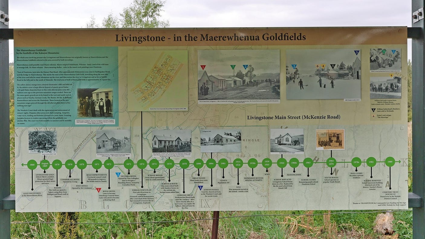
It’s worth going a little further up the Livingstone-Duntroon Road past Danseys Pass Road to start with, to check out the old goldmining town of Livingstone and its cemetery.
Doubling back to the Danseys Pass Road turnoff, the first part of Danseys Pass Road is tarsealed. It also runs beside the Maerewhenua River, and it wasn’t long before we came across another holiday park nestled in a bend of the Maerewhenua. It would be interesting to stay there!

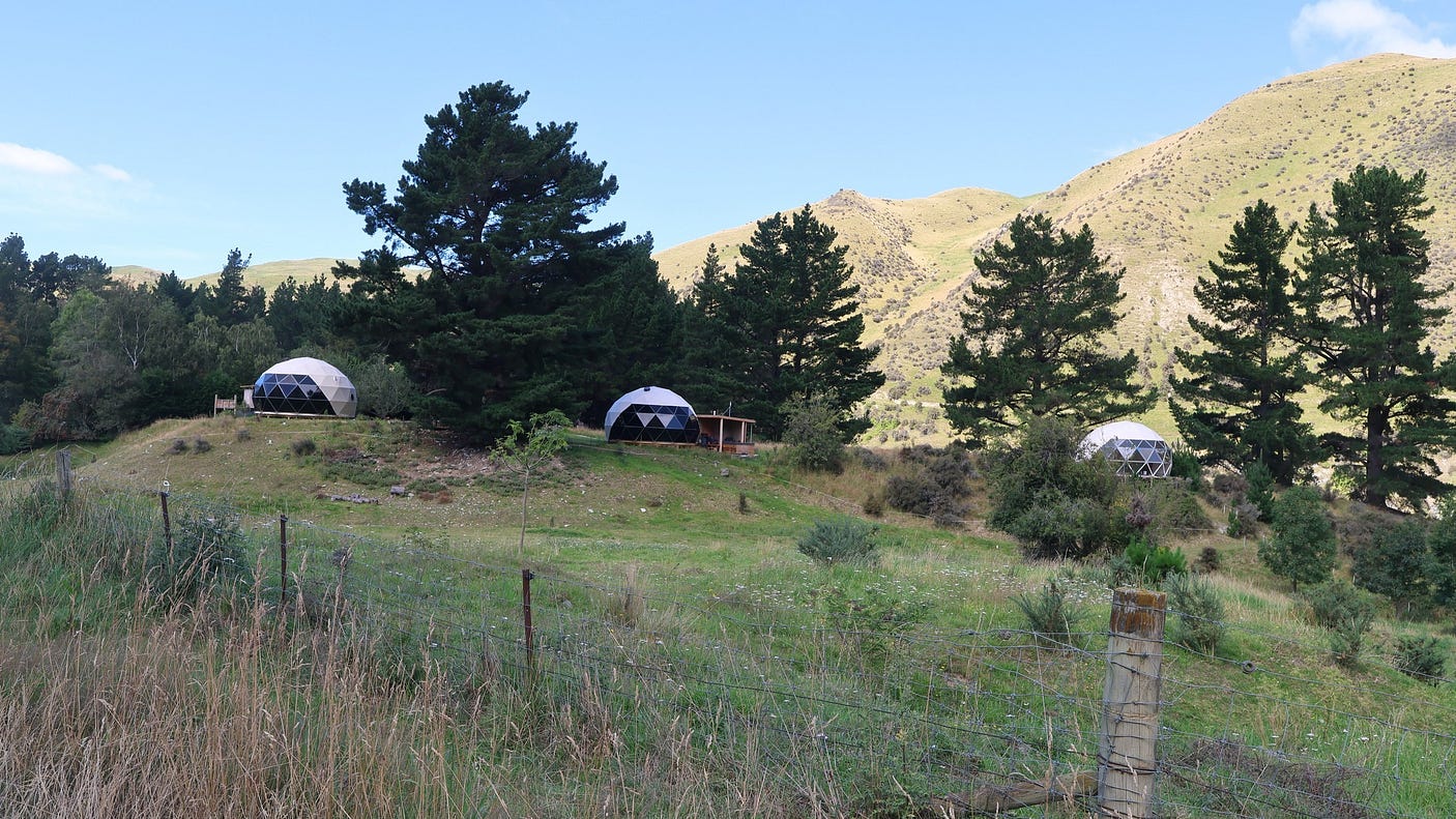
Many of the old woolsheds in this area have been converted into farmstays. And we also went past a place called the Danseys Pass Lavender Farm, which had distinctive geodesic domes for people to stay in.
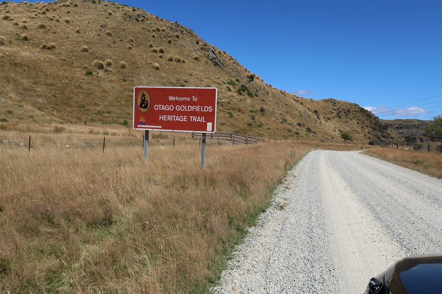
Once past the Lavender Farm, the road starts to get steeper and more precarious, and eventually turns into a gravel road. Here’s a sign reminding drivers that it is part of the Otago Goldfields Heritage Trail.
But the views are spectacular.
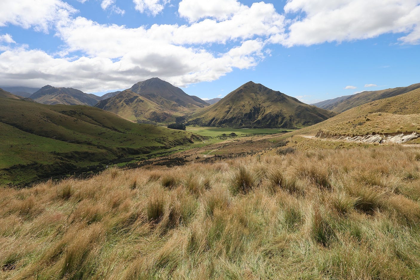
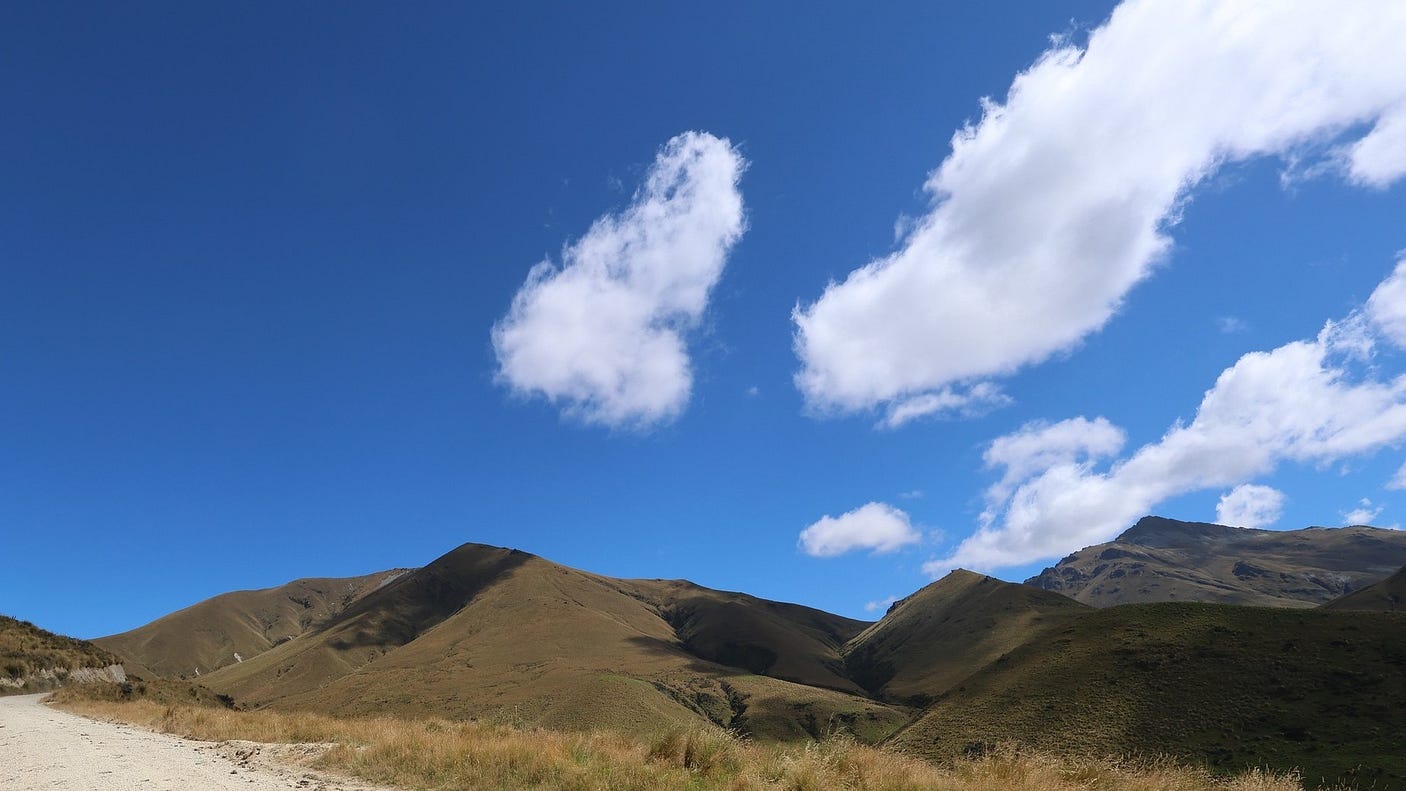
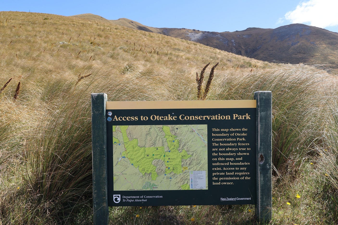
Much of this area is in the Oteake Conservation Park.
The website dangerousroads.org says, as of the time of writing, that “It’s very exposed to the weather, and snow is common, so if there’s any hint of bad weather, it’s advisable not to venture up there.” Here’s a YouTube video on that page, which also shows some of the scarier bits (and why you shouldn’t be towing a caravan):
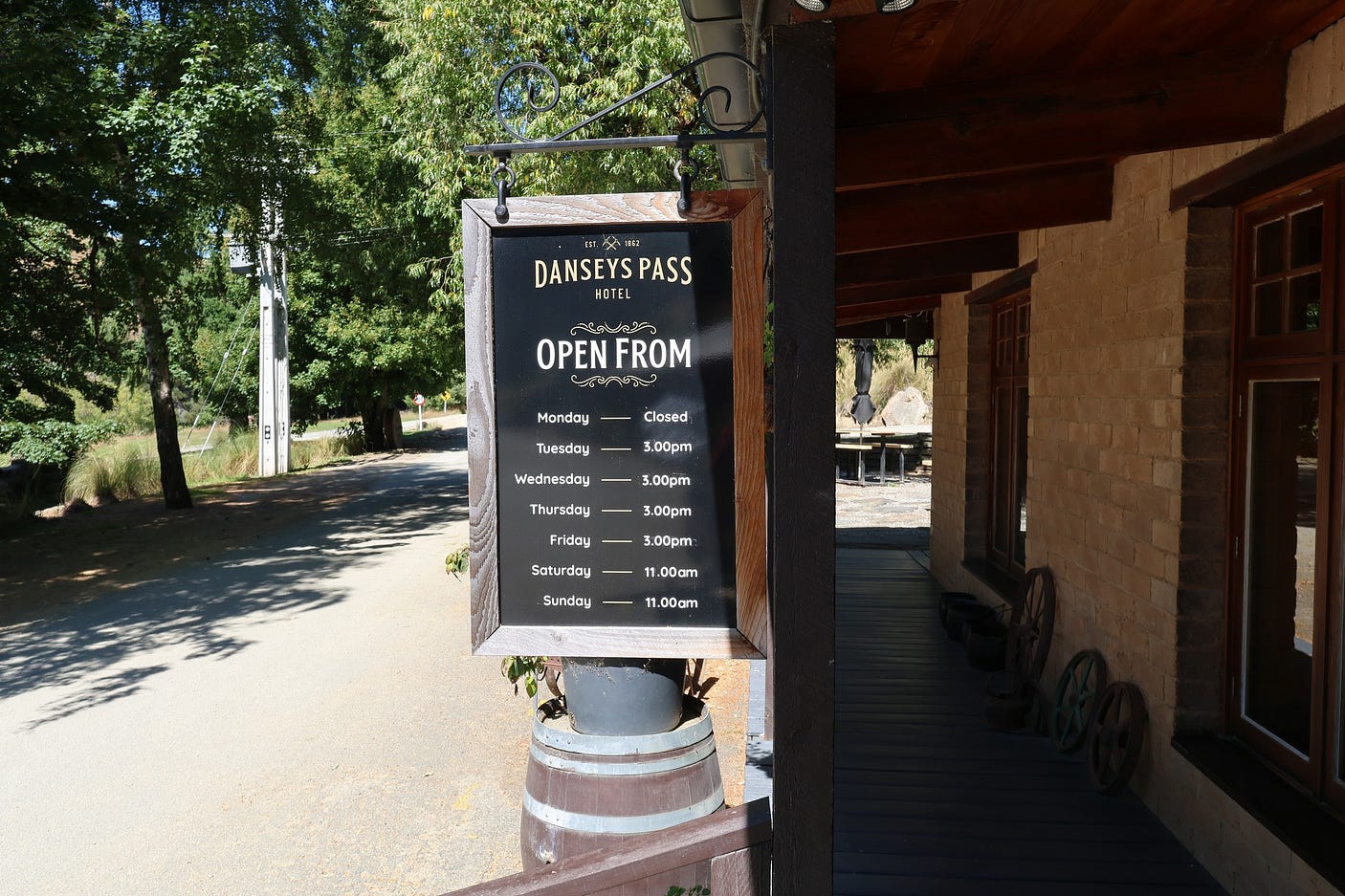
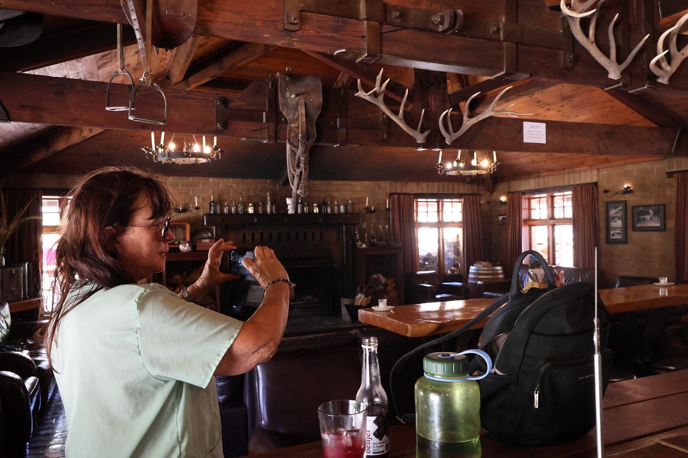
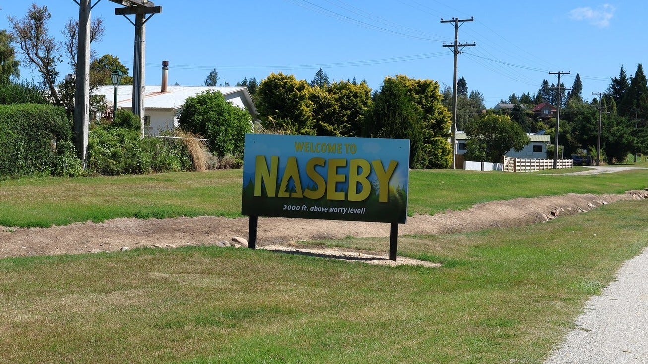
However, in fine weather, if the road is open, it is a great way to come back to Queenstown, as you go past the historic Danseys Pass Hotel (1862) and the equally historic upland town of Naseby, “two thousand feet above worry level.”

At the hotel, you are already heading down from the pass toward Naseby, by way of the historic Kyeburn Diggings cemetery and a very informative sign, though there is not much else thre these days apart from the nearby pub. As the sign says, “It is hard to believe this area was once a thriving gold mining settlement.”
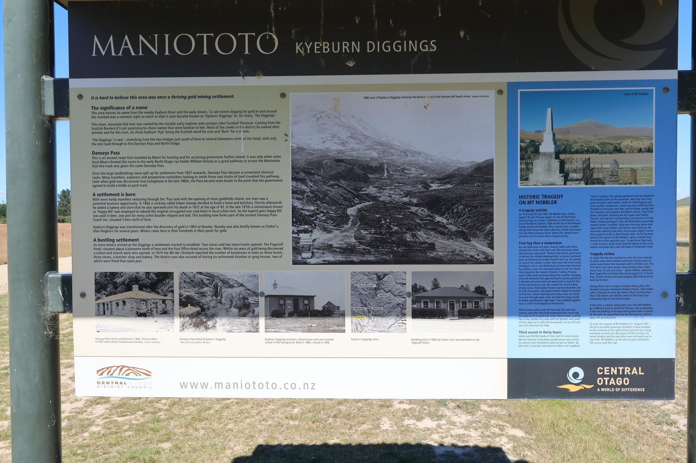
The graveyard is dominated by a monument to the victims of the Mount Nobbler avalanche of 1891, described on the panel above.
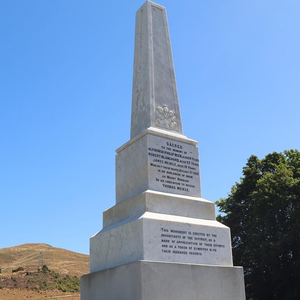
The other side of the information panel is devoted to the activities of Chinese miners.

You can access the Kyeburn Diggings and the Danseys Pass Hotel from Naseby even if the pass itself is closed, as the pass and its closure gates are above the level of the hotel.
Further on down toward Naseby is the Spec Creek Galaxiid Sanctuary, which opened in 2023 and has a visitor centre and a walking track to explore. Galaxiids are a rare type of freshwater fish found only in the Southern Hemisphere, endangered by the transformation of wild landscapes into farms and by the introduction of trout and salmon from the Northern Hemisphere, which prey upon them.
Eventually, you get to Naseby.
Naseby’s Royal Hotel dates back to 1862 or 1863 as well, and, unusually for a colonial wooden building, has never burnt down and had to be rebuilt, so you see it as it was.

Naseby’s Black Forest Cafe also has a couple of nice outdoor seating areas, not just out in front but also a courtyard facing the street.

You can see the courtyard behind this sticker, advertising the Central App, for information about Central Otago.

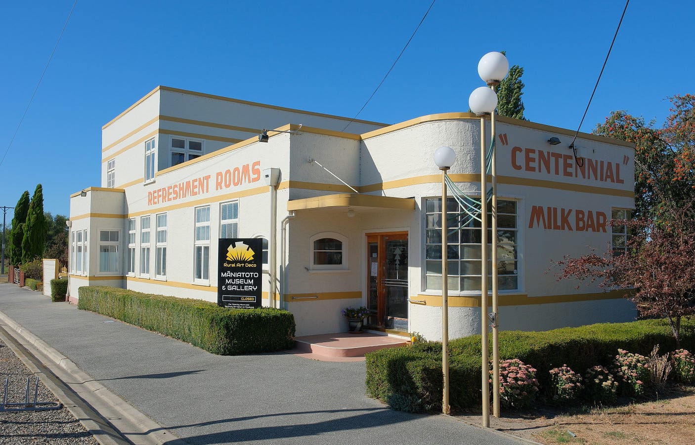
After Naseby, you join the Pigroot at Ranfurly, to head back to Queenstown. The most distinctive building in Ranfurly is its Centennial Milk Bar, which as the style and name suggest must have been erected around 1940, the 100th anniversary of the Treaty of Waitangi. It is now an art deco gallery.
For a guide as to what it is like on the way back, along the Pigroot, check out my 2024 post ‘Above Worry Level: From St Bathans to Ranfurly, on the high plains of the Maniototo.’
There’s a great online article about the Waitaki in New Zealand Geographic, called ‘Waitaki: Water of Tears, River of Power’.
For a further guide as to what to see, check out the Central App, Kurow. org.nz, Duntroon.co.nz, Maniototo.co.nz and Waitakinz.com, as well as 100% Pure New Zealand.
If you liked this post, check out my book about the South Island! It’s available for purchase from this website, a-maverick.com.
Subscribe to our mailing list to receive free giveaways!
