Giveaways
BEFORE going to Vanuatu, I was in Hokitika, a town whose name is often said to mean ‘come back the right way’ in Māori.
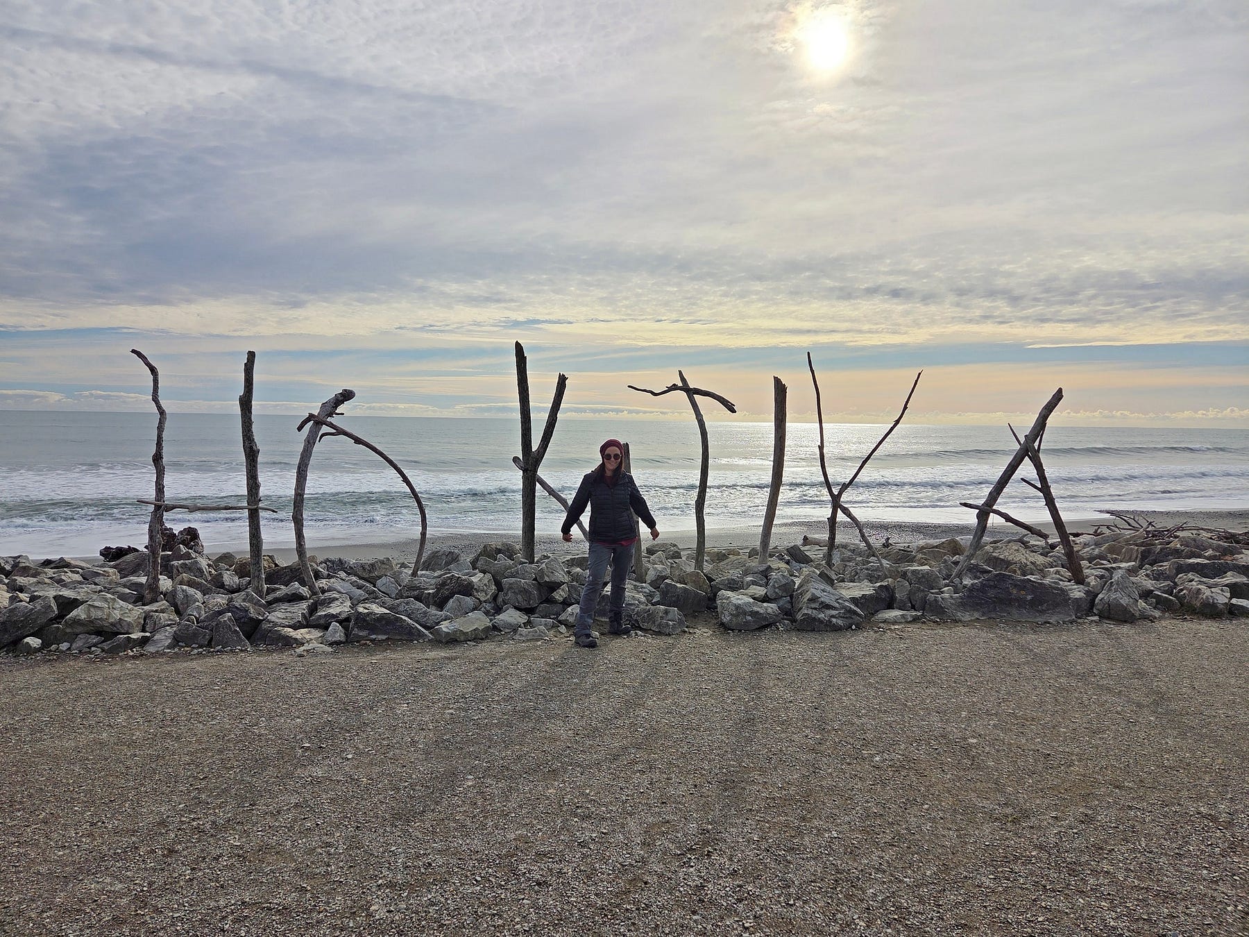
Early explorers for pounamu, or greenstone, from the east coast, knew they could get back if they found themselves at Hokitika.
That is one translation, though according to the story ‘A Digger’s Legacy,’ published in a 2014 issue of New Zealand Geographic, it could also mean ‘a place to retreat from,’ in the sense that you don’t even want to go there for fear of drowning in the Hokitika River!
Anyway, it is all fine these days. From Hokitika, I travelled south, over Haast Pass, which was the right way back for me.
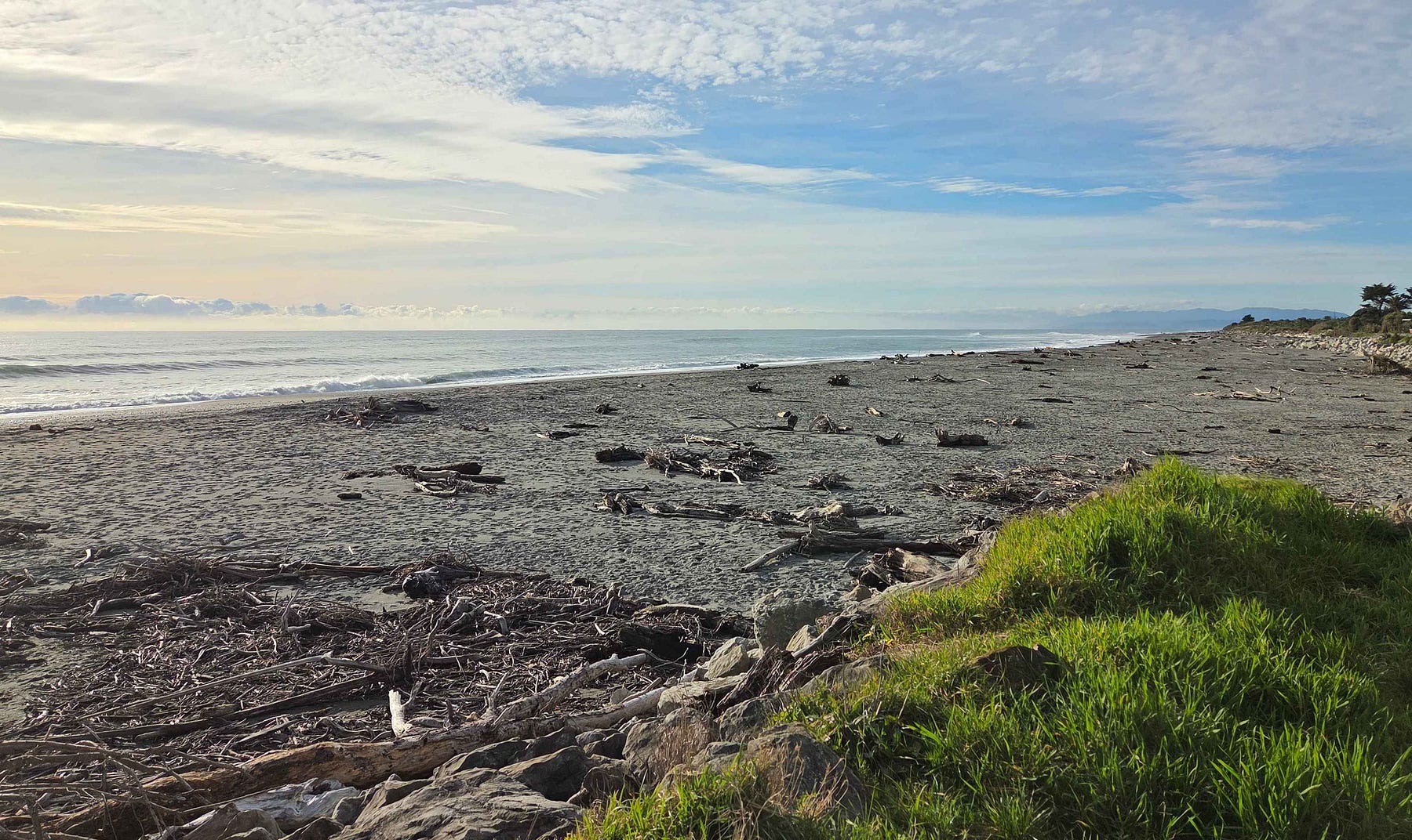
Hokitika has glorious wild west coast beaches.
Travelling south, you can visit
I’ll talk about all those places, with new photos, in this post.
Next week, I will continue my journey southward from Fox Glacier to the Haast Pass and Jacksons Bay.
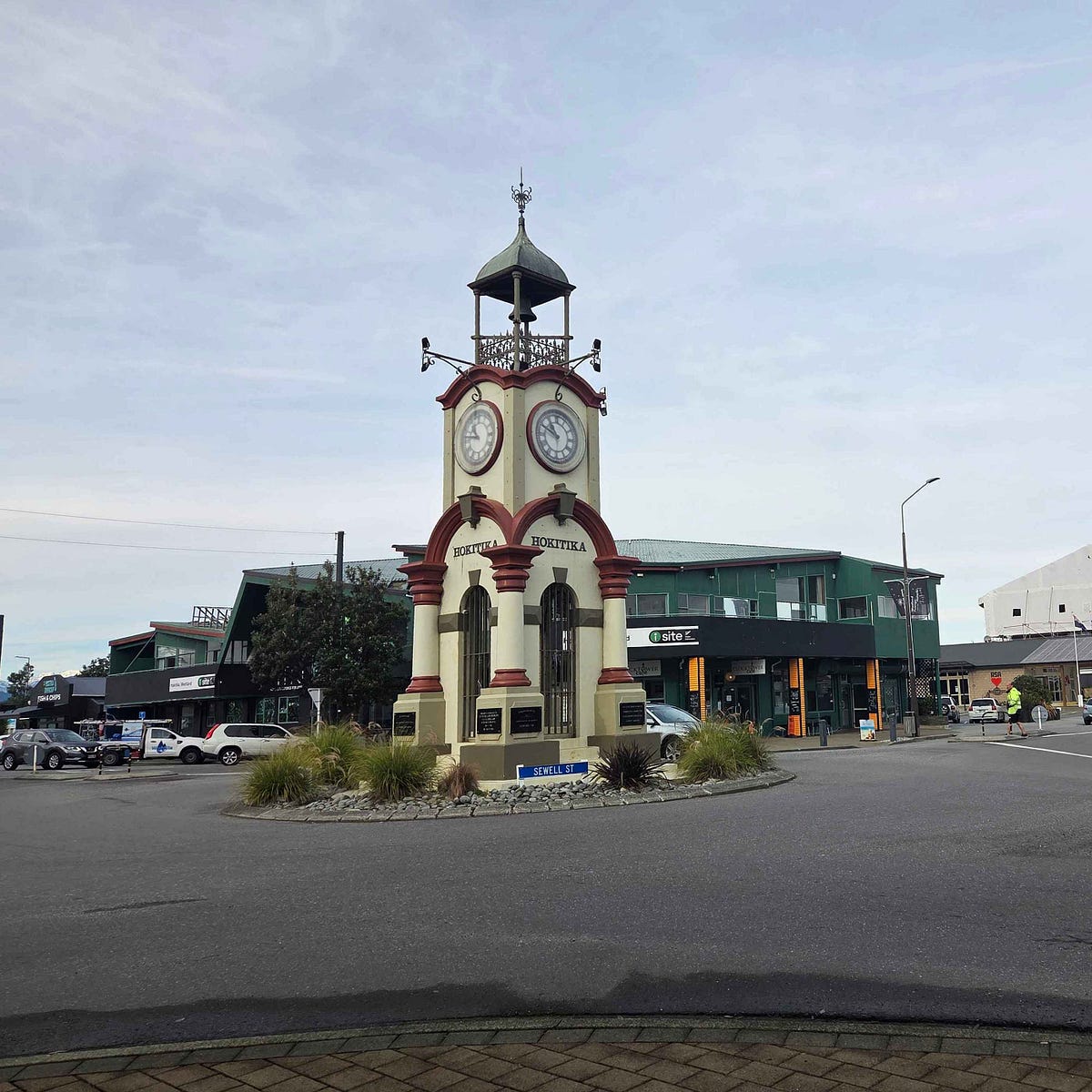
In Hokitika, you can spot the clocktower with the iSite, or information centre, behind, which makes the latter easy to find.
I visited a pounamu shop run by the Ngāi Tahu iwi, or tribe, the largest in the South Island.
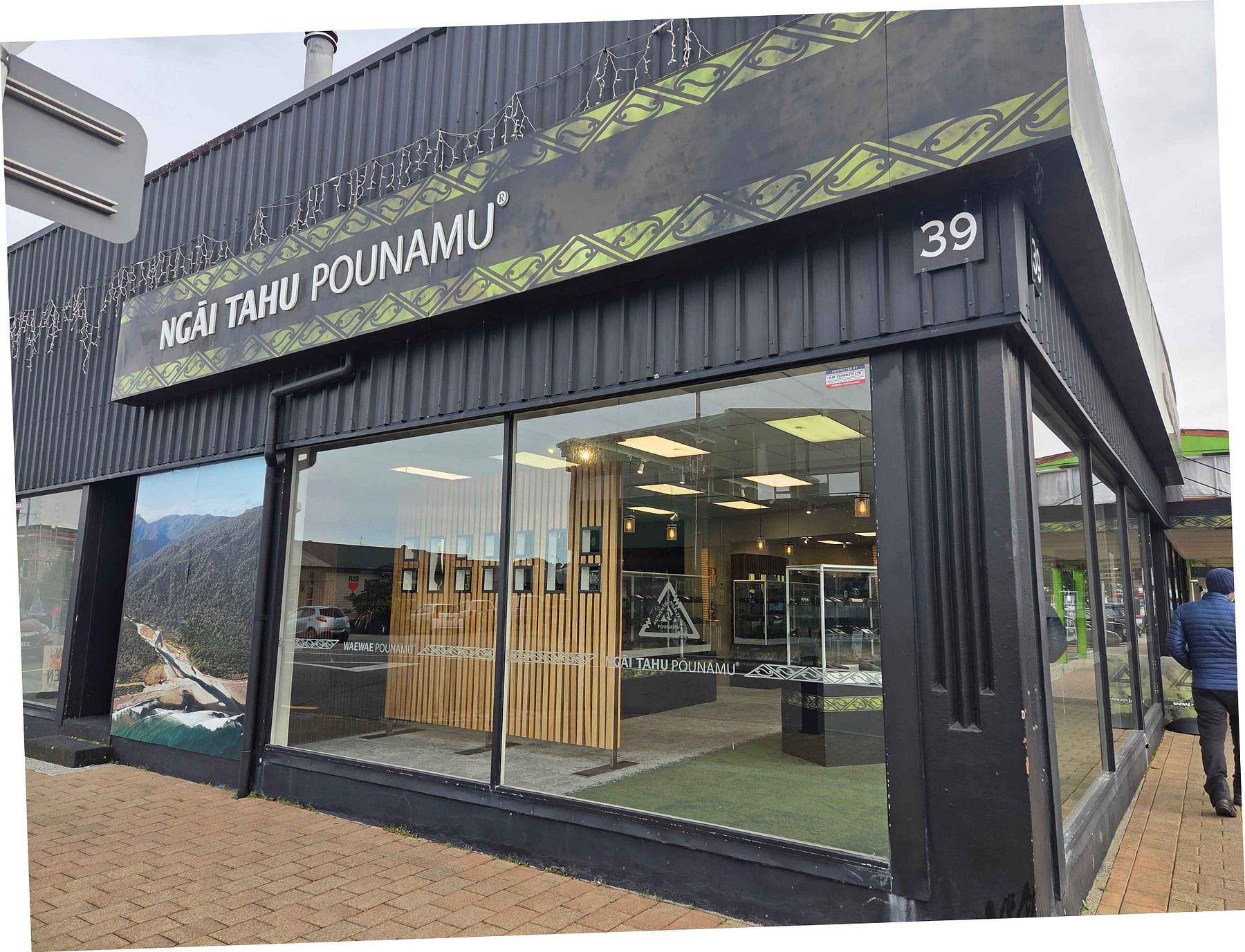
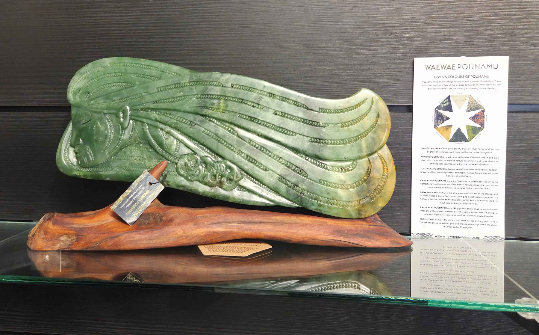
Much of the pounamu in Aotearoa comes from the Arahura River just north of Hokitika, the bed of which belongs to the Māwhera Incorporation, a Maori trust from Greymouth, making it, as of the time of writing, “the only New Zealand that is not publicly owned.”
Much of the country’s mother-lode of pounamu is found up West Coast rivers like the Arahura, and is formally allocated to Māori groups, though there are places, such as certain beaches, where anyone is allowed to fossick for small pieces.
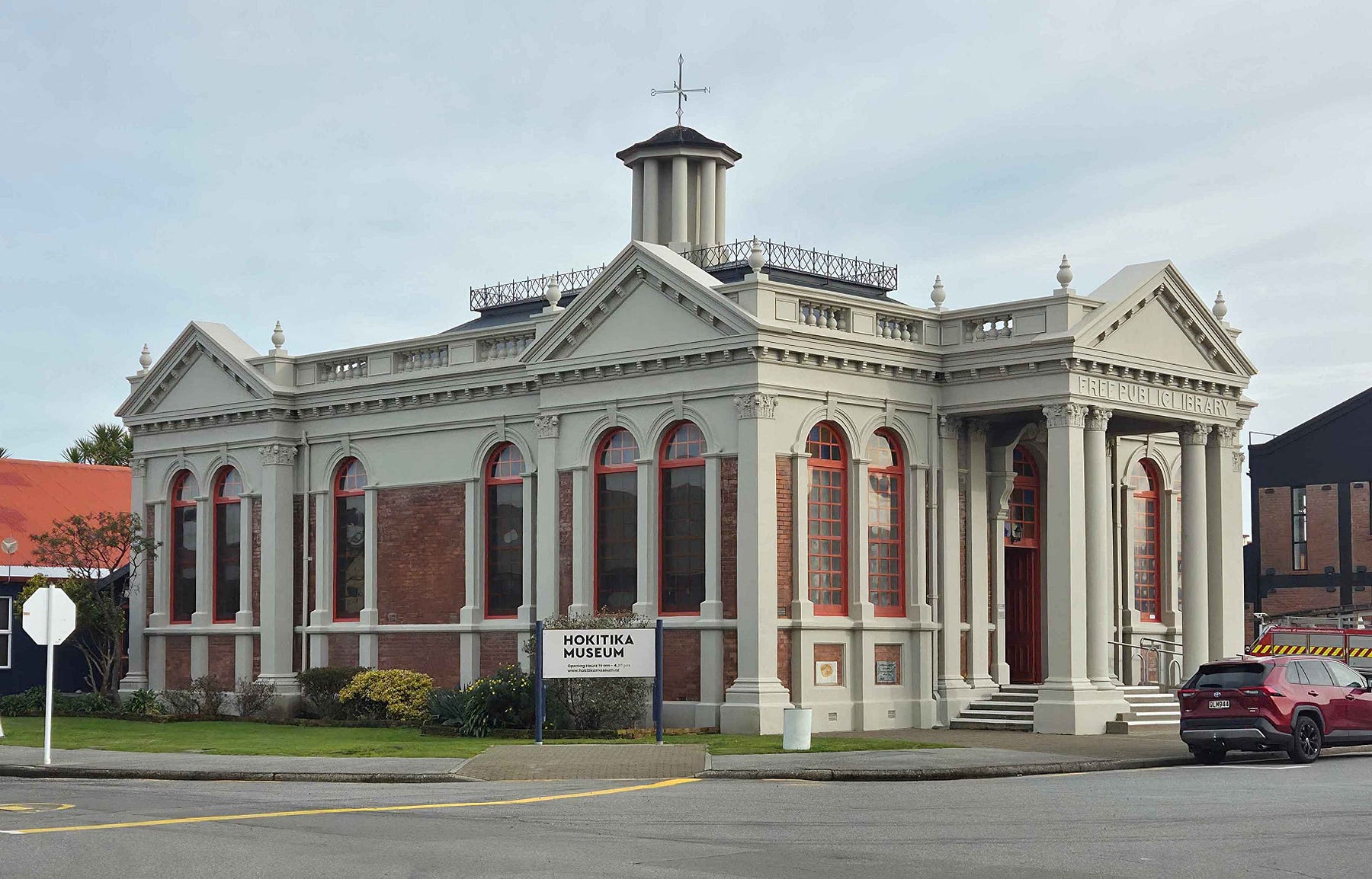
I visited the Hokitika Museum, at 7 Tancred Street, which has displays dispelling all kinds of myths. It had reopened less than a week before I visited, after being closed for nine years for refurbishment.
Things were a lot more rough and ready in the old days!
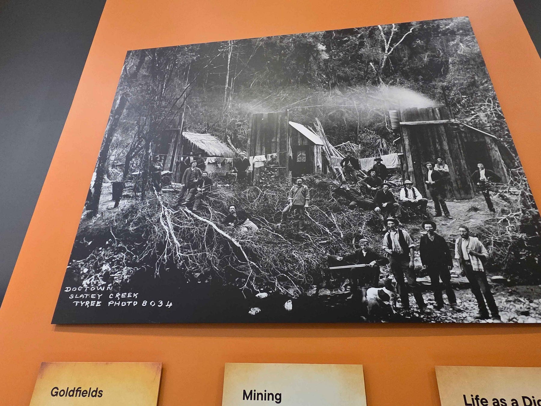
Just as is also reported in ‘A Digger’s Legacy,’ I discovered, at the museum, that the gold that fuelled the massive Hokitika gold rush was discovered by two Māori prospectors, Ihaia Tainui and Haimona Taukau, while searching for pounamu.
However, the museum exhibit goes further to state that the credit (and claim) was then taken and filed by Tainui and Taukau’s associate, one Albert Hunt, who was for a long time credited with the discovery of gold at Hokitika until that claim began to seriously unravel in 2016.
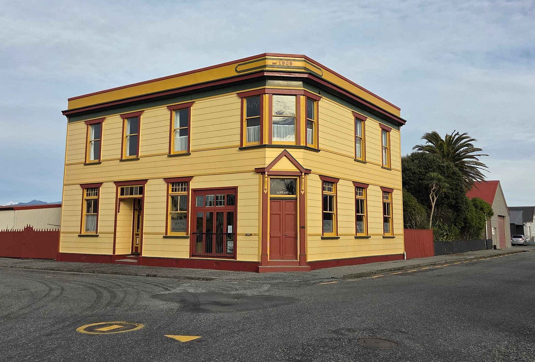
The old wooden Bank of New South Wales Building is now a copper artisan workshop, called IaNZArt after its proprietor, Ian Phillips.
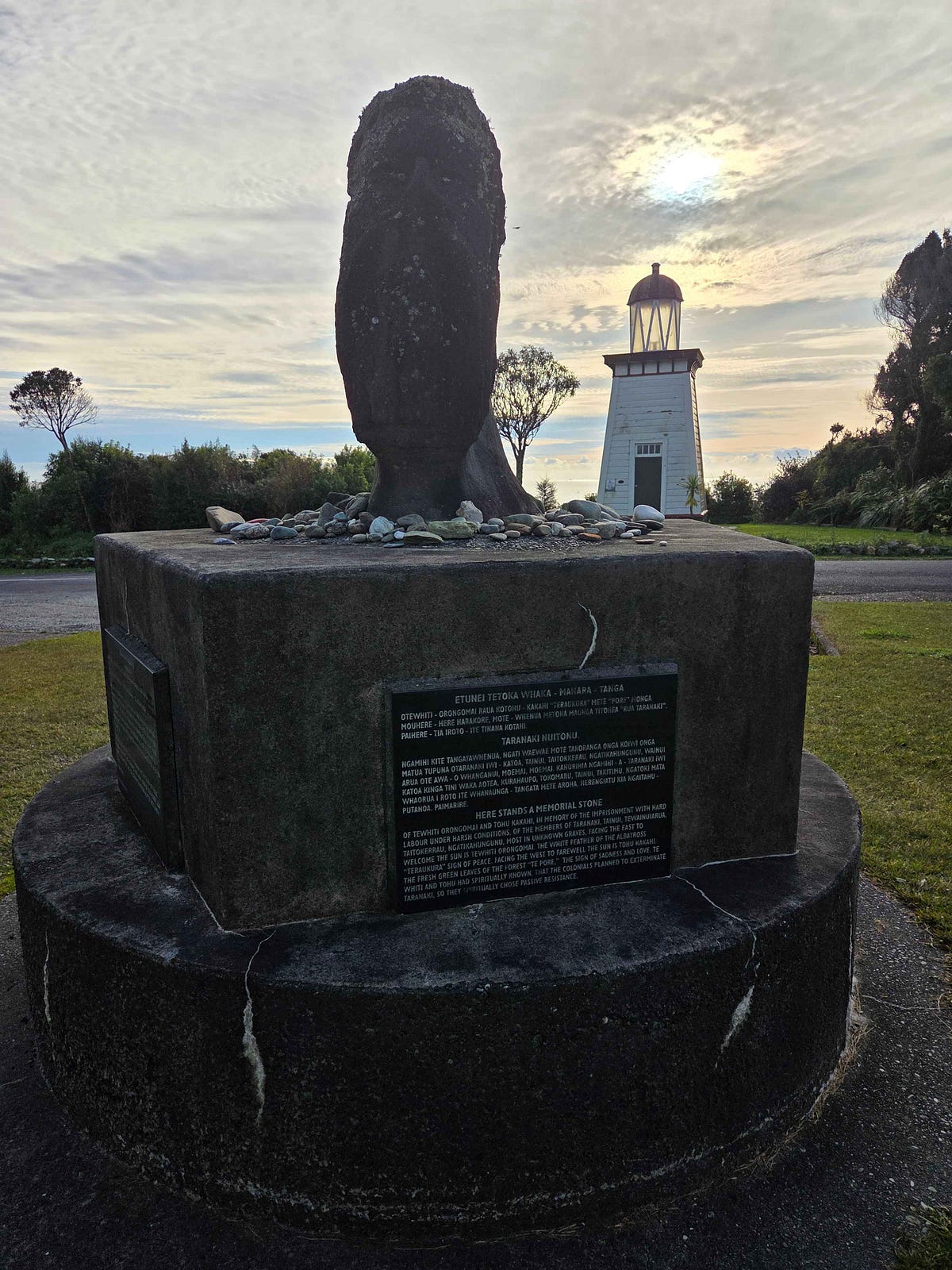
There is also a small lighthouse with a memorial to Māori from the North Island who were temporarily detained at Hokitika after passively resisting the colonisation of Taranaki.
Here’s a photo of myself, behind a lifebelt for anyone who falls into the Hokitika River at a popular spot.
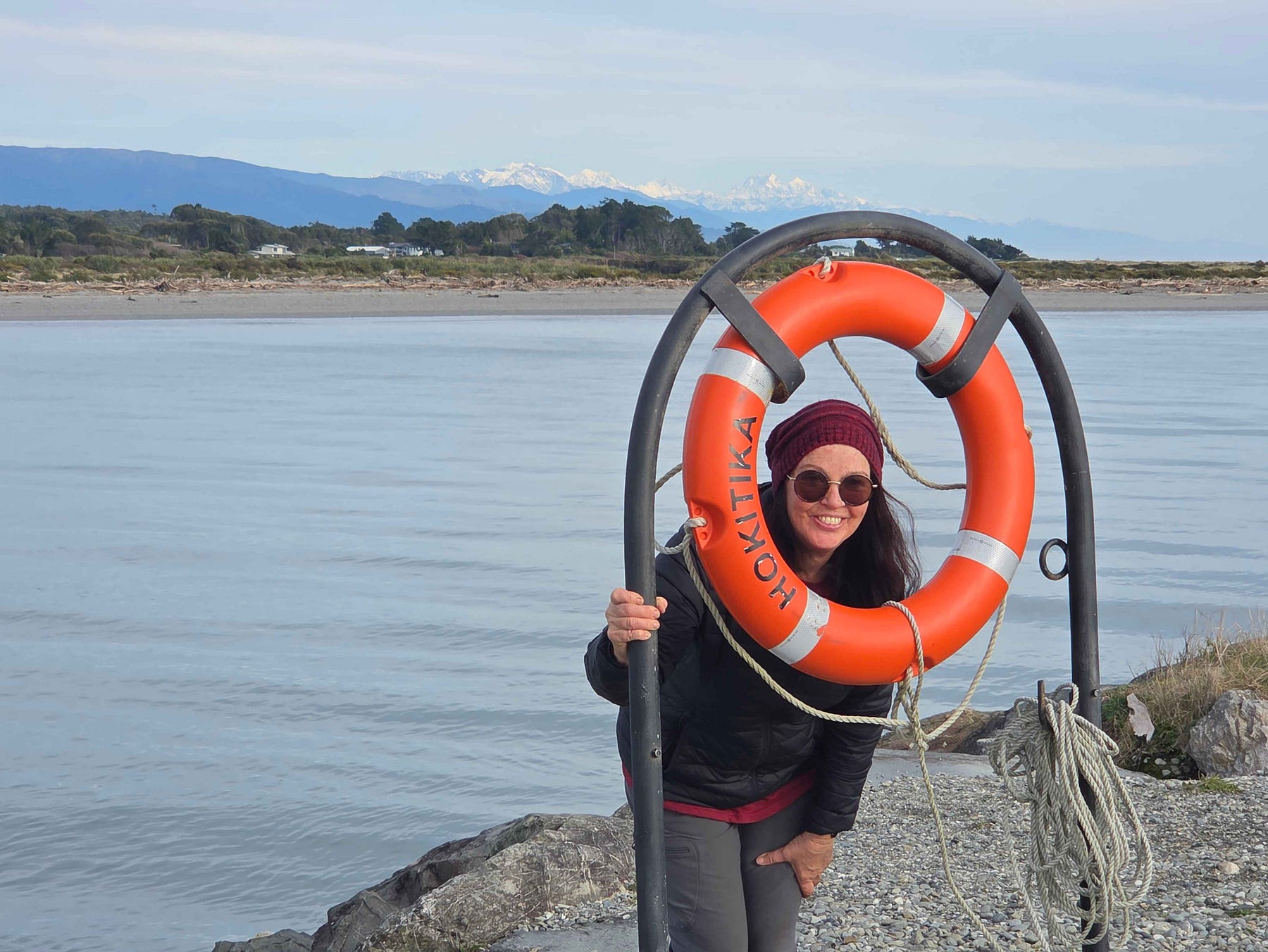
It’s mainly of interest because you can see the scenic and snowy mountains behind: a common view on the West Coast.
Finally, I heard that a lot of the baby boomers are leaving this area because they fear that the health system has gone downhill, and that young people are coming in instead.
There are plenty of places to stay and to eat: it’s a great place to stay in between seasons.
This is well worth taking a slight trip out of town to visit as well.
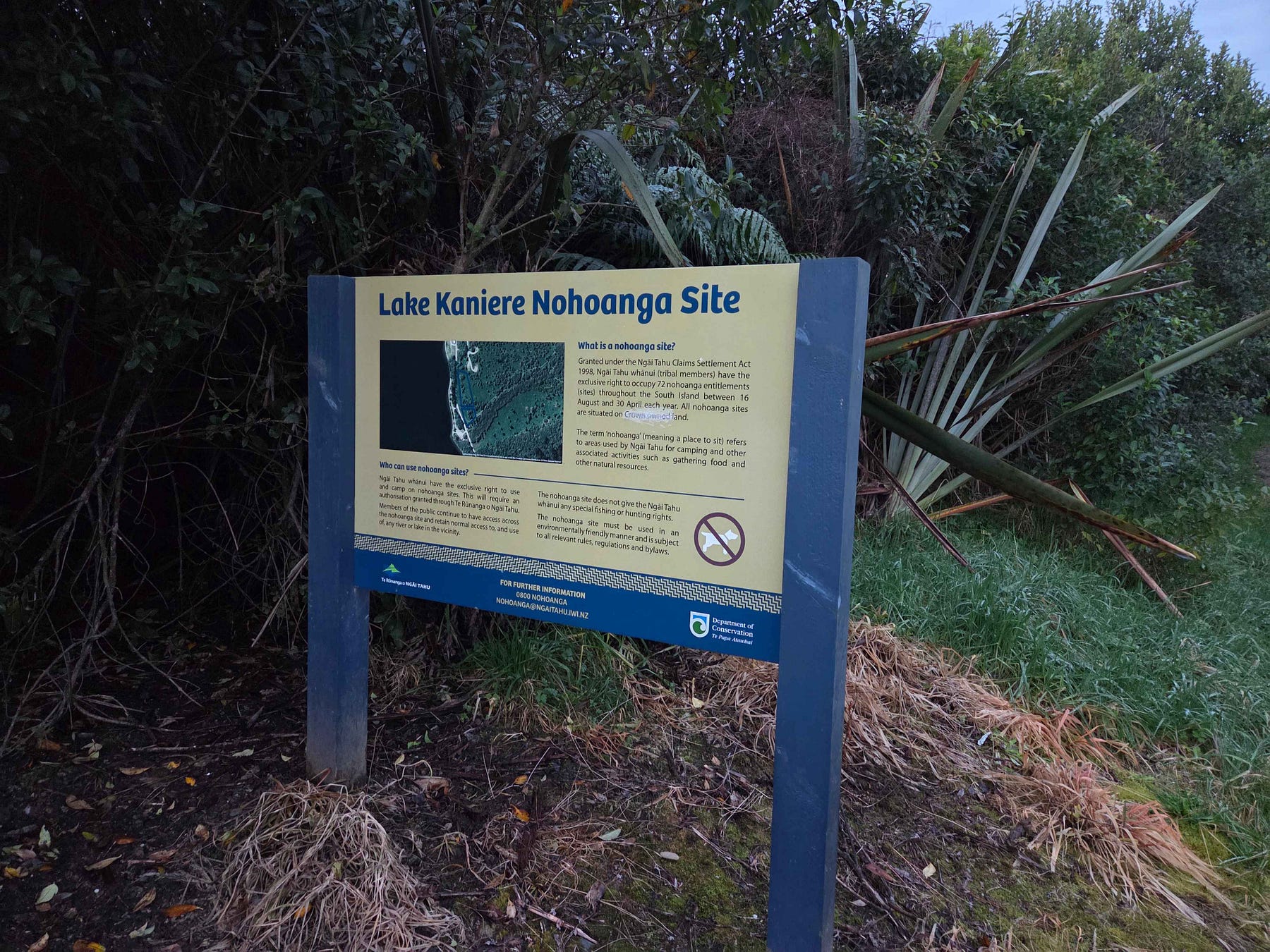
Lake Kaniere is a really nice place to camp.
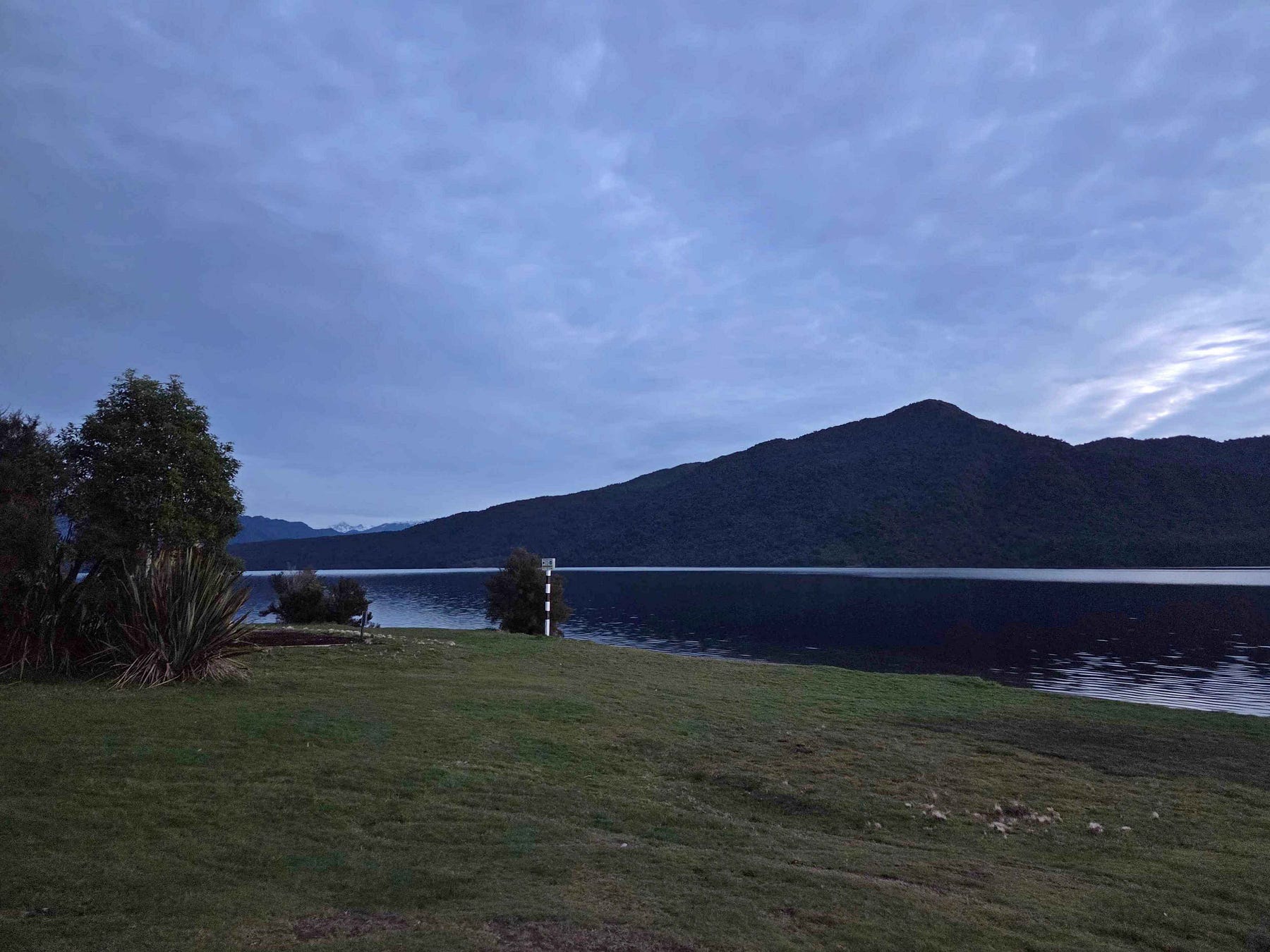
On the shores of Lake Kaniere, you can take a short hike to Dorothy Falls.
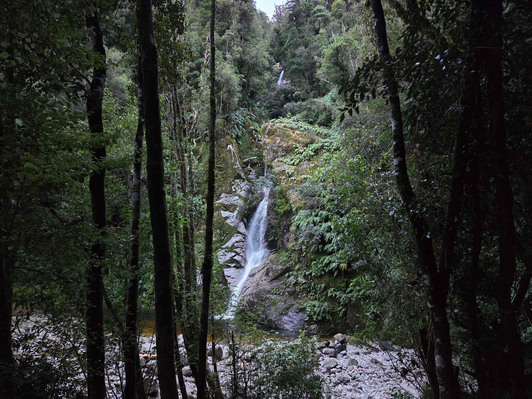
In the vicinity of Dorothy Falls, you can also ascend to Mount Brown Hut, above the south end of Lake Kaniere, for the popular, Instagrammable view out over Lake Kaniere and Hokitika. A mountain hut with sea views is always extra special!
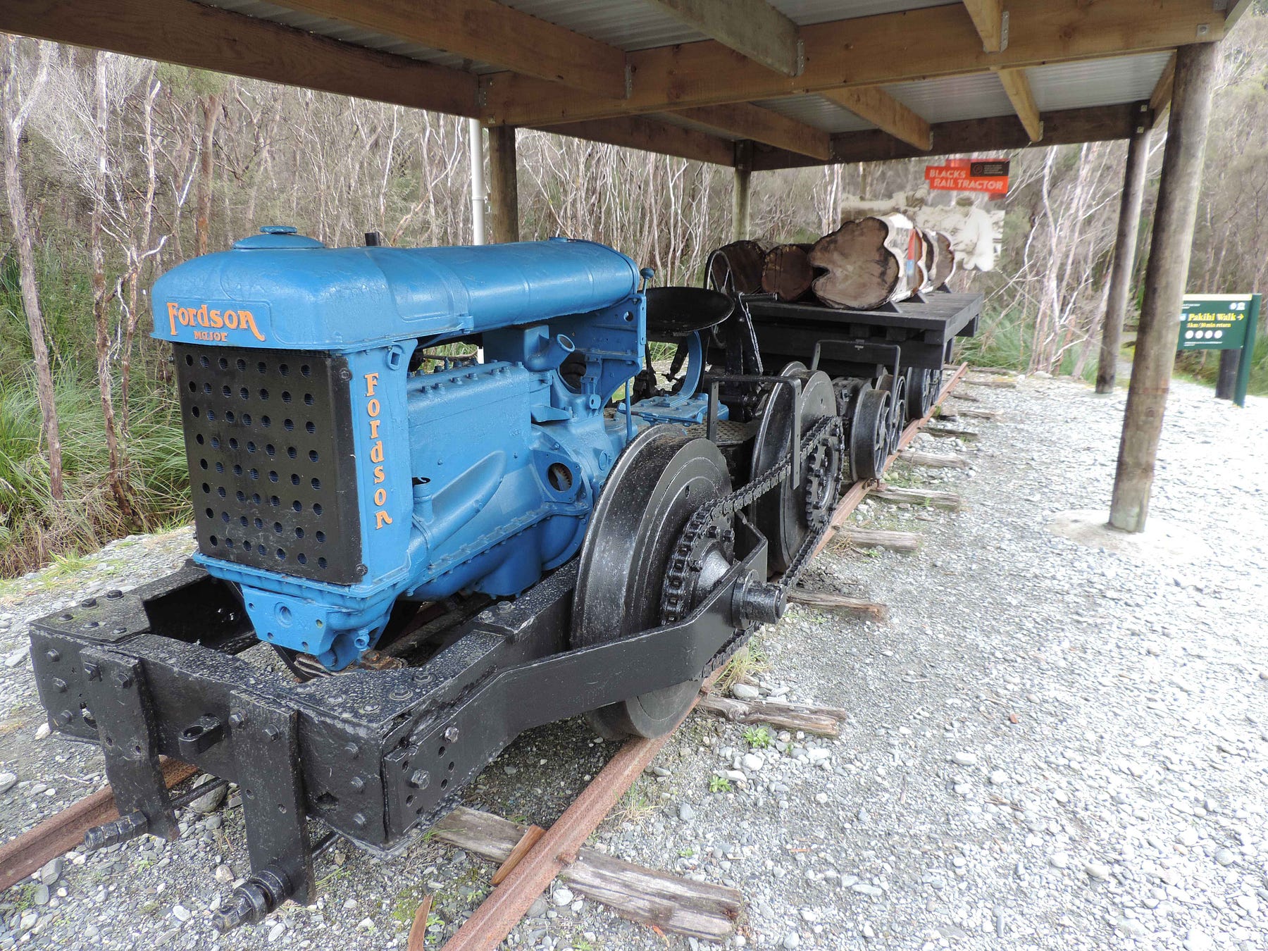
As the following display shows, there are a huge number of mountain huts on the West Coast of the South Island, even when the northern and southern ends of the South Island are not included.
Many of these huts, including Mt Brown Hut, are no longer maintained by the New Zealand Department of Conservation (DOC), and are instead looked after by volunteers.
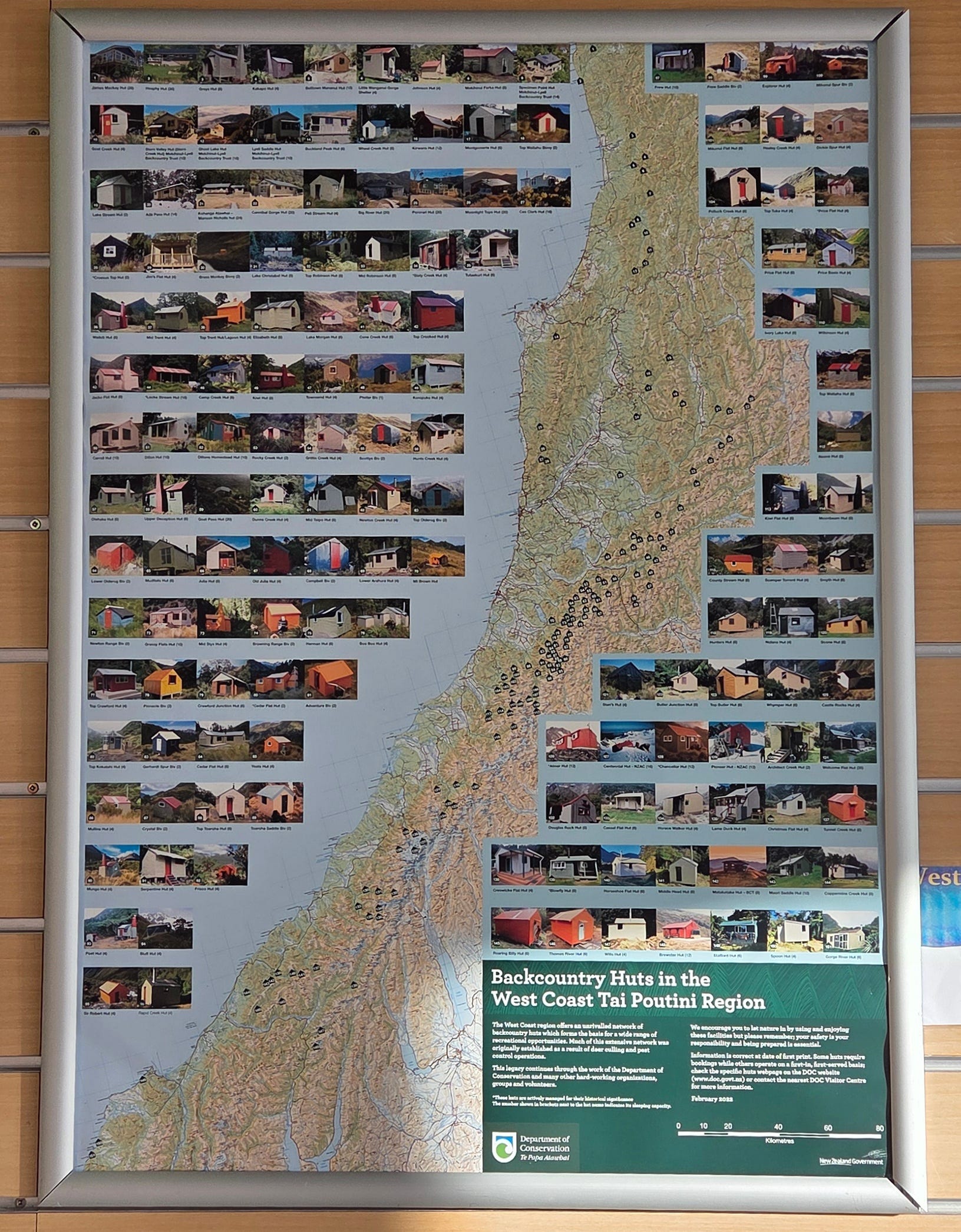
Mount Brown Hut is no exception. It was an old government hut, erected in 1962 on another site. It was going to be demolished in 2010, but instead, some West Coasters acquired it and erected it on its present site.
You can read more about the Mount Brown Hut on the community-based Remote Huts Website. I also went to a film about the community groups that were saving remote huts, which screened at the Mountain Film Festival in late May, called Hut Keepers. The film has its own website, hutkeepersfilm.com. Here’s the official trailer:
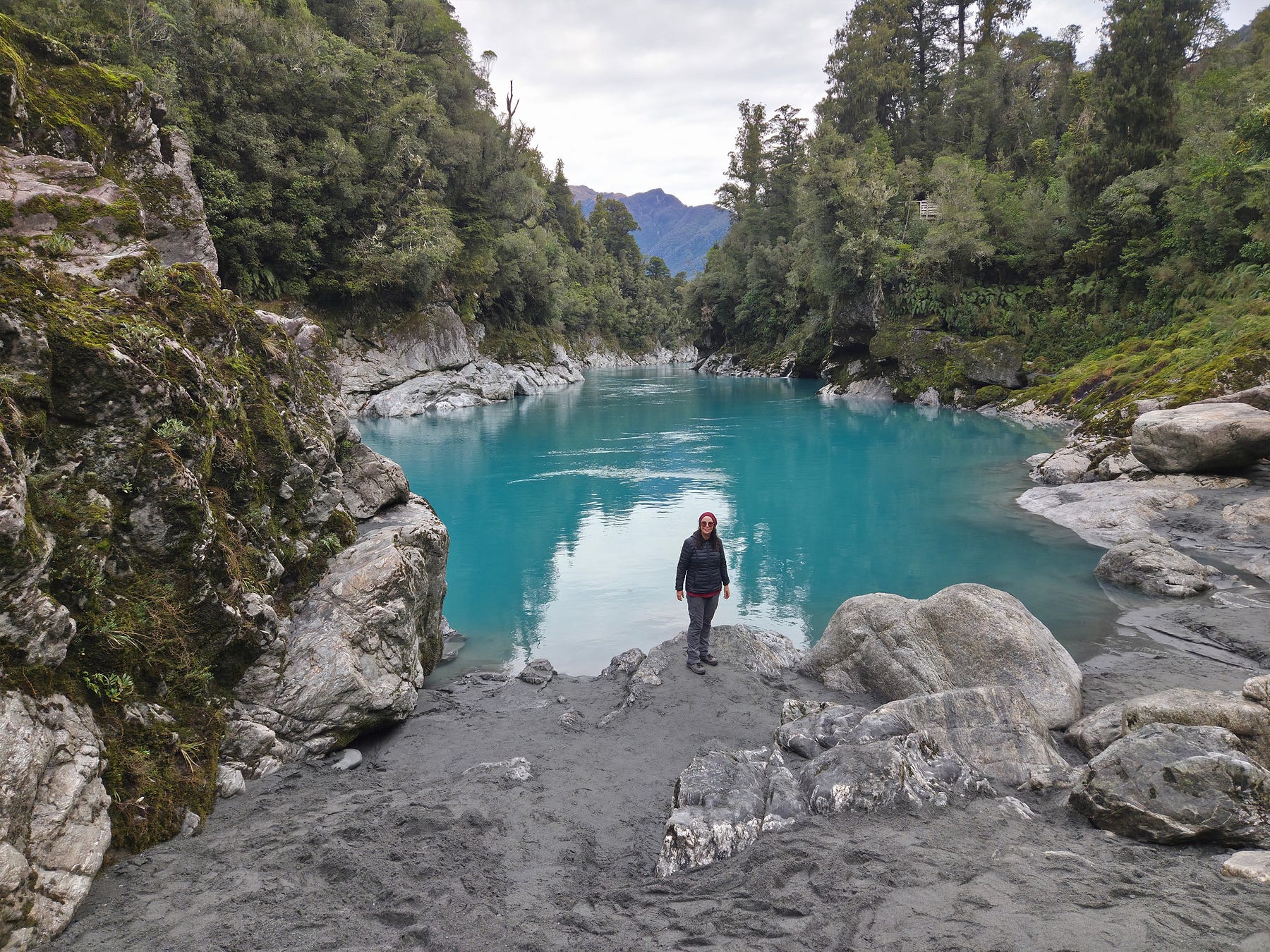
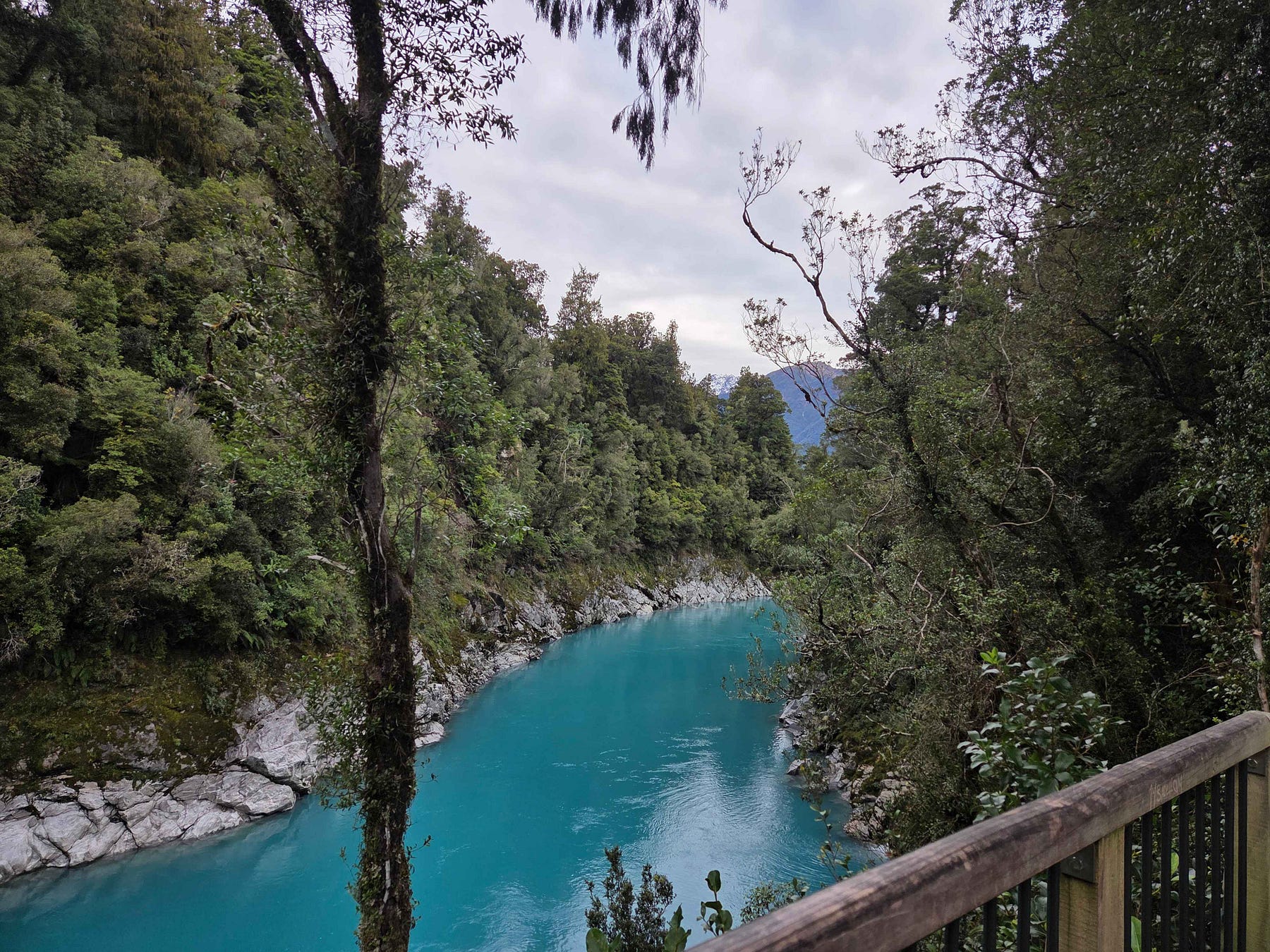
I did get to the blue pools of the Hokitika Gorge in the end, for which I have previously been relying on my friend Chris’s photos and his word— and they were stunning.
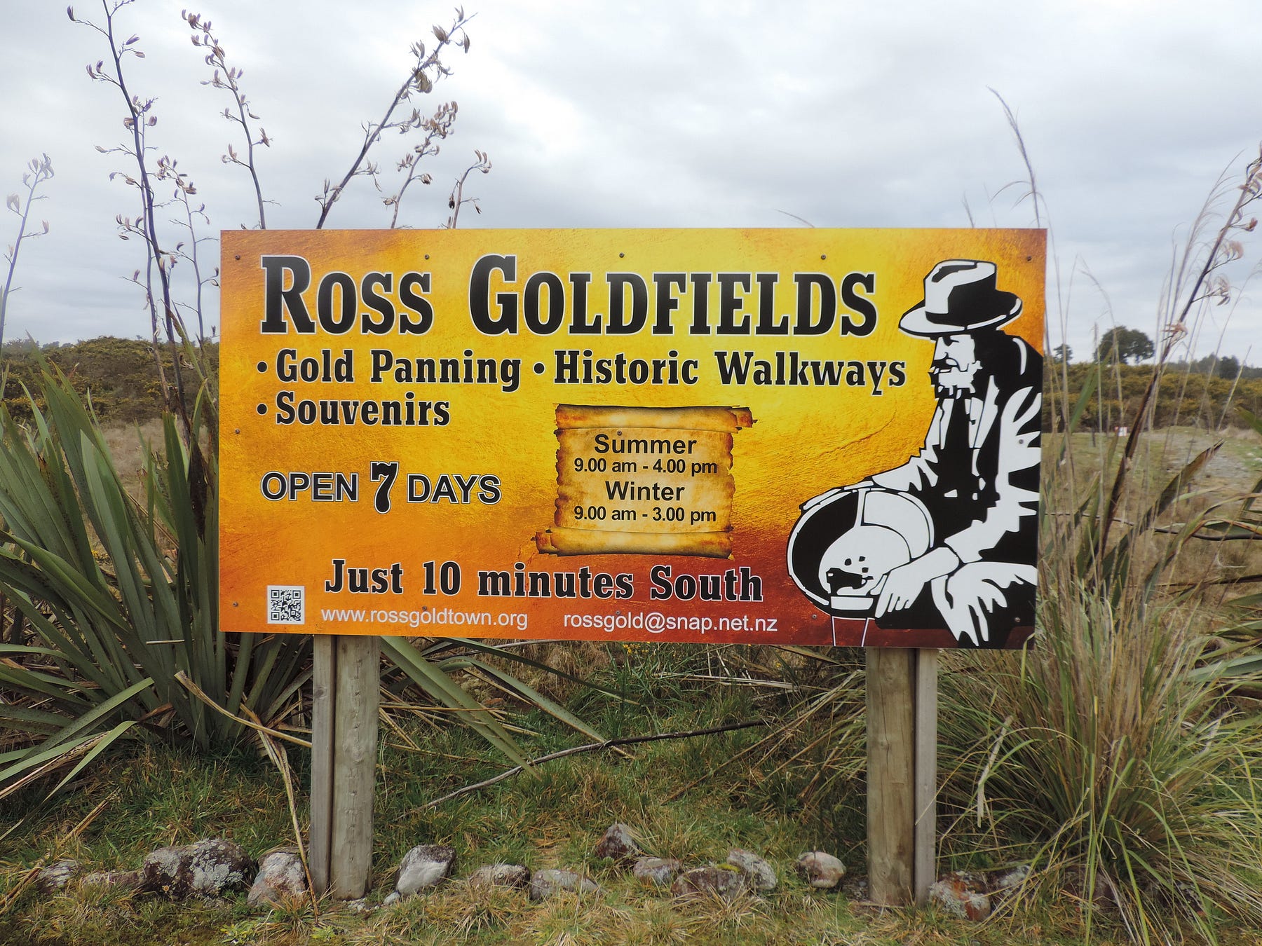
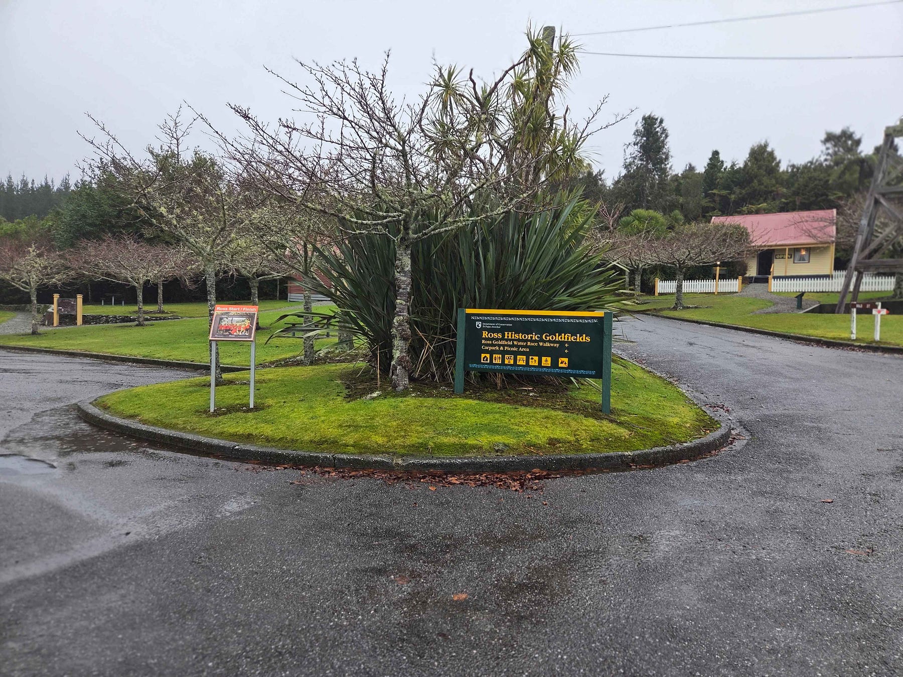
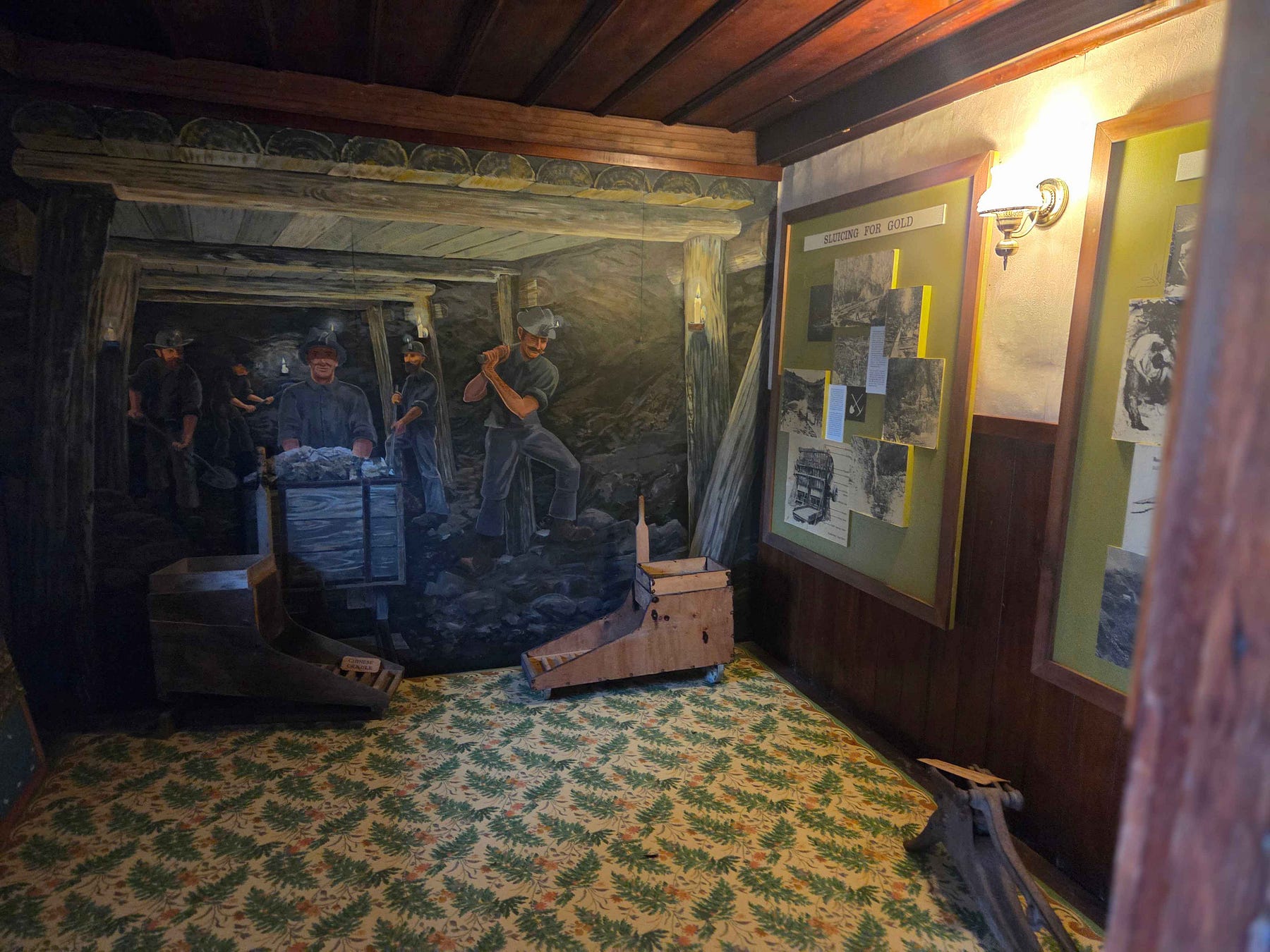
A little way further south, you come to the town of Ross, which has a historic goldfields area, complete with old cottages (a bit like Arrowtown).
I managed to find a place to stay for only NZ $25 a night, and was able to get orange roughy and chips for NZ $20.
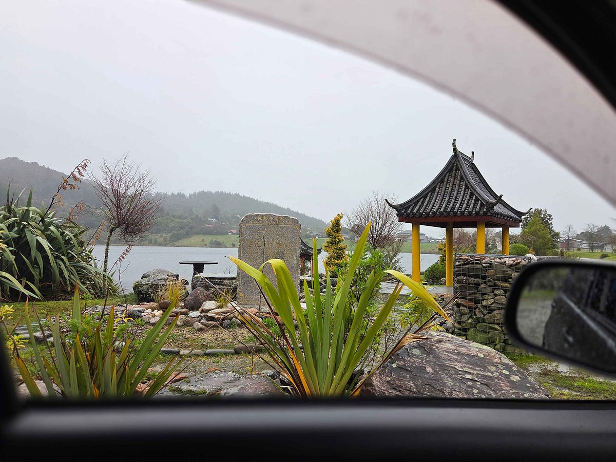
The largest gold nugget in New Zealand was found at Ross. The town still has one working gold mine on private land. An old, open caste mine has also since been made into a lake. They have since built a Chinese Garden around the lake to commemorate the Chinese miners there.
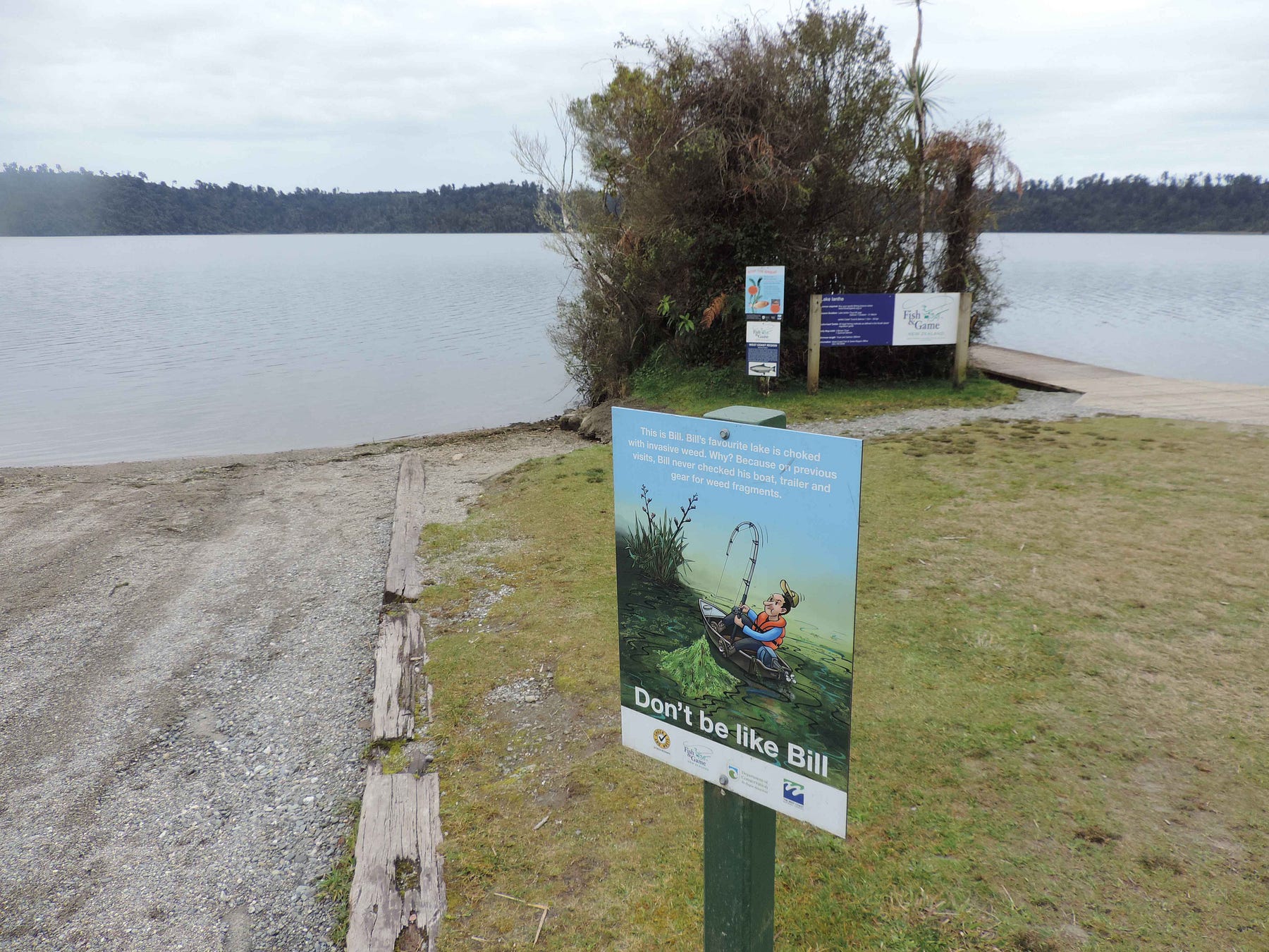
Further on down State Highway 6, the main highway on the West Coast, is Lake Ianthe, more formally Lake Ianthe / Matahi.
Lake Ianthe has an easily accessible jetty and is very popular with boaties. There are signs everywhere warning of the dangers of spreading lakeweed.
Here’s a video I made there with my friend Grant, in twilight:
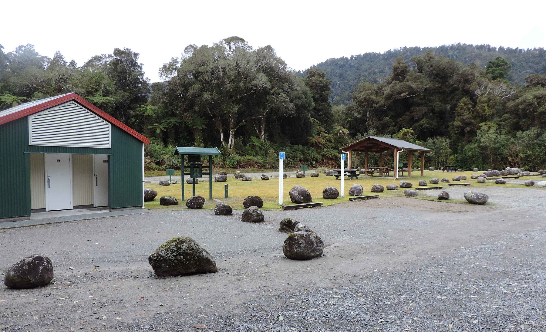
Further on still is Lake Mapourika, which has a large campsite next to it as well, the Macdonalds/Otto’s Corner Campsite.
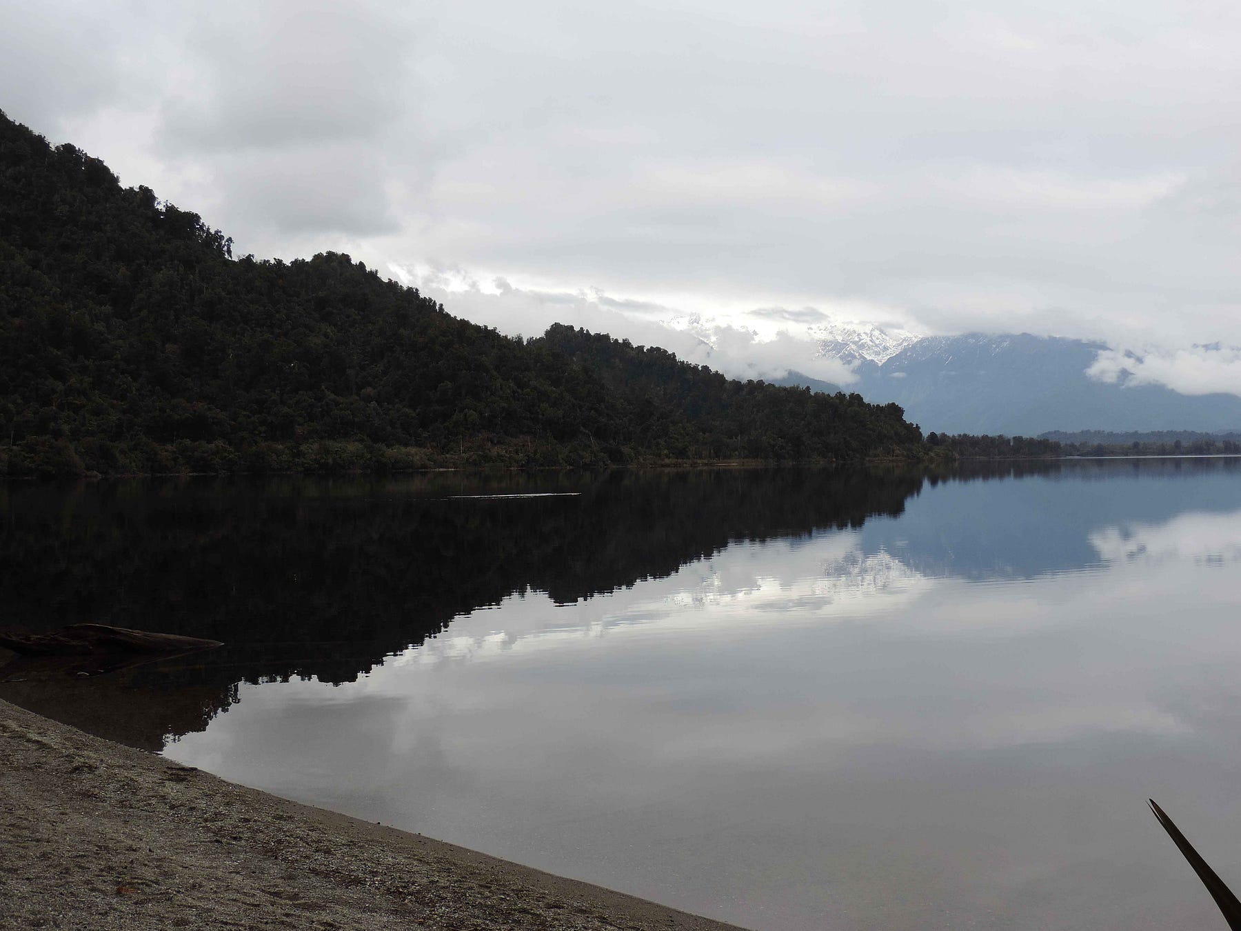
Mapourika and Ianthe are just two of the tranquil lakes that you come across while driving up and down the West Coast. Mostly formed by the melting of huge blocks of ice at the end of the last ice age, they are called the ‘mirror lakes’ of the West Coast. As you can see, the views over these mirror lakes would be stunning if it weren’t so cloudy a lot of the time.
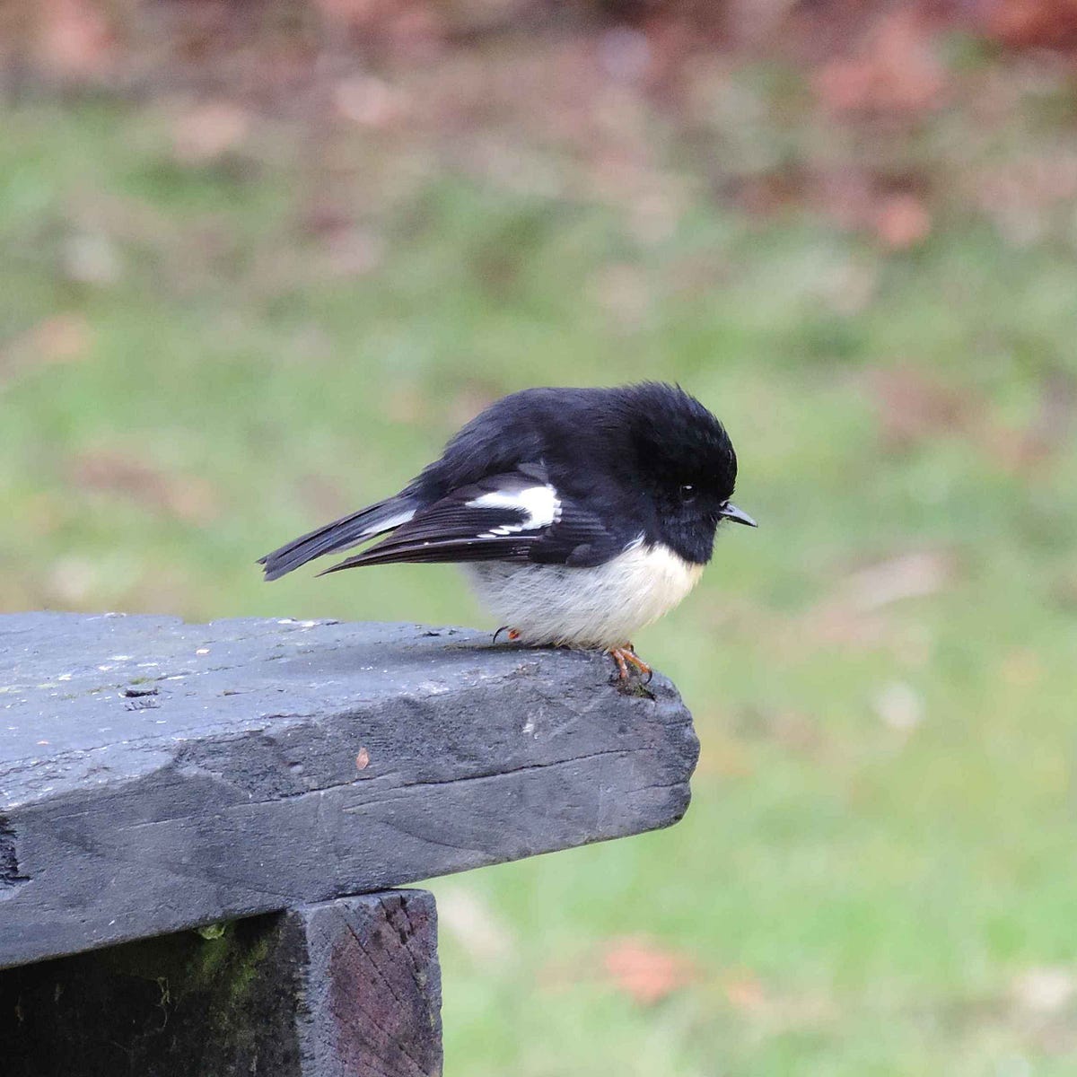
An adorable tomtit at the Lake Mapourika campsite.
I love visiting Ōkārito whenever I can. I’ve mentioned it in several posts, and have one that is all about it, called ‘The Ōkārito Coast: Lagoons at the Feet of Glaciers.’
Here are some photos from a more recent visit by a friend of mine, who hiked up to the ‘Trig,’ the trigonometric reference point, and got some more pictures.
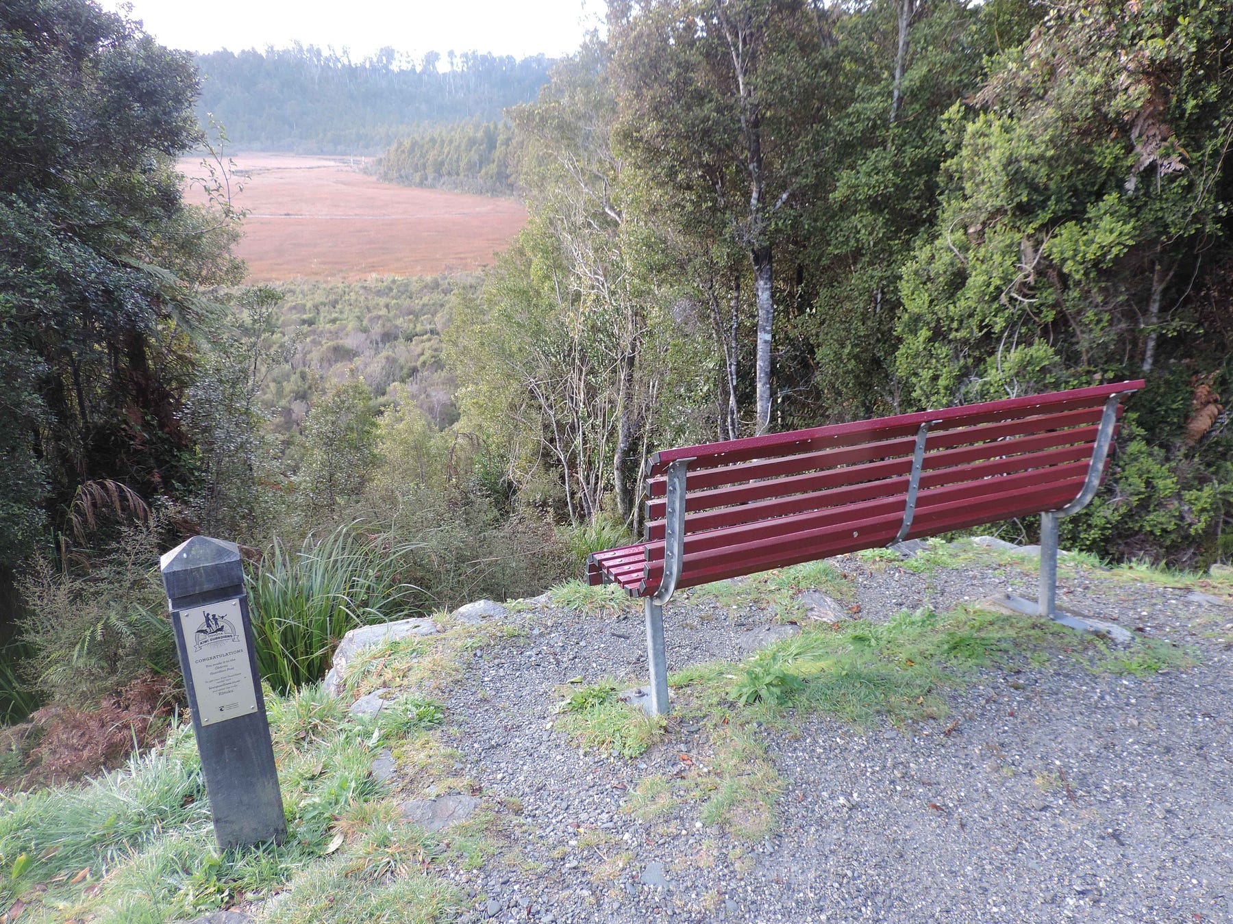
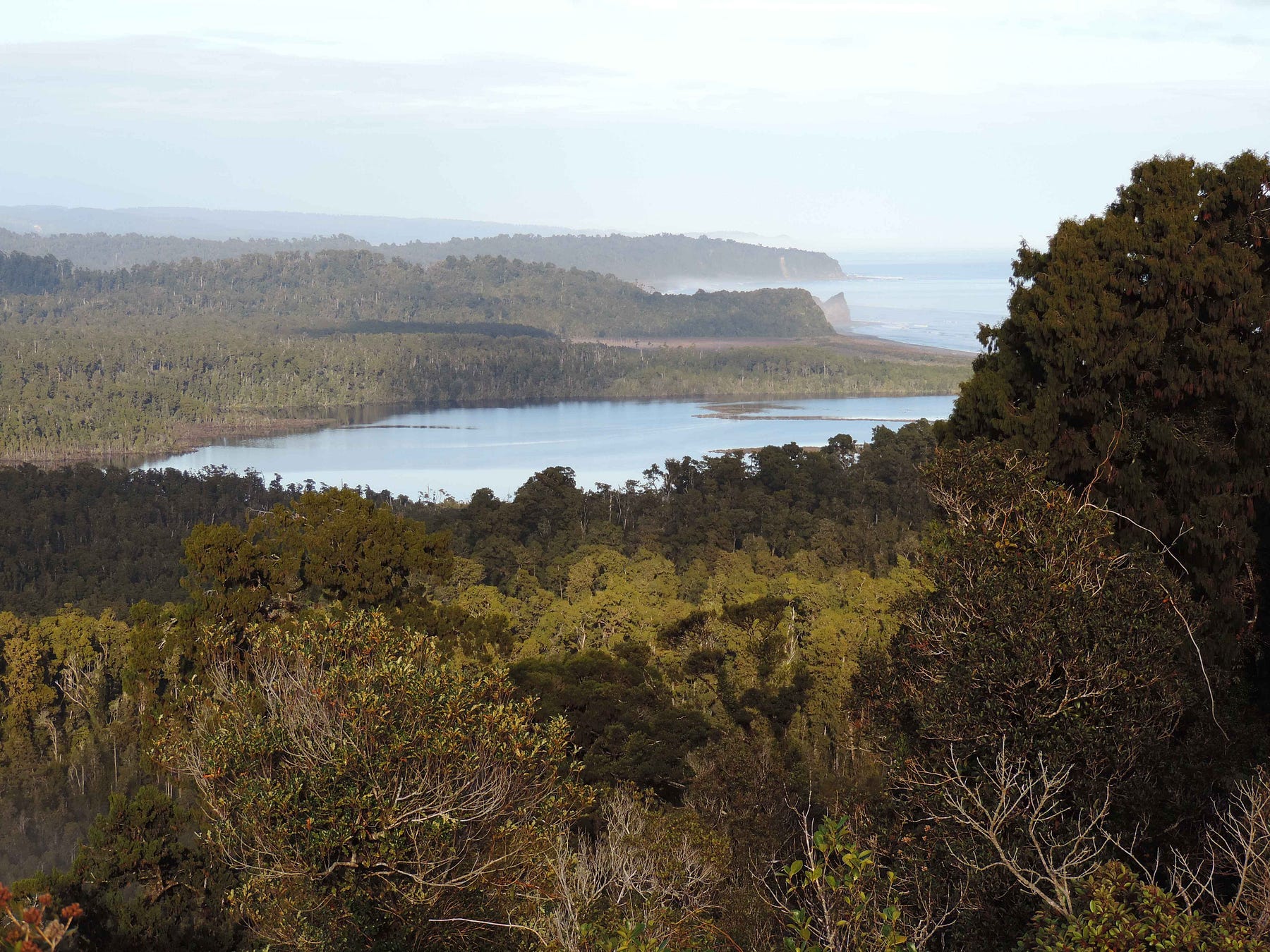
You can hike up to the Ōkārito Trig along the wetland trail, one of several walks at Ōkārito.
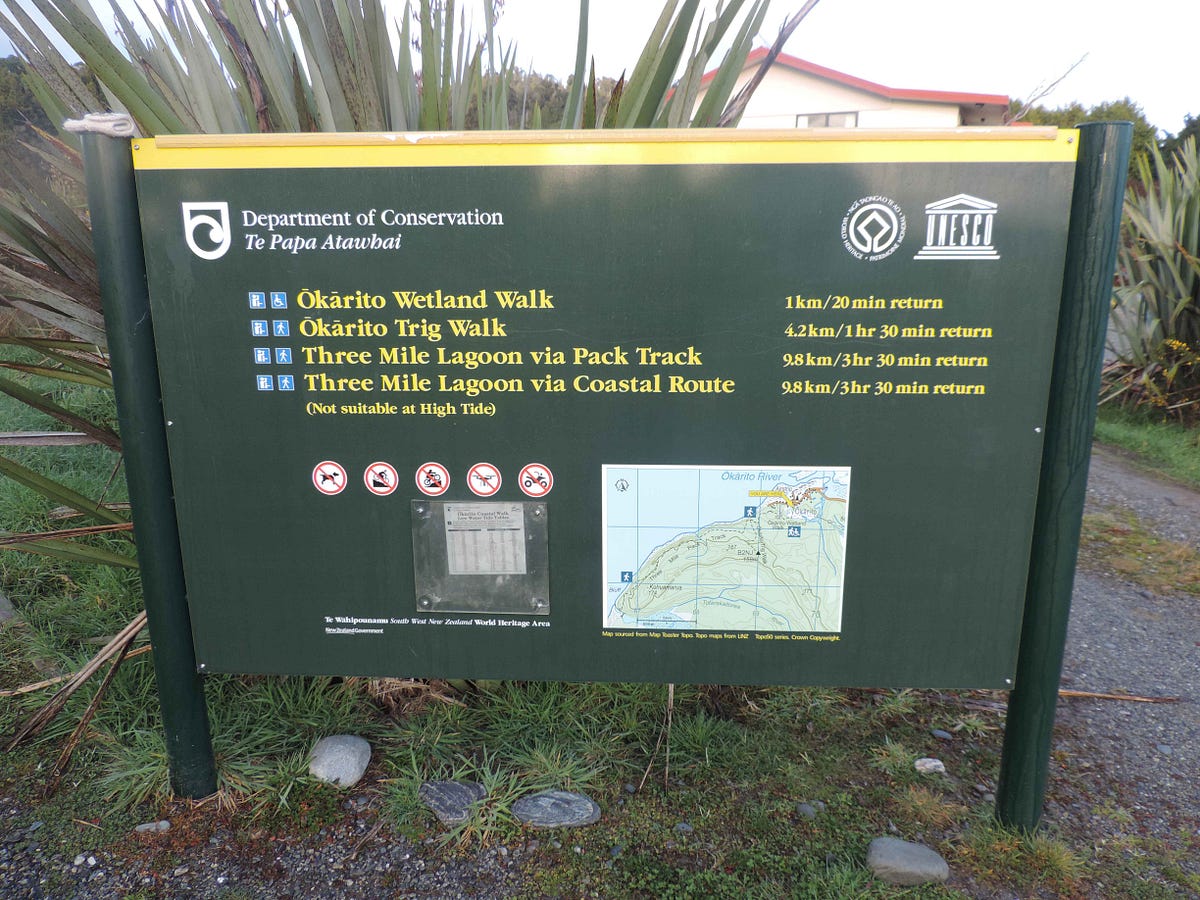
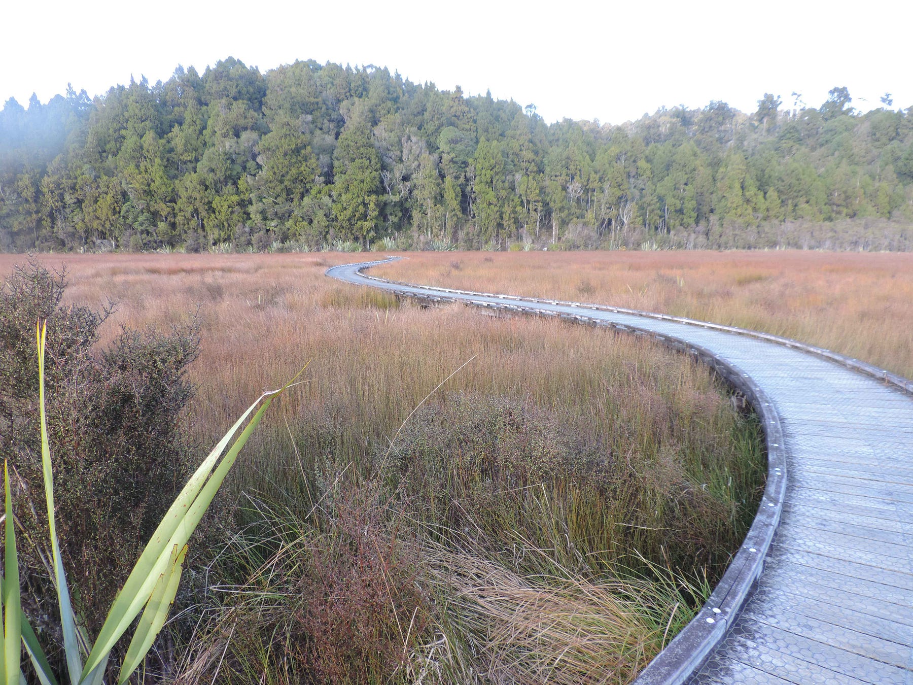
The trail has a lookout over the wetlands partway up.
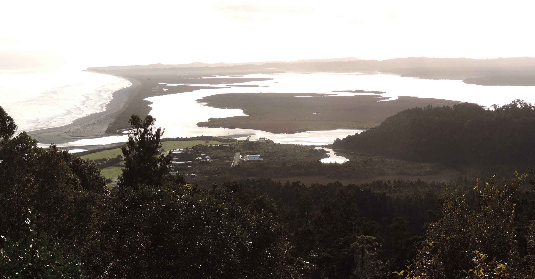
Finally you get to the Trig at the top.
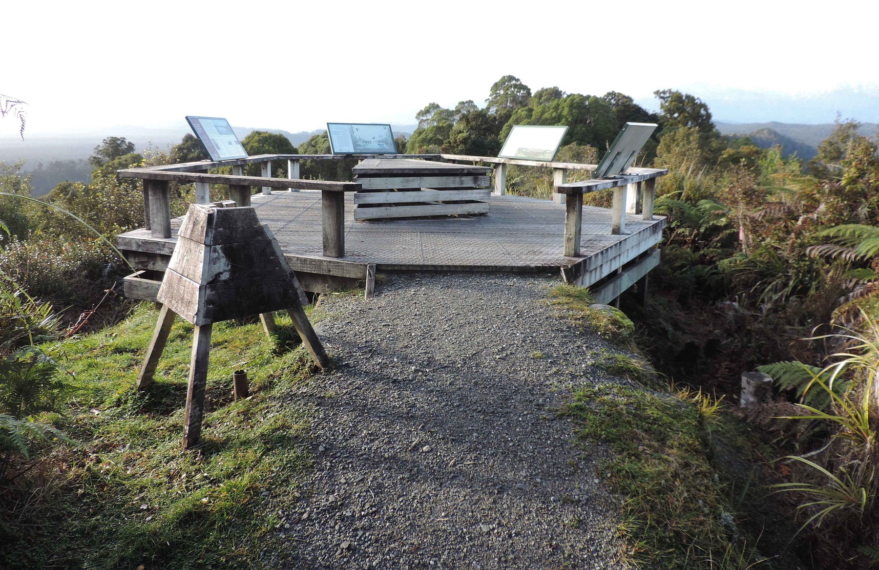
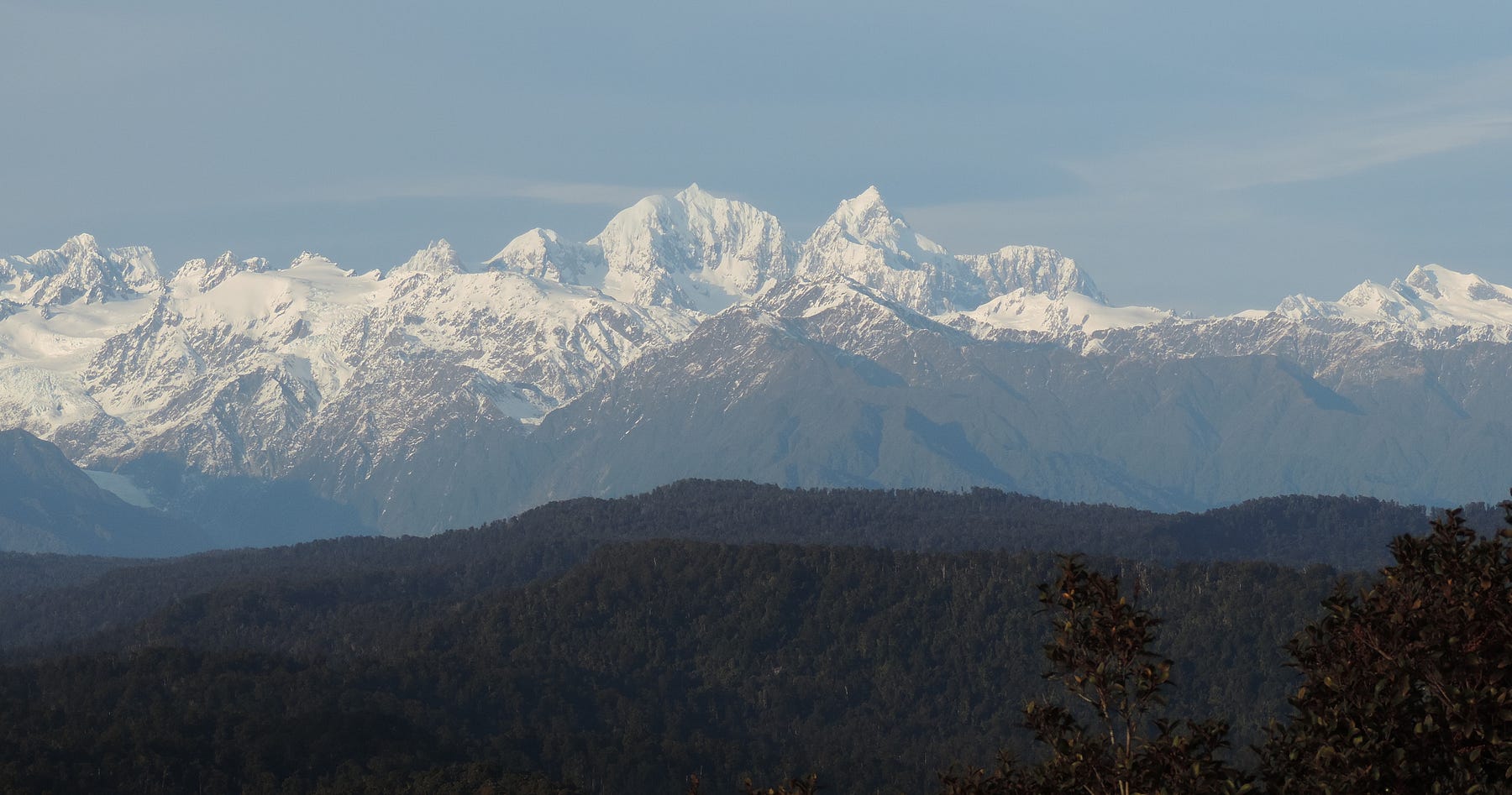
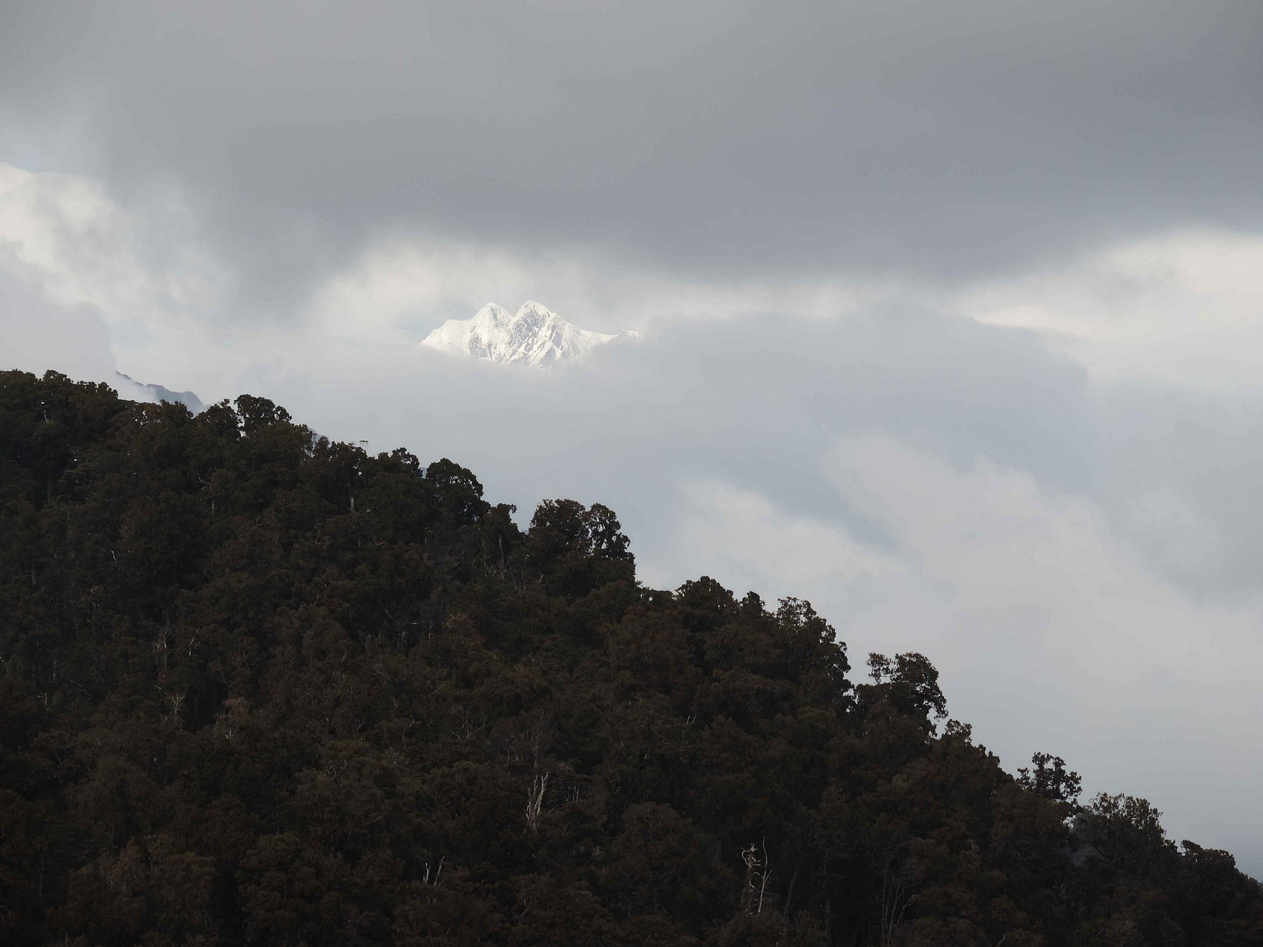
There were stunning views of mountains and lagoons from the Trig, with the cloud lifting enough to get these photos.
Here is a video I made a few years ago of the jetty at Ōkārito, the Trig, and a view over the lagoon in fine weather.
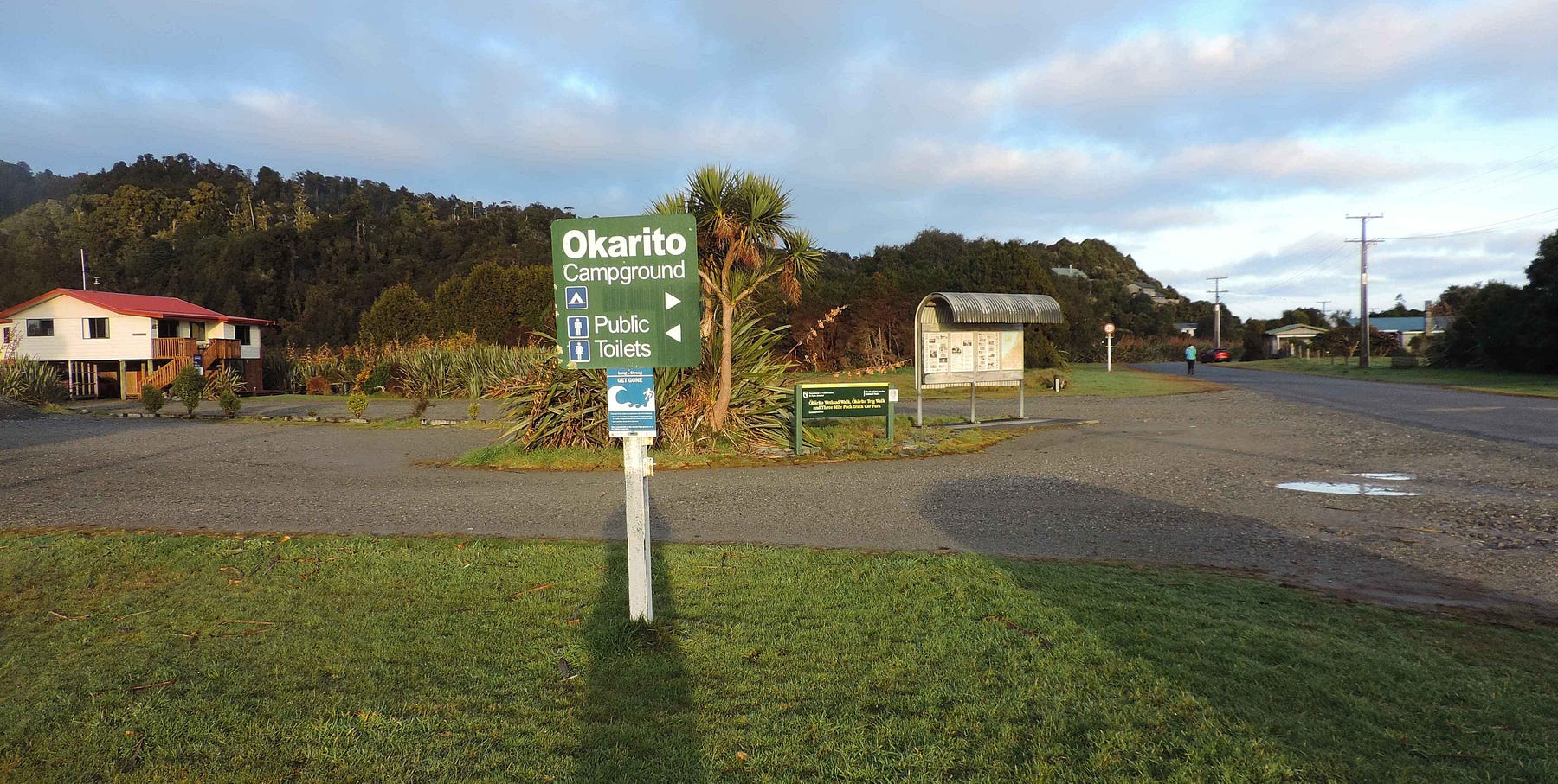
And, of course, there is a campground at Ōkārito. It often gets sun when the rest of the West Coast is cloudy, since this low-lying area juts out into the sea and the clouds mostly form over the mountains.
Another walk on the road to Ōkārito, with a somewhat lower lookout than the Trig, is the Pakihi walk.
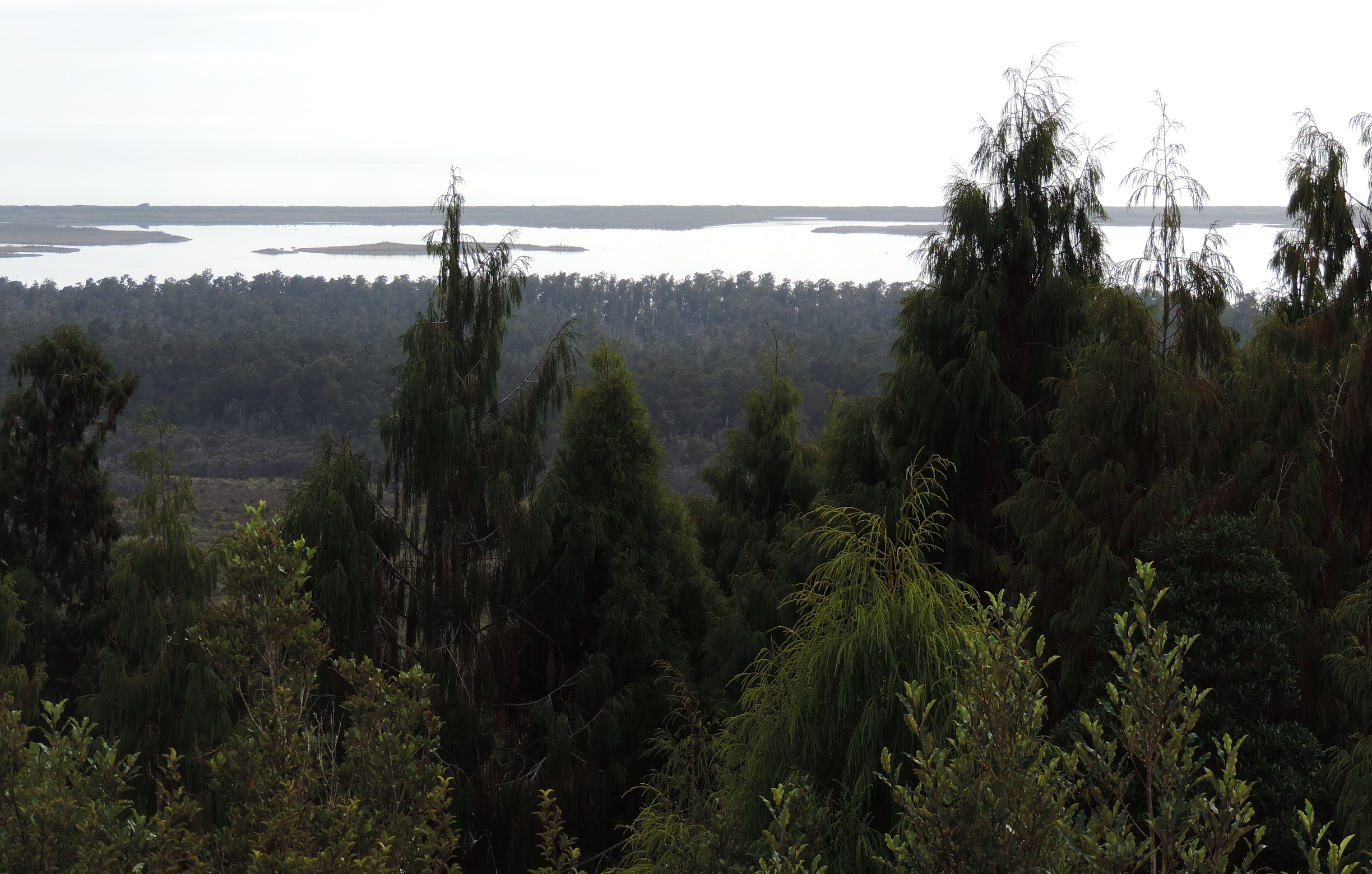
Here are a couple of photos from the Pakihi Walk lookout. Again, the view of the mountains would surely be amazing if the cloud lifted.
And over the lagoon.
Here is a video of Ōkārito scenes that first appeared in a 2023 post of mine called ‘Enjoying the Glaciers while we Can,' a post that included a return to Ōkārito and Franz Josef.
Franz Josef was really interesting in 2025. Apparently, this was the quietest winter season they had had since Covid.
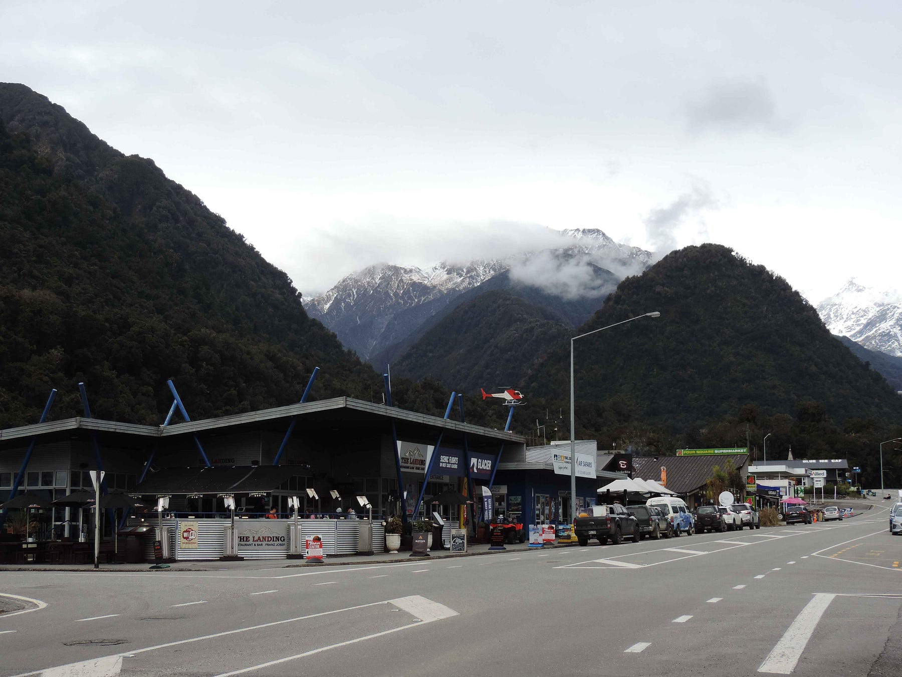
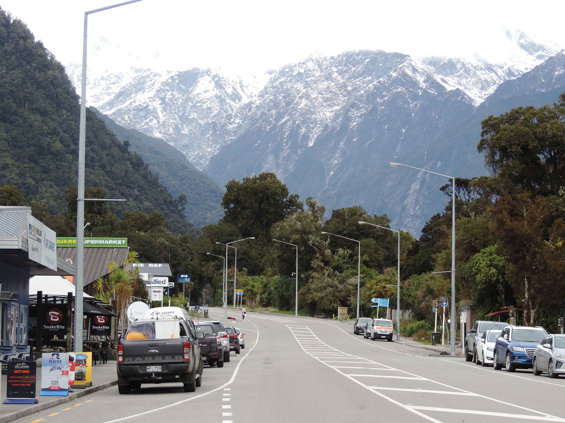
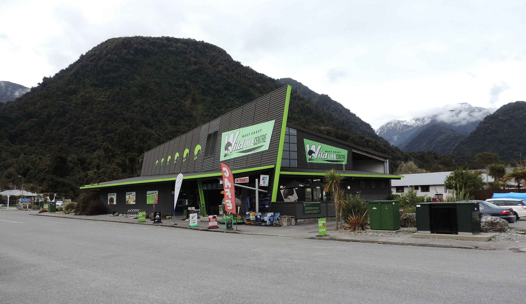
There’s the West Coast Wildlife Centre in ‘Franz,’ always worth a visit, along with hikes to Franz Josef Glacier.
The glacier otherwise known as Franz Josef has a traditional and very romantic Māori name as well, Kā Roimata o Hine Hukatere, meaning ‘tears of the avalanche girl.'
According to the Ngāi Tahu webpage just above, as of the date of this post,
The legend describes how Hine Hukatere took her lover Wawe into the mountains. Traversing the ranges where the glacier now lies, Wawe hurried to keep up with her, he slipped, tumbling to his death. Hine Hukatere watched him fall but could not prevent his death. “Her grief was so pronounced and her tears so excessive that the gods froze them as a perpetual memorial of her regret and sorrow.”
That page also includes some old photos that show the glacier at a much lower level than it is today.
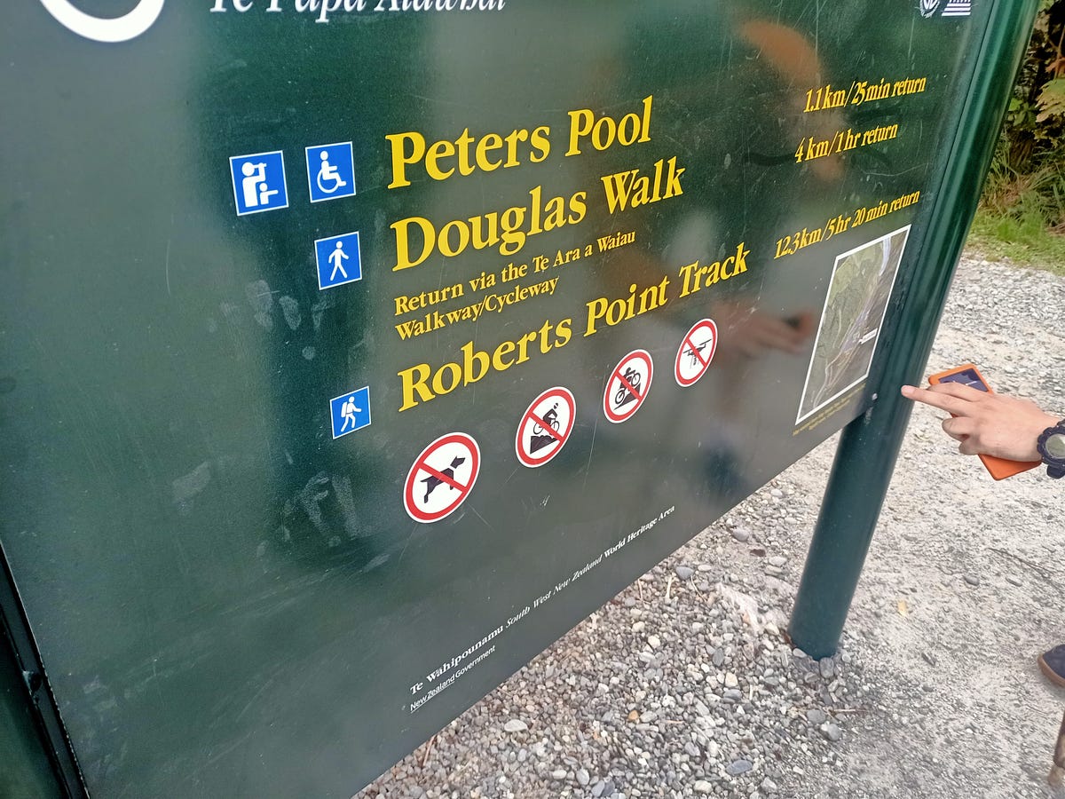
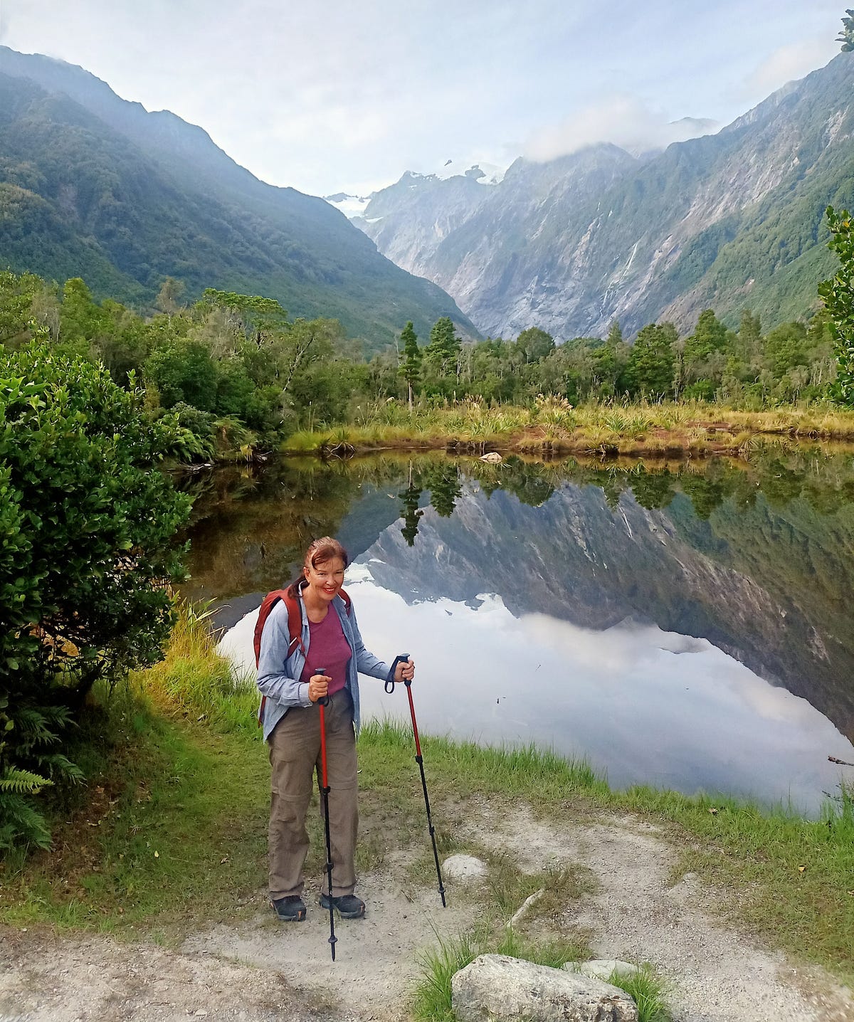
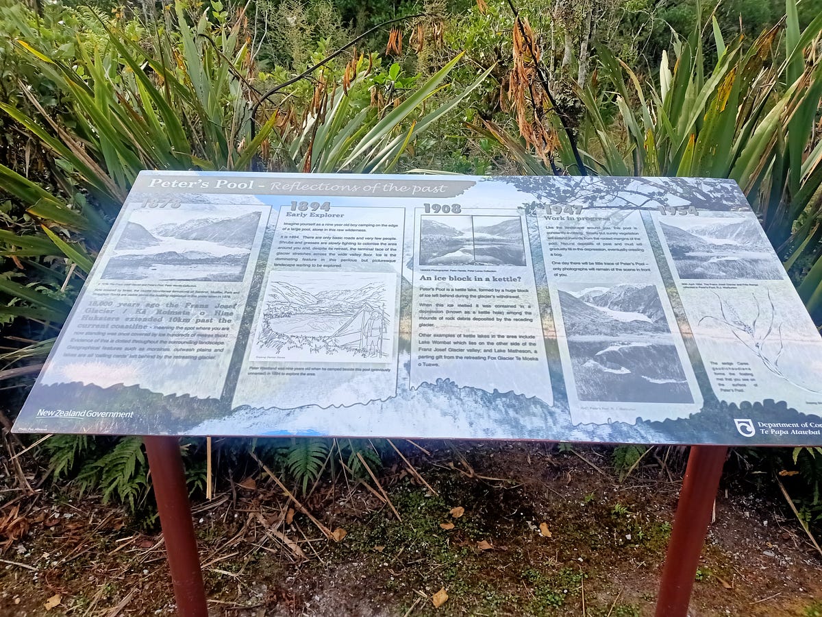
When I was there a couple of years ago, there was a beautiful pool on the way to the glacier, called Peters Pool.
A Russian tourist asked about Peters Pool, so it must be popular.
Here is a sign on the way to the Franz Josef Glacier, describing Peters Pool and two other attractions called the Douglas Walk and Roberts Point Track.
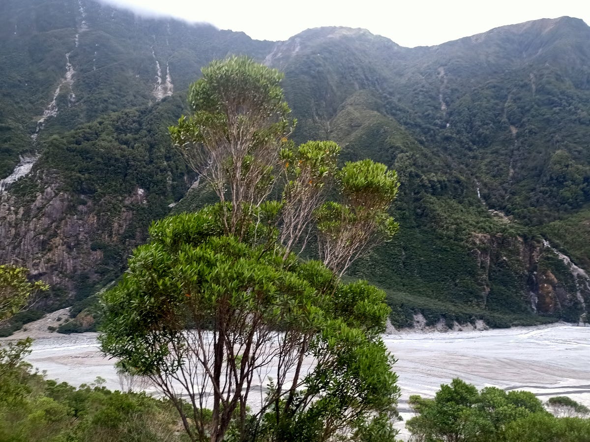
The glacier, at last! But seriously, folks, it used to descend through the forest, well within living memory. Now it is peeping at us over a rock sill in a Kilroy-was-here fashion, like some animal that all the tourists have frightened away.
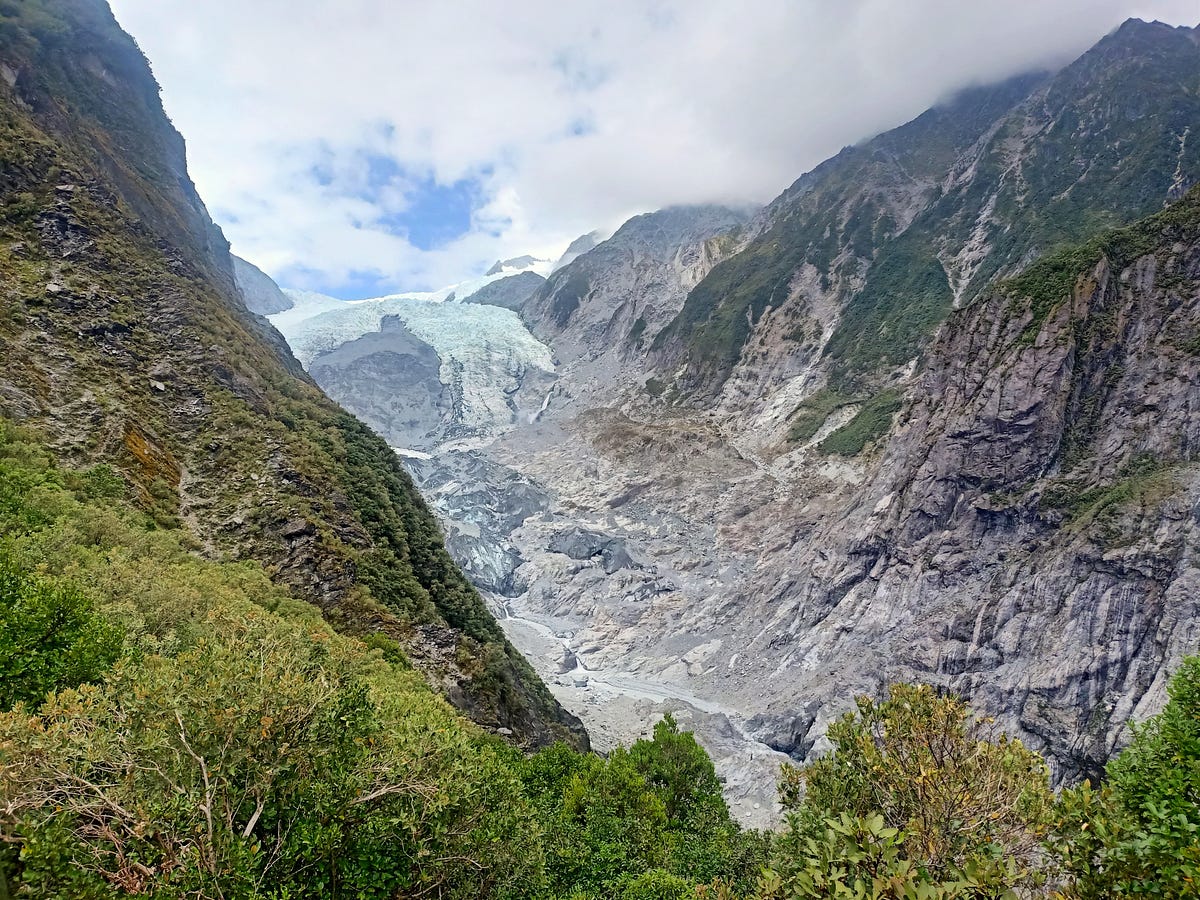
Here is a video of the track, and the glacier, that also appeared in ‘Enjoying the Glaciers while we Can.’
For more about the West Coast in general, see another post of mine called ‘Green Jungles and Waters of Jade.’
Next Week: I continue my latest journey down the West Coast, to some even more scenic spots in South Westland!
If you liked this post, check out my book about the South Island! It’s available for purchase from available from this website, a-maverick.com.
Subscribe to our mailing list to receive free giveaways!
