Giveaways
WHILE I was in Alice Springs, I decided that I couldn’t miss a visit to Uluru, or Ayers Rock, even though it was a surprisingly long drive, more than 440 kilometres even when you are starting from the Alice.


I stopped off at the Hoosh Cafe, about an hour out from Alice Springs on the Stuart Highway, where they had camel tours, aboriginal art, and emus as well.


You carry on down the Stuart Highway, and then turn right onto the Lasseter Highway.

As you can see from that sign, some place names around here are often written with a little line under some consonants. That means that they are ‘retroflex consonants’ in the local Pitjantjara and Yankunytjatjara languages, in which the tip of the tongue is curled back as you say them so that they sound a bit as if there was an ‘r’ just beforehand, or mixed in.
The third ‘t’ in Kata Tjuta is retroflex and that means that that name is pronounced like Kata Tjurta.
The ‘r’ in Uluru is also retroflex. What that means is that you can’t call the rock Uluwu. Its name has to be spoken with a proper ‘r’, rhotic as the experts say.
The Lasseter Highway is named after a prospector who supposedly discovered a fabulous deposit of gold — Lasseter’s Reef — but could never find it again (which must have been annoying).
Along the Lasseter Highway, there was a place called Mount Ebenezer, another tourist roadhouse which would have been excellent to drop in at and have a second cup of coffee, if it weren’t for the fact that it has been deserted for years and years after the proprietor was chased away by an indigenous man with a spear and decided not to come back.
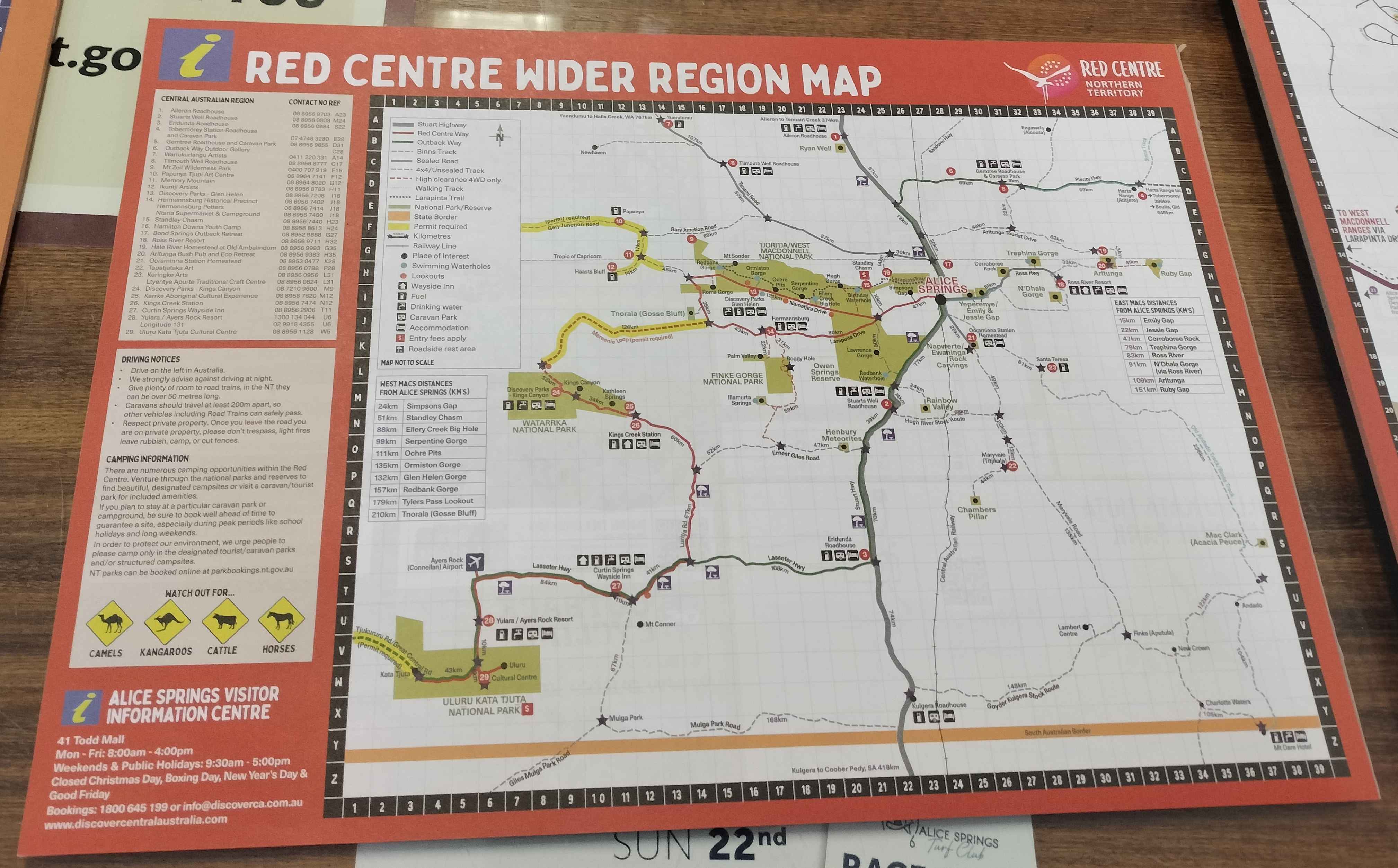
Uluru and Kata Tjuta are at the bottom left of this ‘Red Centre Wider Region Map’ which I photographed in the Alice Springs Visitor Centre.
Uluru is part of what is now called Uluru-Kata Tjuta National Park. Kata Tjuta, or the Olgas, is a similar outcrop to Uluru, but fissured into separate peaks with crevices between them such as the steep-sided Valley of the Winds. The name Kata Tjuta reflects this division: it means ‘many heads’.

On the other hand, the word Uluru refers, strictly speaking, to the locality in which the rock called Uluru is found and has no known meaning beyond that. There is some guesswork as to where the word might have come from, but apart from that, it is just a place name.

Here are a couple of 3D Google views of Uluru showing the outcrop from two different angles. In terms of the longest line that you could draw across it, this great rock is more than three kilometres wide.


Weirdly enough, the Uluru outcrop is now on its side, relative to the way it was when its rock strata were laid down some 500 million years ago. That is why it has striations or bands running across it. It continues underground for a further six kilometres, so the bit that you can see is like the tip of an iceberg.
The landscape around it is a bit like Mars, but greener near the base of Uluru, because what little rain falls in the area runs straight off the top of Uluru, to the benefit of plants nearby.
Indeed, there is a waterhole at the end of one area that is a bit like a funnel: the Mutitjulu Waterhole, an important cultural site that has some Aboriginal rock art (it is not a swimming hole). The first ‘t’ in Mutitjulu is also retroflex, by the way.


I thought that Uluru would just be in the middle of the desert by itself, but in fact, there is a cultural centre, cafes, hotels, camping, camel tours, and even a shopping village nearby.

I stayed in the Ayers Rock Campground for A$55 a night, but it was crowded and noisy. I could even hear people burping, so I got no sleep at all inside my flimsy tent.
Unless you have a caravan or campervan, it is probably best to stay in one of the hotels or motels or in one of the campground’s cabins. All the more so as you would need to be rested for the long drive back to Alice Springs.


The cultural centre had a half-hour movie about what the Aboriginals ate in the desert: wild plums, other sources of Vitamin C, how they caught lizards and found grubs — amazing!

Local Aboriginal clans have traditionally lived toward the west of the rock, around the permanent water of the Mutitjulu Waterhole, and initiated elders would sometimes ascend Uluru. Uluru is traditionally regarded as a living being and very sacred.

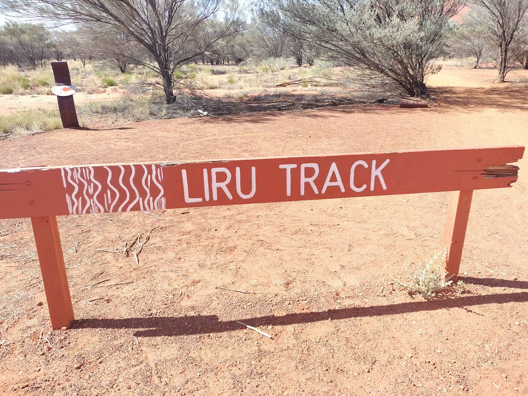
Several trails lead around Uluru. People used to climb it, but that has now been discontinued as it is thought to be disrespectful.
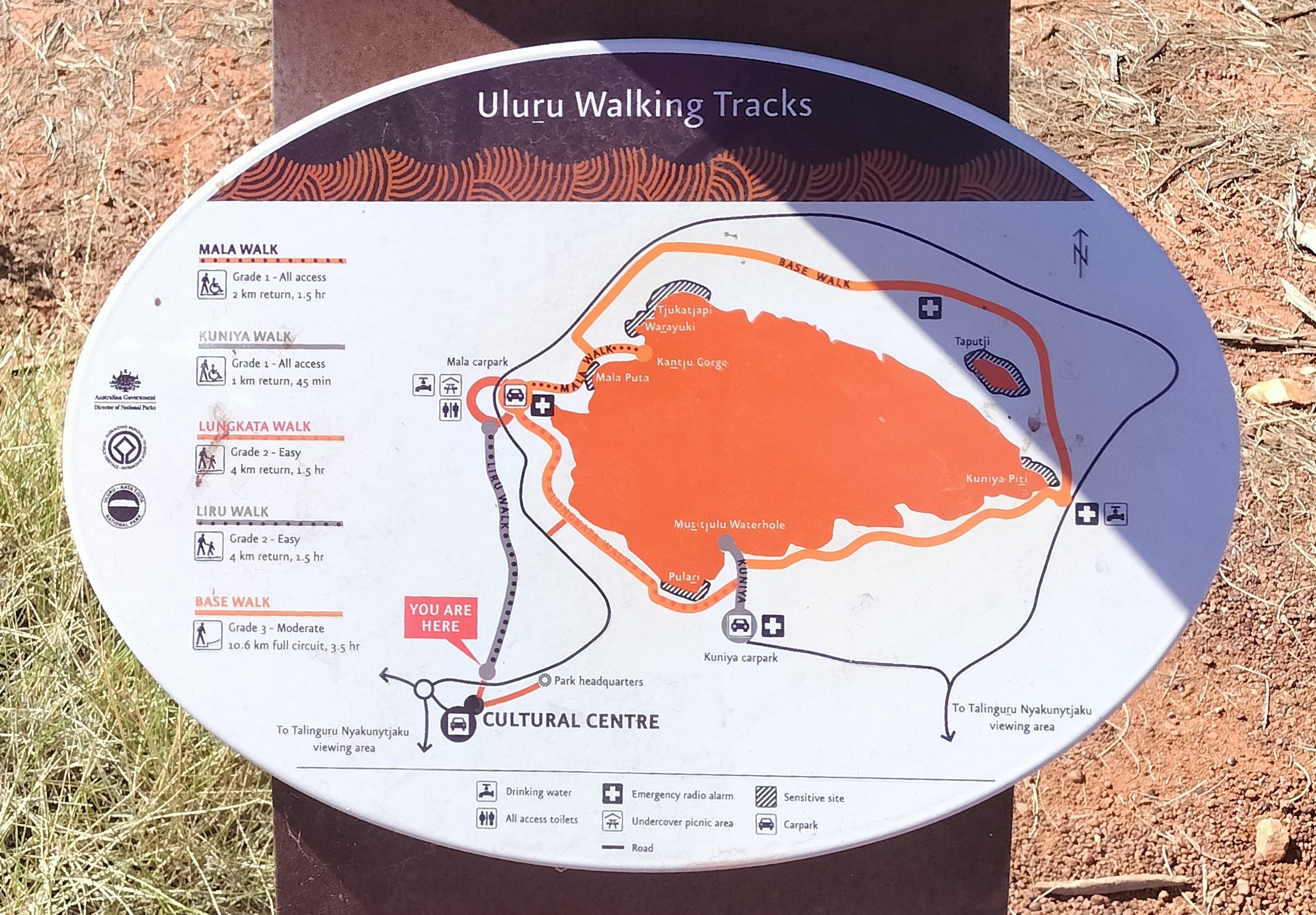
Along with walking, you can take Segways or bike around. You can hire bikes from the Cultural Centre.
In some areas, it is forbidden to take photos.


Here are some views of the mighty rock and the trails around it. It changes colour constantly, depending on the angle of the sun. It is at its best at dawn and sunset.


Uluru is made from a kind of sandstone called arkose, which is grey, but turns rusty red when weathered in the outside air because of its iron content. There are many caves on Uluru, and deep inside those caves, the arkose is still in its original grey colour.


Here is a video I made of morning, evening, and, in between, the Mututjulu Waterhole.
Next time, I would like to visit the similar but more divided outcrops of Kata Tjuta, which have pleasant valleys and meadows in between, kept verdant by runoff just like the forest around Uluru.
And Watarrka/Kings Canyon, where again there is unusually lush greenery, for these parts, at the bottom.

In my next post, I return up north, to Litchfield National Park.
Subscribe to our mailing list to receive free giveaways!
